


Freeing a Trapped River
Celebrating 10 years of restoration, partnership and the largest ecological restoration in Maryland’s history.

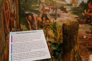
The Pocomoke River Discover how the Pocomoke River connects communities, supports conservation, and showcases the natural beauty of the Delmarva Peninsula. © Melisa Soysal/TNC
Springing from the dark pools of Delaware’s Great Cypress Swamp, flowing past rural Maryland towns and cities, and emptying into the Chesapeake Bay in Virginia, the Pocomoke River travels across three states and 73 miles to tell a story of restoration, connection, and community.
Join us on a journey down this iconic river to learn about its unique place in the Chesapeake Bay watershed and how The Nature Conservancy (TNC) is partnering with Pocomoke communities and allies to preserve its vital habitats and deep links with people's past and present.
Use the map to explore the Pocomoke River’s unique role in the Chesapeake Bay watershed and discover how TNC and local partners are working to protect its habitats and cultural heritage.
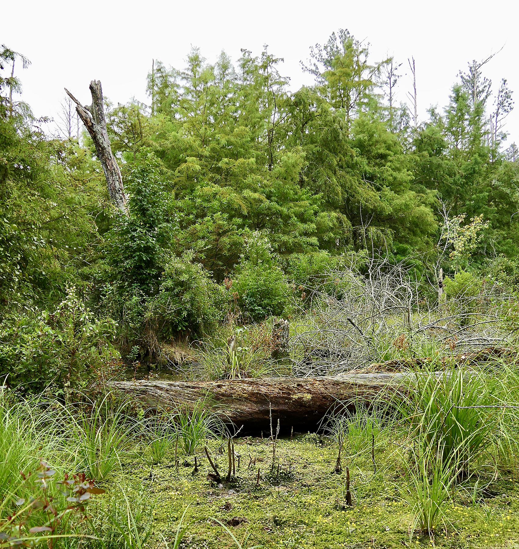
We begin our journey at the headwaters of the Pocomoke, nestled within Delaware’s Great Cypress Swamp. Spanning 10,000 acres, the Great Cypress Swamp is Delaware’s last true wilderness, home to rare plants like Atlantic White Cedar, pawpaw trees, and five orchid species, as well as wildlife from otters to wild turkeys. Past restoration work by The Nature Conservancy and Delaware Wild Lands helped revive its floodplain, contributing to a 124% increase in plant diversity. TNC continues to collaborate with Delaware Wild Lands to protect this vital habitat and its role in the broader Pocomoke River watershed.
At Whiton Crossing, The Nature Conservancy led Maryland’s largest ecological restoration effort, reconnecting 14 miles of the channelized section of the Pocomoke River to its natural floodplain. By removing berms at 165 locations, TNC and partners revived wetlands, reduced pollution, and brought back native vegetation. This collaborative project benefits wildlife, water quality, and local economies, and continues to inspire regional restoration efforts.
In Pocomoke City, the river is both a cultural touchstone and a modern challenge. The Pocomoke Indian Nation continues to honor its deep connection to these waters, while residents face flooding and sea level rise. The Nature Conservancy is working with local partners and the community to co-create a flood resilience plan rooted in local stories, values, and nature-based solutions, ensuring the river remains central to life and legacy.
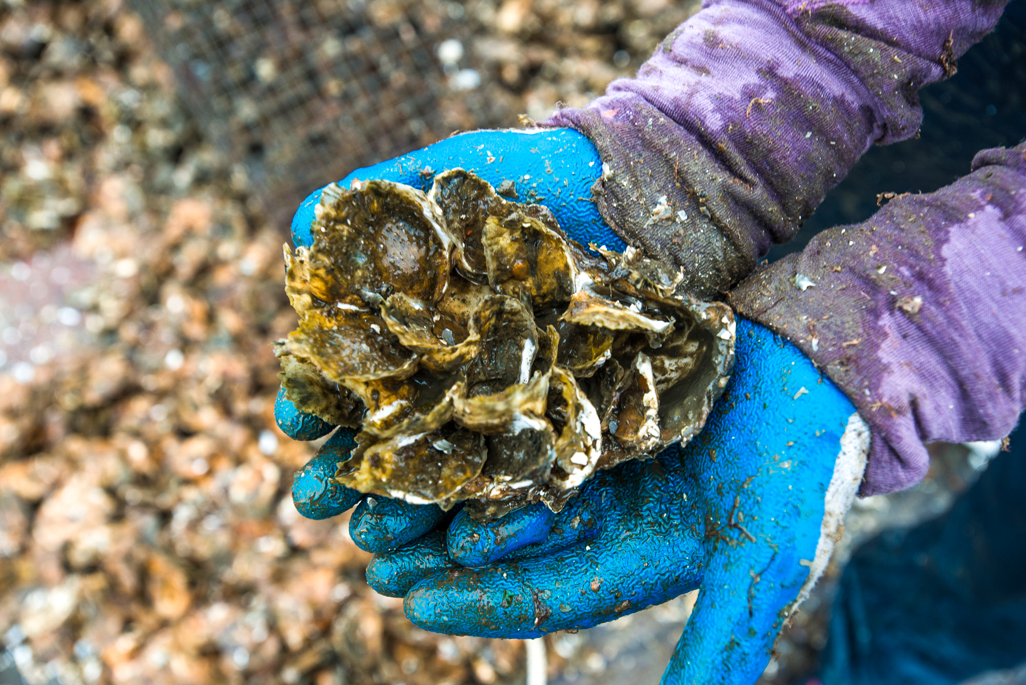
Where the Pocomoke River meets the Chesapeake Bay, The Nature Conservancy is working with the Saxis community to restore oyster reefs and protect shorelines from sea-level rise. Oyster castles installed along the coast help clean the water and buffer waves, while a multi-partner resilience plan is shaping a nature-based future for this flood-prone village. TNC’s efforts here support both ecological health and the livelihoods tied to fishing and aquaculture in the Pocomoke Sound.
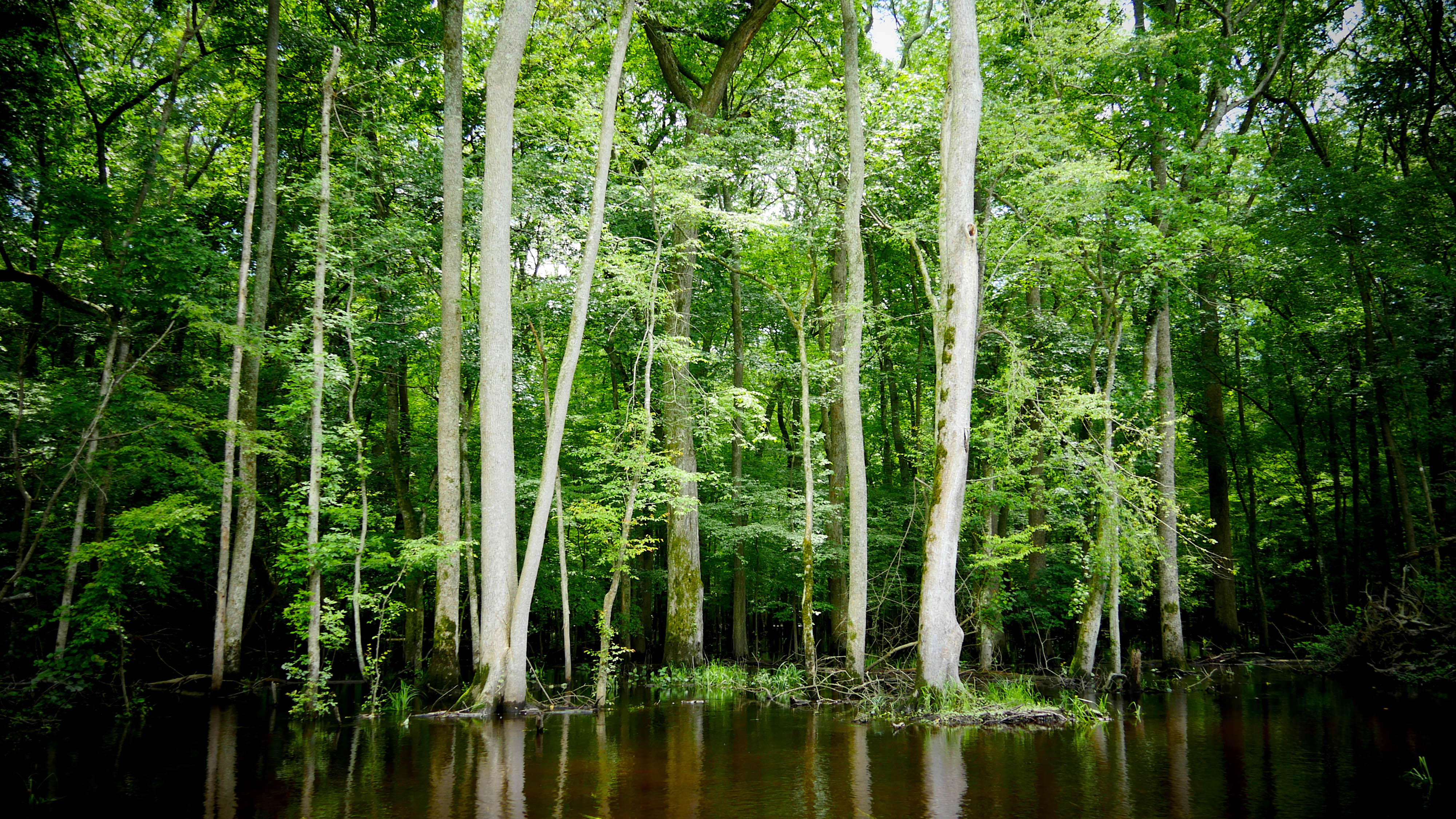
Just about 25 miles west of Ocean City, Maryland, the Pocomoke River is one of Maryland's nine “Wild and Scenic” rivers. “It’s a really interesting watershed. The Pocomoke is probably—with the exception of the Appalachian forests in Maryland—the most intact forested landscape we have in this state,” says Amy Jacobs, who oversees The Nature Conservancy’s work across the Chesapeake. That’s critically important for clean water and habitat for a wide diversity of species, she notes, particularly migrating songbirds who move in masses so large they show up on radar.
Unlike other major rivers connected to the Chesapeake Bay, the Pocomoke has largely escaped heavy development. Its tributaries, marshy shorelines, and open waters support a wide degree of biodiversity, including invertebrates, fish species, as well as the livelihoods of those who harvest food from its waters.
Situated on the western side of the Delmarva Peninsula (made up of Delaware and parts of Maryland and Virginia), the Pocomoke is part of a region that has some of the strongest influences on the Chesapeake Bay’s water quality.
Our tour of The Nature Conservancy’s Pocomoke conservation efforts begins near the river’s headwaters in the Great Cypress Swamp in Delaware.
Home to Rare, Threatened, and Endangered Plants and Animals
“The Great Cypress Swamp is the last true wilderness in Delaware, home to species of conservation need and providing habitat they need to grow and survive,” says Marcia Fox. She is the executive director of Delaware Wild Lands, the nonprofit that oversees the 10,800-acre swamp.
Yet over time, dredging and ditching in the Pocomoke watershed have been so extensive that the Great Cypress Swamp also now drains eastward and feeds Delaware’s Rehoboth Bay.
Supported in part by The Nature Conservancy’s past work to restore the floodplain at the swamp’s lower section, she says that over the past 30 years, there has been a 124% increase just in the species of flora in the swamp. “The seedbed is there - all it needs is a chance to grow,” she notes.


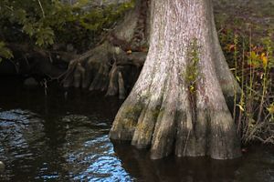
The northernmost range for Bald Cypress trees, the swamp is also seeing the return of young Atlantic White Cedar, both trees that had been heavily timbered in past years to support shipbuilding and commerce. She also points out that the Swamp is home to a significant stand of fruit-bearing native pawpaw (Asimina triloba) trees and five different rare orchids.
New plant species are continually being discovered and documented in the swamp, including the Seaside Alder (Alnus maritima), known to live only in a few counties in Delmarva, as well as Georgia and Oklahoma. It is the only Maryland alder that blooms in late summer or fall and is at risk of global extinction or collapse.
Myriad animals call the swamp home, from wild turkeys (Meleagris gallopavo) and ducks to otters, herons, and raccoons.
To protect its future, Marcia works closely with members of The Nature Conservancy team, including Emily Knearl, Delaware Director of Government Relations & External Affairs. “Emily keeps us updated on important legislative issues and is always the first to call when an issue arises that could affect the conservation community,” she notes.
For Fox, the swamp is a living and breathing place. “We’ll see fog rise out of the swamp and trees come alive. We’ll watch storms dissipate over it. The swamp is its own entity, shaping the climate around the community. There are countless questions about this place still waiting to be asked and researched.”
The Great Cypress Swamp is the last true wilderness in Delaware, home to species of conservation need and providing the habitat they need to grow and survive.
Righting the Wrongs of the Past at Whiton Crossing
From its headwaters in the Great Cypress Swamp, travel just 18 miles down the Pocomoke and you’ll encounter a massive restoration project led by a collaboration of partners, including The Nature Conservancy. Working with partners, landowners, and allies, The Nature Conservancy reversed years of human impact to restore the Pocomoke River’s natural shorelines.
To support the expansion of agriculture and development in the region, the Pocomoke Drainage Project was initiated in 1939 to quickly move water off the land to the Pocomoke Sound. The main channel of the Pocomoke was deepened and straightened, and in the process, miles of steep berms were created along the river’s banks. Corralled, water that previously slowly soaked into the marshland to be filtered was now quickly funneled down the river, carrying sediment and nutrients with it. As adjacent wetlands were cut off from the river, they no longer stored water during rain events, and habitat for plants and animals changed.


That’s where TNC and Mike Dryden, then a restoration specialist, came in. Beginning in 2012, Mike led landowner outreach efforts for The Nature Conservancy’s work with partners, including US Fish and Wildlife, NRCS, and the Maryland Department of Natural Resources, to engage landowners to restore the river and adjacent wetlands. Using LiDR ground penetrating technologies, partners identified areas along the river where they could most easily break down the artificial berms and create channels back out into the floodplain.
With the partnership of local landowners along 14 miles of the river, the partnership created large openings through the berms at 165 places, restoring the Pocomoke River’s access to the floodplain and capturing over 30,000 pounds of phosphorus and 100,000 pounds of nitrogen annually.
In doing so, TNC and its partners achieved one of the largest ecological restoration efforts in Maryland history.
Mike Dryden notes that, going back a year later, it was a completely different world. “Vegetation came in. Tree seedlings carried in by river water popped up. It was an awesome, hard project but extremely rewarding.”


In addition to benefiting wildlife and habitats, the restoration work is good for business. The river supports a tourism industry that has become one of the largest economic sectors in Worcester and Wicomico counties. Keith Donoway, Co-Owner of the Pocomoke River Canoe Company, credits the restoration work, combined with local infrastructure investments in bringing about significant decreases in the flooding of Porter’s Crossing Road above Snow Hill. With the shoreline not covered in water as often, he also reports seeing more small plants growing near it. “For instance, I have noticed more Jewelweed this season than in past seasons,” he said.
It’s all work that helps preserve the wildness of the Pocomoke. Keith notes, “After less than half an hour of paddling, it seems like you are miles away from civilization, and you know this river looks the same as it did hundreds of years ago.”
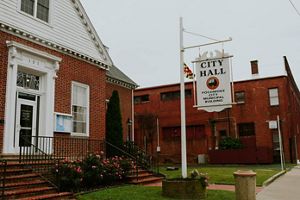
Valuing the River and Planning for Its Future in Pocomoke City
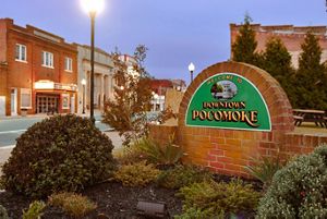
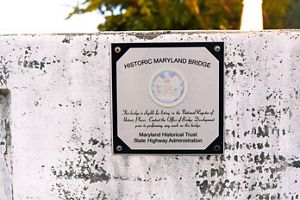
About 22 miles below that massive restoration project, we come to the small urban center of Pocomoke City, Maryland. In its Delmarva Discovery Museum, a large mural depicts the vital role the river and its tributaries played in the lives of the Pocomoke Indian Nation prior to Colonial contact.
For tribal nations, the Pocomoke’s are living waters, a place of connection to a heritage and culture that tribe members continue to foster today.


But Chief Norris Howard Sr. of the Pocomoke Indian Nation believes that people need to do more than respect that native connection. He hopes that everyone who visits or lives near the river appreciates it as a valuable natural resource and joins in the effort to protect its waters, uplands, marshes, and all that go with them. “It’s a beautiful river. A lot of stories go along with the Pocomoke,” he says.

Water is the basis for life and the Pocomoke is no exception. It was and is central to our homelands, both geographically and culturally.
Chief Norris is concerned that those who haven’t known the river over the years may not realize how modern changes have affected it. Without knowing what once was, they don’t realize what has been lost. “They aren’t alarmed by it,” he rues.
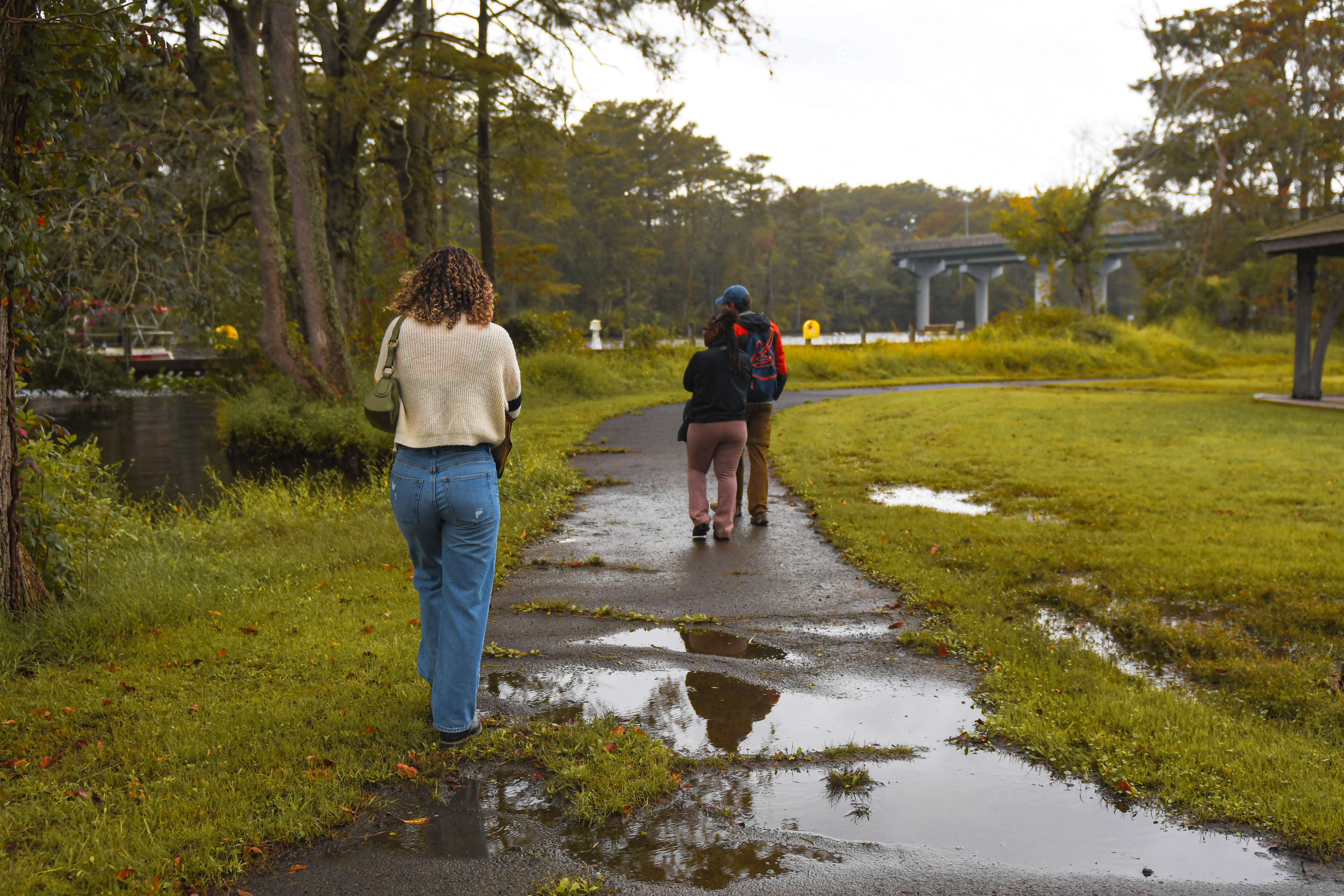
Walk down the streets surrounding the museum and you’ll encounter others who are concerned about how changes in the river are impacting their lives and community. In Pocomoke City, residents’ memories of flooding from Hurricane Sandy are still vivid and sea level rise is changing life as they know it.
It’s here that George Mason University, Resources for the Future, the Maryland Department of Natural Resources, and TNC are working with the city government and residents to co-create a vision for the city’s flood mitigation and conservation.
The project aims to support Pocomoke City planners in considering how nature-based solutions could be strategically used to achieve the community's vision of a more resilient future, even in the face of sea level rise.
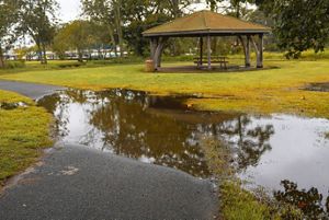

Flooding : Pocomoke City suffers from flooding after rainfall. © Melisa Soysal/TNC
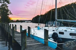
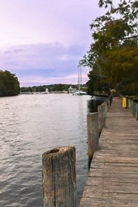
A Hub for Recreation : The Pocomoke River provides opportunities for people to connect with nature through fishing, boating, birding and much more. © Melisa Soysal/TNC
A group effort : George Mason University, the Maryland Department of Natural Resources, and TNC are working with the city government and residents. © Melisa Soysal/TNC
A City Rich in History : Pocomoke City is rich in history, with deep cultural roots and a strong connection to the river. © Melisa Soysal/TNC
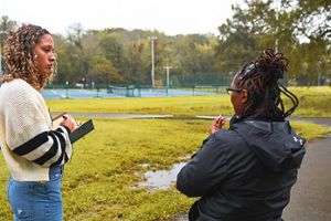
Community Outreach: TNC’s Joseph Galarraga and Elizabeth Van Dolah, Ph.D., launched a community outreach initiative with support from Master’s candidate Ayanna Healy. © Melisa Soysal/TNC
Cypress Park: The surrounding community wishes to protect and restore the once vibrant Cypress Park along the river. © Melisa Soysal/TNC
The River's History : The Delmarva Discovery Museum provides visitors with a rich timeline of the river's history. © Melisa Soysal/TNC
Pocomoke and tourism: The river supports a tourism industry that has become one of the largest economic sectors in Worcester and Wicomico counties. © Melisa Soysal/TNC
A Community's Voice: Having a voice and sharing their story is a powerful shift for the people of Pocomoke City,” says Environmental Anthropologist Elizabeth Van Dolah, Ph.D. © Melisa Soysa/TNC
Pocomoke Indian Nation: The Pocomoke Indian Nation once relied upon the river for survival, fishing its bountiful waters, gathering oysters, and using the waters to travel and hunt. © Melisa Soysal/TNC
GMU enlisted TNC’s help to ensure those plans are built on the community’s self-described cultures, stories and values.
With learnings from a similar outreach project in Crisfield, Maryland, TNC Coastal Resilience Manager Joseph Galarraga and Environmental Anthropologist Elizabeth Van Dolah, Ph.D., began a community outreach initiative, with support from Environmental Anthropologist and Master’s candidate Ayanna Healy.


Some of their early findings: Among the treasured areas the community wishes to protect and restore is the once vibrant Cypress Park along the river. It used to be home to family cookouts, a concert series, and the Great Pocomoke Fair, but now the ground is so saturated, equipment can get stuck in the mud.
TNC is working with community members, scientists, and stakeholders to provide technical support tailored to local needs, connecting residents with funding opportunities, building strategic partnerships, and raising awareness about the impacts of sea level rise on Pocomoke City. This effort strengthens nature-based solutions by aligning conservation with community priorities, fostering healthy ecosystems and resilient livelihoods.
Protecting Oysters and Vanishing Shorelines Along the River's End
Tracing the river’s 20 miles of twists and turns below Pocomoke City, it finally meets the Chesapeake Bay near the tiny village of Saxis, Virginia, which sits on the southern edge of the Pocomoke Sound.
TNC’s Amy Jacobs sees the sound as an exciting area for conservation given its importance to food production: “As it transitions from a freshwater system into a tidal system, we’re thinking about the importance of those areas for food production, and what we need to do to support the fishing and oyster industries in the estuary. That means providing clean water from upriver into those tidal portions and ensuring enough habitat in those areas, as the salt marshes are threatened by sea level rise.”
Oysters have always played a critical role in the Chesapeake Bay ecosystem. In addition to filtering the water, reefs created by oysters provide vital habitat for a variety of bay species, including striped bass and blue crabs. As only 1-2% of the historic Chesapeake Bay native oyster population remains, restoring them could provide massive benefits to the Bay’s ecological health.
TNC Coastal Scientist Bo Lusk identified areas where oyster reef restoration could support oyster populations, as well as where the Saxis causeway is threatened by sea-level rise and storms. He secured 3,240 “oyster castles” to be installed along a key area of the Saxis shoreline.
Created by stacking long rows of specially designed, interlocking cinderblock squares, oyster castles offer places for young oysters to attach and grow. As they do, they add to the size of the castles. Installed in long rows along a shoreline, oyster castles absorb the energy of incoming waves, reducing their impact on eroding the shoreline. With every year of growth, the extra shells and oysters are cleaning the waters of the Chesapeake and also protecting the shoreline.
The Saxis community experiences extreme high tides and storms that cut the town off from the mainland.
The TNC team is eager to continue to work with Saxis to support the waterside community and the nature surrounding it.
TNC Coastal Science Program Manager Susan Bates and TNC Volgenau Virginia Coast Reserve Program Director Jill Bieri have been working with the Saxis community for several years, a community Susan says is eager for partnership. Susan recalls conversations at the Saxis annual oyster roast. “Everybody that we interacted with was really interested in what we were talking about doing…They all know there is an issue because the road into town floods. They have to time their trips to the grocery store and tell visitors to check the tide charts before making the drive out to Saxis.”
Honoring the Pocomoke’s past while shaping its future.
The Pocomoke’s enduring wildness and free-flowing waters reach across centuries, local history, and communities, to provide a future for the people, plants, and wildlife who call it home. Restoring the river means caring for the wider watershed. Building on partnerships with landowners, local governments, and river advocates of all kinds, mile by mile, The Nature Conservancy is fostering a bright vision for the Pocomoke’s future and building momentum around the protection of the wider watershed.
By taking this watershed-wide view of the Pocomoke, The Nature Conservancy is protecting and preserving a vital natural resource and the lives connected to it.

Whether you are in a canoe or boat on the river or mucking through the swamp, there’s always something to see in the Pocomoke.
Lifelong Pocomoke River advocate Joe Fehrer worked with TNC and has spent his life exploring the river. Go out on the Pocomoke in the winter, Joe says, and you’ll see the vistas and evergreen species. In the spring, immerse yourself in the hundreds of shades of green against the dark tannin-stained waters. Celebrate the summer's cacophony of sound and color as thousands of songbirds migrate and nest in the area. In the fall, he says, watch the Bald Cypress trees most identified with the Pocomoke River as their needles turn from lime green to deep green to cinnamon brown before they fall.
Protect the river and treasure these sights, Joe urges, and keep coming back: “Whether you are in a canoe or boat on the river or mucking through the swamp, there’s always something to see in the Pocomoke.”
Explore how TNC is working to restore this vital watershed.


