Virginia’s Public Lands
Celebrating the contribution public lands make to Virginia’s natural heritage, culture and economy, and the role TNC has played in protecting them.
The sheer diversity of local, state and federal lands protected for the benefit and enjoyment of Virginians and our visitors is cause for pride and celebration.
Roughly 3.7 million acres of land across Virginia is managed for public benefit. From the smallest city parks to the vast George Washington and Jefferson National Forest, our shared green spaces provide vital natural services: clean water, recreation to boost our physical and mental well-being, habitat for diverse wildlife, and economic activity and jobs.
Of course, we acknowledge and pay our respect to the traditional custodians of these and all the lands that we know today as Virginia. As Karenne Wood (Monacan) writes in The Virginia Indian Heritage Trail, “Our histories, our ancestral connections, and our traditions are intertwined with the land called Tsenacomoco by Virginia Algonquian peoples.”
The Monacan, Powhatan and Cherokee were the predominant tribes here when Europeans arrived in the 17th century and began displacing the Indigenous people. Today, Virginia’s vibrant cultural tapestry owes much of its richness to the ongoing contributions of nearly a dozen recognized tribes, including Chickahominy, Eastern Chickahominy, Mattaponi, Upper Mataponi, Nansemond, Rappahannock, Monacan Indian Nation, Pamunkey, Cheroenhaka (Nottoway), Nottoway of Virginia and Patowomeck.
By any measure, there’s a lot to love about Virginia’s public lands.
- Virginia’s 41 state parks offer thousands of campsites, hundreds of cabins, more than 500 miles of trails and easy access to activities such as boating, fishing and swimming.
- Virginia’s 26 state forests provide 300 miles of trails exclusively for non-motorized uses such as hiking, horseback riding, and biking; 81 miles of open roads; and many lakes and rivers for fishing, canoeing and kayaking.
- Virginia’s 46 wildlife management areas offer more than 200,000 acres for public recreation, including traditional activities such as hunting, trapping and fishing.
- More than 2.3 million acres of national parks, forests, wildlife refuges and other federal lands serve as a massive public playground for hiking, camping, wildlife watching and sightseeing.
- Outdoor recreation in Virginia generates $21.9 billion in consumer spending and $1.2 billion in state and local tax revenues, while directly supporting 197,000 jobs that put $6.5 billion into people’s paychecks.

My work for The Nature Conservancy has taken me to some of the most amazing places on Earth, including national parks from Arizona to Zambia. As the saying goes, though, there’s no place like home.
From my home near Charlottesville, a half-hour drive will take me to Shenandoah National Park or the Blue Ridge Parkway and my choice of hikes to scenic waterfalls or stunning mountain vistas. In even less time, I can be paddling my kayak on one of many tranquil lakes protected within our Albemarle County parks.
Virtually anywhere you live or visit within the commonwealth will offer similar opportunities. I will confess, though, to a certain bias not only in favor of my local parks, but also toward the public lands whose conservation stories I’ve been fortunate to help tell over the years for TNC.
For more than 50 years, our organization has worked in partnership with many dedicated conservationists, from visionary individuals to local, state and federal agencies to protect more than 500,000 acres in Virginia. As a result, more than a third of all the land TNC has helped protect in Virginia now lies within the boundaries of public lands.
So in addition to inviting public visitation at TNC preserves, such as Warm Springs Mountain and the Volgenau Virginia Coast Reserve, we have had a hand in creating more than 120,000 acres of public land across the state.
Below are some of our greatest hits, by region, that we encourage you to visit—or see again.
Eastern Shore

Kiptopeke State Park
TNC has worked with Virginia's Department of Conservation and Recreation to acquire land for this state park on the Eastern Shore’s southern tip, where our conservation partnerships focus on migratory bird habitat. Kiptopeke offers recreational access to the Chesapeake Bay and 5.1 miles of hiking and biking trails. Sitting just offshore, the Concrete Fleet is a unique feature of the park—nine concrete ships scuttled in 1948 to create a breakwater for the busy ferry terminal that existed at the time.

Eastern Shore of Virginia National Wildlife Refuge
Expanding the Eastern Shore of Virginia National Wildlife Refuge has been central to TNC's partnership with state and federal agencies—and individuals including singer James Taylor—to preserve globally important habitat for migratory birds. Our contributions to the refuge include Wise Point, which features a popular public boat launch. Opportunities abound here for birding, photography, wildlife watching, fishing and boating.

Mutton Hunk Fen Natural Area Preserve
TNC has worked with Virginia's Department of Conservation and Recreation to make additions to this Eastern Shore preserve. Five state-rare plant species occur in this globally rare sea-level fen community. Visitors can explore two walking trails, one to the marsh overlooking Gargathy Bay and one along White's Creek.
Southeastern Virginia

Great Dismal Swamp National Wildlife Refuge
In 1973, the nation’s first major corporate donation for conservation—from Union Camp to The Nature Conservancy—protected the first 50,000 acres that would soon become Great Dismal Swamp National Wildlife Refuge. Now exceeding 110,000 acres, the refuge is a magnet for migratory birds. In 2015 Great Dismal became home to eight red-cockaded woodpeckers—Virginia’s rarest bird. Since then a total of 36 woodpeckers have been translocated into the refuge, an historic effort to establish a second viable breeding population of the federally endangered species. The refuge is a must-see if you’re looking to expand your birding life list. And your bucket list should definitely include canoeing or kayaking among the cypress trees rising from Lake Drummond, one of only two natural lakes in Virginia.

Big Woods Wildlife Management Area and State Forest
TNC transferred almost 4,500 acres of former commercial timberland, which we purchased in 2006, to the state to create Big Woods Wildlife Management Area and State Forest. In 2019, the Virginia Department of Wildlife Resources (DWR) documented the first instance of red-cockaded woodpeckers nesting in Big Woods—and later that spring, the first chicks hatched in the WMA. The nesting pair originated in TNC’s adjacent Piney Grove Preserve, which is managed to help support the recovery of Virginia’s rarest bird. The expansion of RCWs into Big Woods is a story of partnership success between TNC, DCR and our monitoring partners at the Center for Conservation Biology. Both state-owned sites are open to the public for birding, hiking and hunting; check with each area for other recreation opportunities.
Eastern Virginia

Dragon Run State Forest
Virginia’s Department of Forestry acquired the first of several large tracts from TNC in 2008 to create Dragon Run State Forest. Today, more than 9,500 acres of state forest anchor a network of conservation lands covering a remarkable 23 percent of the Dragon Run watershed, which feeds critical clean water to the Chesapeake Bay. The state forest is accessible for varied outdoor activities, including hunting and horseback riding, while Dragon Run itself offers one of Virginia’s finest blackwater paddling experiences.

Hog Island Wildlife Management Area
TNC has worked with Virginia's Department of Wildlife Resources to acquire land for this wildlife management area located along the James River and designated as part of the Captain John Smith Chesapeake National Historic Trail. The island’s name derives from the 17th century practice by English settlers of allowing hogs to forage on the land. Large numbers of bald eagles can be spotted here, and visitors also will find excellent opportunities to view and photograph waterfowl and other wetland species, particularly during winter.
Central Virginia

James River State Park
TNC has worked with Virginia's Department of Conservation and Recreation to make additions to this state park. Visitors can hike, bike, canoe, kayak, fish or tent camp on the banks of the historic river. The park also has a universally accessible fishing pier and a .25-mile-long wheelchair accessible trail around Green Hill Pond.

Greenbrier Park and the Meadow Creek Trail
In 2013, TNC completed one of the largest urban stream restoration projects in Virginia to date along Charlottesville's Meadow Creek, restoring 9,000 linear feet of Meadow Creek and preserving 12 acres of wetlands, over 1.5 miles of the Rivanna Trail and a total of 72 acres of land that provide an oasis of recreation as well as wildlife habitat.

Ivy Creek Natural Area
Over several years in the 1970s, TNC worked with citizen groups and officials from Albemarle County and the city of Charlottesville to protect the entirety of the former Riverview Farm, which faced impending development. Today, the 215-acre Ivy Creek Natural Area is Charlottesville’s preeminent site for environmental education and recreation. Ivy Creek features six miles of family-friendly trails for you to explore, or for a different perspective, paddle your canoe or kayak into the natural area from the boat launch below the Woodlands Road bridge.

Rappahannock River Valley National Wildlife Refuge
TNC transferred Tobys Point to the U.S. Fish and Wildlife Service in 1999 to help create the Rappahannock River Valley National Wildlife Refuge, which protects land along the main branch of the Rappahannock. As part of a coalition, TNC works with the refuge toward a goal of protecting 20,000 acres along the Rappahannock and major tributaries. Visitors to the refuge can enjoy year-round bird and wildlife watching, along with fishing, hiking and interpretive programs.
Northern Virginia

Great Falls Park
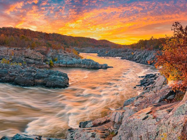
A 1957 publication that TNC produced with assistance from several partners helped galvanize support for a park at Great Falls on the Potomac River. The National Park Service protected the land in 1960, and Great Falls Park opened in 1966. Only 15 miles from the nation’s capital, Great Falls hosts a half-million visitors annually for activities ranging from picnics and hikes to whitewater paddling.

Bull Run-Occoquan Regional Park
TNC worked with Northern Virginia Regional Park Authority (now NOVA Parks) to make additions to this regional park. The site is connected to three other parks by a nearly 20-mile hiking trail that offers visitors access to more than 5,000 acres of scenic woodlands. The Bluebell trail offers a 1.5-mile loop that in spring blooms with over 25 varieties of wildflowers.

Chester F. Phelps Wildlife Management Area
TNC acquired more than 3,700 acres in 1975 for transfer to the Virginia Department of Wildlife Resources. Bounded to the west by the Rappahannock River, the C.F. Phelps WMA now encompasses 4,539 acres. A ramp for small boats and canoes is located on the Culpeper side of the river at Kelly’s Ford. Wildlife viewing, hiking and nature photography are among the outdoor opportunities available for visitors to enjoy.

Caledon State Park
TNC has worked with Virginia's Department of Conservation and Recreation to acquire land for Caledon State Park. This National Natural Landmark in King George County is known for its old growth forest and population of American bald eagles. The park offers paddle-in and hike-in campsites, along with 10 hiking and four multi-use trails winding through environmentally sensitive marshlands and picturesque wooded areas of the park. The popular 2-mile Boyd's Hole Trail leads to the Potomac River.

Mason Neck State Park and Elizabeth Hartwell Mason Neck National Wildlife Refuge
Starting in 1967, TNC assembled close to 3,000 acres to build Mason Neck State Park and Elizabeth Hartwell Mason Neck National Wildlife Refuge. These efforts followed from a grassroots campaign led by Hartwell to encourage the protection of Mason Neck and its abundant bald eagles. Start your visit at the state park, which offers a wide variety of nature programs and recreation such as hiking, biking and paddling.

Algonkian Regional Park
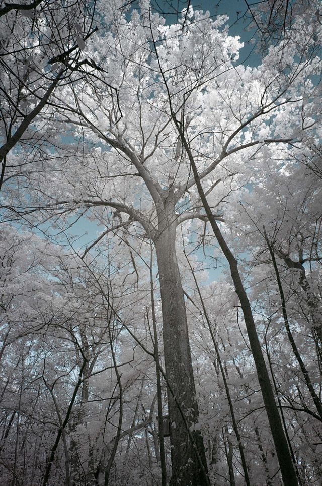
TNC worked with Northern Virginia Regional Park Authority (now NOVA Parks) to make additions to this regional park. A boat launch offers visitors an entry point to explore the Potomac River and enjoy views of bald eagles and other wildlife. The park is also home to one of the largest trees in Loudoun County. The Shumard oak (Quercus shumardii), estimated to be about 200 years old, measures 112 feet high and 176" around the trunk.

Crow’s Nest Natural Area Preserve
A decade-long collaboration involving Stafford County, state and federal agencies and private organizations came to fruition in 2008 with the establishment of Crow’s Nest Natural Area Preserve. TNC and Army Corps of Engineers helped fund the commonwealth’s acquisition of nearly 2,900 acres on this peninsula rising above the Potomac River. Crow’s Nest is one of the most recent state sites to open to the public, offering 8 miles of forest hiking, a shoreline birding/nature trail and an ADA-accessible canoe/kayak launch.


Harpers Ferry National Historical Park
“This scene is worth a voyage across the Atlantic.” That was Thomas Jefferson’s impression of the view of the confluence of the Potomac and Shenandoah rivers during a visit in 1783. TNC transferred nearly 400 acres on Short Hill to the National Park Service in 1981, helping preserve the iconic view from what we know today as Jefferson Rock, which is situated along the Appalachian Trail at Harpers Ferry National Historical Park.
West / Southwestern Virginia
Clinch River State Park
As partners in the Clinch River Valley Initiative, TNC was part of the movement to create Clinch River State Park. All four counties through which the river flows share the park’s physical footprint and economic benefits, making it a unique addition to Virginia's state park system.
The first unit of Virginia’s 41st state park, the Sugar Hill Unit in St. Paul, was dedicated on June 16, 2021. It currently has nearly 9 miles of hiking trails, more than 2 miles of river frontage and significant cultural and historical attributes.
Once fully developed, Clinch River State Park will highlight the Clinch River’s natural, historical and recreational resources. The first blueway state park in Virginia, it will ultimately consist of several smaller (250-400 acres) anchor properties connected by multiple canoe and kayak access points. This “string of pearls” along a 100-mile stretch of the Clinch River will provide outdoor enthusiasts access the river as well as opportunities to enjoy its beauty and ecological diversity.

Mount Rogers National Recreation Area
In 1965, TNC acquired 1,300 acres of Mount Rogers for the U.S. Forest Service. Virginia’s highest natural point became part of the Mount Rogers National Recreation Area in the Jefferson National Forest in 1966. The area boasts more than 500 miles of trail, including 60 miles of the Appalachian Trail, 18 miles of the Virginia Creeper Trail and 67 miles of the Virginia Highland Horse Trail. Over 1 million visitors come to Mount Rogers every year.

High Top Mountain
TNC acquired the roughly 800-acre tract on High Top Mountain for transfer to the National Park Service. The land forms a protective buffer around the Appalachian Trail and directly adjoins Shenandoah National Park. Park at Smith Roach Gap on Skyline Drive and walk the fire road to enjoy excellent birding and spring wildflowers.

Pinnacle Natural Area Preserve
Since 1989, TNC has worked with Russell County and the commonwealth to protect and expand the Pinnacle Natural Area Preserve. This state preserve follows Big Cedar Creek for two miles to its confluence with the Clinch River. Pinnacle offers scenic hiking, including views of the towering rock formation that gives the site its name, along with fishing in Big Cedar Creek, birding and wildlife watching.

The Channels State Forest and Natural Area Preserve
In 2004, TNC purchased the largest privately owned tract in Washington County to protect key intact forest. Thanks to our partnership with the state, the nearly 5,000-acre Brumley Mountain site is now open to the public as Channels State Forest. The namesake Great Channels of Virginia, 400-million-year-old sandstone formations etched into Brumley’s crest, are protected within The Channels Natural Area Preserve.

Tinker Mountain
In 1968, TNC protected nearly 100 acres on Tinker Mountain, which was featured in Annie Dillard’s nonfiction masterpiece Pilgrim at Tinker Creek. The property was transferred to the Appalachian Trail Conservancy. In a 1975 issue of the Virginia chapter’s state newsletter, Dillard writes of the mountain, “It’s a very good place: granite and grit-dirt, needle and soft-leaf, long light lobes on the flanksides; home.”
Stay In Touch
Sign up to receive monthly conservation news and updates from Virginia. Get a preview of Virginia's Nature News email
