
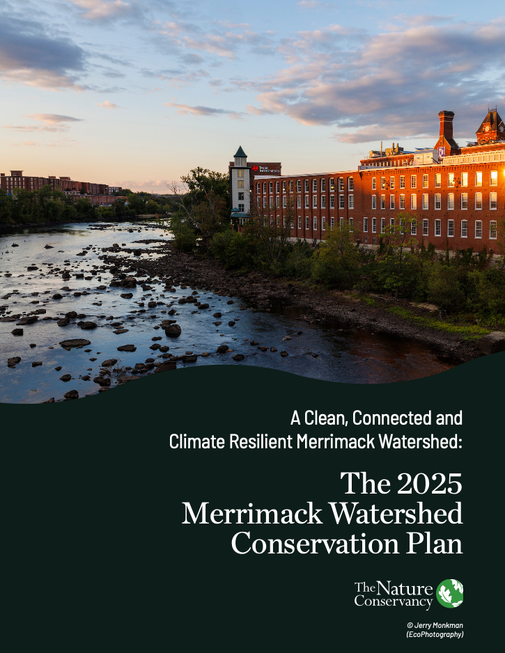
The Merrimack River The view upstream from the Granite Street Bridge in Manchester, NH. © Jerry Monkman/EcoPhotography
The Merrimack River Watershed—spanning New Hampshire and Massachusetts—is home to more than one million people across several large cities and contains a rich mosaic of forests, wetlands and wildlife. But it’s also one of the most threatened watersheds in the country. Climate change, flooding, urban heat and access to green spaces challenge cities like Manchester, Nashua, Lowell and Lawrence. These are large cities with limited access to green space, each of which still bears the legacy of textile mills, which reshaped the river during the Industrial Revolution.

Centering Community in Conservation
In response, TNC and the Merrimack Conservation Partnership (MCP) re-envisioned the 2014 Merrimack River Watershed Conservation Plan to meet today’s challenges. In addition to traditional plans’ focuses on undeveloped land, this version centers residents’ experiences and expertise—reflecting a growing understanding that conservation must serve both people and nature.
“We approached the planning process as a sustained dialogue with Merrimack River communities to ensure we had all perspectives included,” says Ally Snell, community partnerships manager for TNC in New Hampshire. “It also means expanding our definition of what we consider expertise.”
Quote: Allyson Snell

We approached the planning process as a sustained dialogue with Merrimack River communities to ensure we had all perspectives included. It also means expanding our definition of what we consider expertise.
Over two years, TNC worked with local governments and organizations to engage hundreds of residents in four focal cities: Manchester and Nashua in New Hampshire, and Lawrence and Lowell in Massachusetts. Focusing our efforts on deeper engagement within fewer communities allowed us to build relationships with local organizations, learn from residents and address significant gaps within the 2014 conservation plan.
The 2025 Merrimack Watershed Conservation Plan


Want more stories like this?
Sign up for our monthly e-newsletter to get the latest stories, news and updates right to your inbox!
Mapping Stories into Solutions
Through surveys, interviews and community mapping sessions, people shared stories about flooding, heat and access to nature. These insights, layered with ecological data, created an interactive map identifying priority areas across four themes: wildlife habitat and connectivity, working lands (forests and farms), water quality and quantity, and community climate resilience.
Chart the Way Forward
Check out the Merrimack River Conservation Plan's interactive map of the watershed.
View The Map“Community members shared stories and data on heat, flooding and green space needs, which informed our analysis and prioritized solutions,” says GIS Manager and Spatial Scientist Anna Ormiston. “By capturing their experiences of these climate issues, we hope to amplify community priorities in these spaces.”
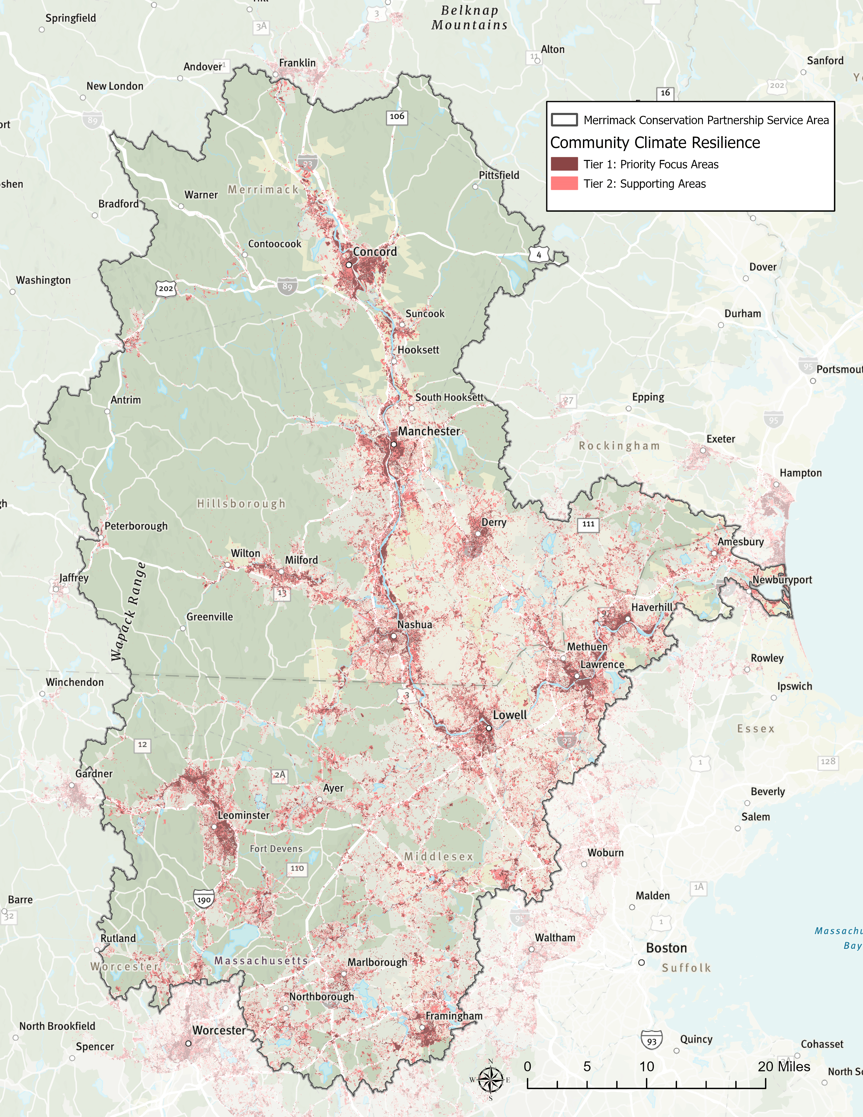
One compelling map highlights community climate resilience. This map identifies priority areas using integrated spatial modeling and community-informed data to address flood risk, heat vulnerability, tree cover and access to green space, making the visual a powerful storytelling tool. It shows where nature needs help and where people do too.
The plan is more than the sum of its maps. It’s a guide for future work, with recommendations to reduce flood risk, expand tree cover, improve water and increase park access. It will help the partnership prioritize places where land conservation, restoration and nature-based solutions can best meet our vision for a sustainable, ecologically healthy and climate-resilient Merrimack River watershed.
Quote: Anna Ormiston

Community members shared stories and data on heat, flooding and green space needs, which informed our analysis and prioritized solutions.
In October 2025, partners adopted a new mission: “The MCP uses our resources to preserve, steward, educate and advocate for a sustainable, climate-resilient Merrimack River watershed.” This vision is rooted in our shared values of commitment to the watershed, respect for community and science, and collaboration across disciplines.
The updated plan shows what’s possible when conservation is inclusive, data-driven and community-centered—a roadmap for protecting places we love and the people who call them home.
“Bringing together different types of knowledge and data were key to a thoughtful revision of the plan,” says Emma Gildesgame, climate adaptation director for TNC in Massachusetts. “We intentionally built its framework to support collaborative, multi-benefit projects on which organizations and communities can work together to meet the needs of people and nature in the watershed now and into the future.”
Quote: Emma Gildesgame
We intentionally built the plan's framework to support collaborative, multi-benefit projects on which organizations and communities can work together to meet the needs of people and nature in the watershed now and into the future.

Collaboration at the Heart of Conservation
About the Merrimack Conservation Partnership
-
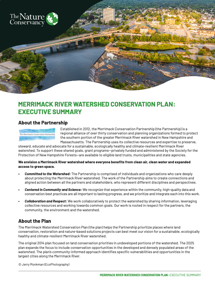
The Merrimack Conservation Partnership (MCP) is a regional conservation alliance formed to protect the southern portion of the greater Merrimack River watershed in New Hampshire and Massachusetts. The MCP uses our collective resources and expertise to preserve, steward, educate and advocate for a sustainable, ecologically healthy and climate-resilient Merrimack River watershed.
-
We envision a Merrimack River watershed where everyone benefits from clean air, clean water and expanded access to green space.
-
- Committed to the Watershed: Our partnership is comprised of individuals and organizations who care deeply about protecting the Merrimack River watershed. The work of the MCP aims to create connections and aligned action between all the partners and stakeholders, who represent different disciplines and perspectives.
- Centered in Community and Science: We recognize that experience within the community, high-quality data and conservation best practices are all important to lasting progress, and we prioritize and integrate each into this work.
- Collaboration and Respect: We work collaboratively to protect the watershed by sharing information, leveraging collective resources and working toward common goals. Our work is rooted in respect for the partners, the community, the environment and the watershed.
- Committed to the Watershed: Our partnership is comprised of individuals and organizations who care deeply about protecting the Merrimack River watershed. The work of the MCP aims to create connections and aligned action between all the partners and stakeholders, who represent different disciplines and perspectives.

Engaging Residents for Lasting Change
The project utilized an innovative conservation planning approach, investing heavily in community partner engagement to develop shared priorities that benefit community resilience and fish and wildlife habitats through nature-based solutions. This effort produced a final product that incorporated resident needs and priorities in conservation planning.
Community Voices Lead the Way
Listening First
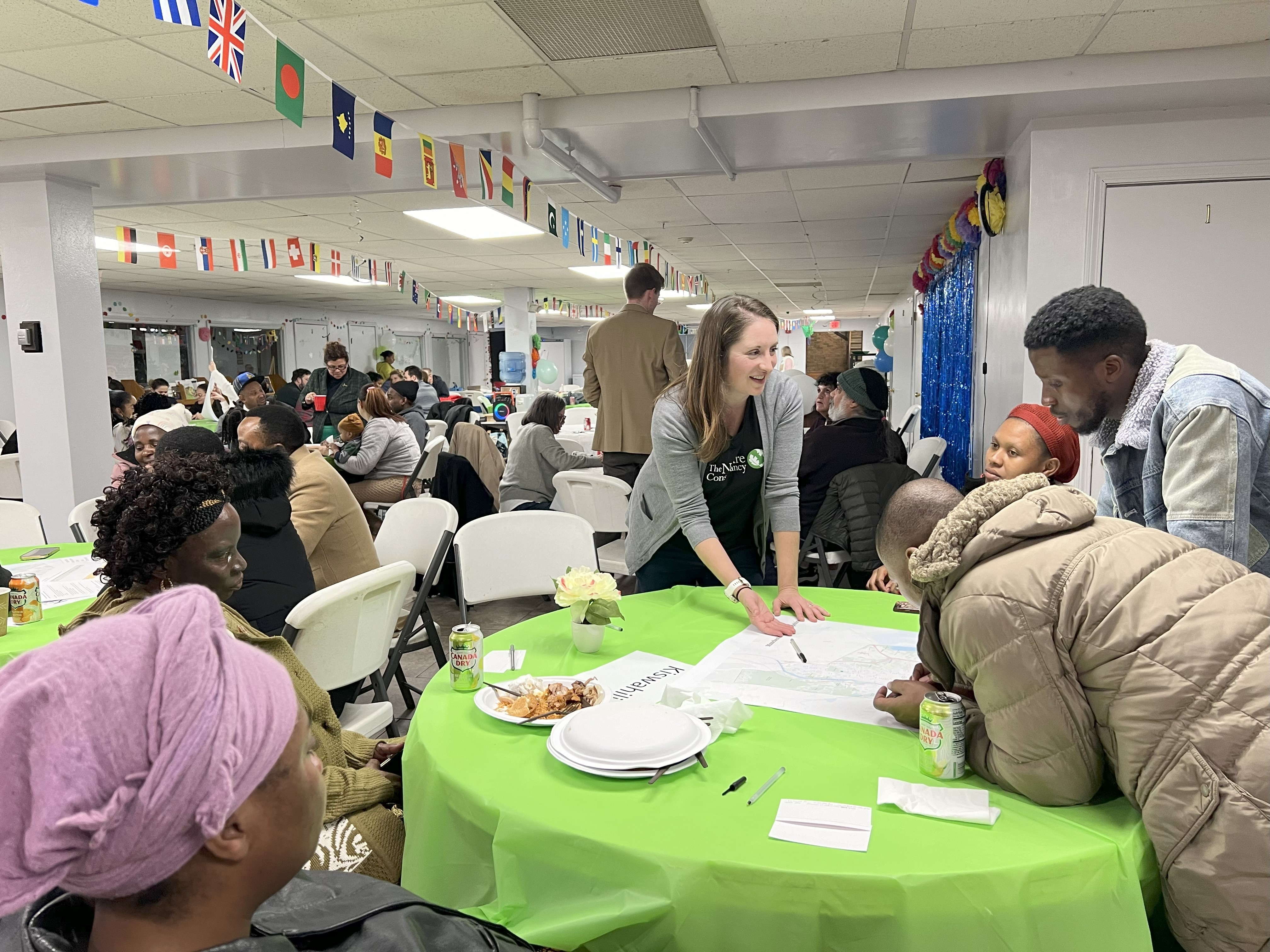
Initial community outreach included a series of informational interviews and conversations with more than 50 community advocates to understand ongoing projects, concerns and opportunities. A poll of 400 watershed residents provided further information about community perceptions of, and values related to, the river. This initial work informed how the team selected and refined themes for spatial analysis and directly shaped the second phase of community engagement.
The project team then collaborated with community advisors to connect with nearly 800 residents in the focal communities. Engagement included tabling at local fairs and festivals and culminated with a series of collaborative community mapping workshops. This revealed information about residents’ experiences of flooding and extreme heat and their access to, and quality of, green spaces in their community. Additionally, the project team conducted a novel approach to youth engagement executed in partnership with local schools and programs, which brought perspectives from some of the youngest watershed residents.
Incorporating project advisors throughout the planning and analysis phases was critical to ensuring a plan that ultimately works for all. An Advisory Committee of members from the partnership assisted with spatial analysis and provided key technical insights into data sources, model parameters and weightings. Advisory Committee members also provided key connections to other community partners and existing work on the ground.
Community advisors—selected by local organizations with deep ties to their respective neighborhoods—played a critical role in ensuring the updated plan reflects resident priorities and ongoing projects related to the Merrimack. As trusted entities, community advisors helped reach a broader subset of residents through co-hosted events.
Bringing Youth Voices to Watershed Planning
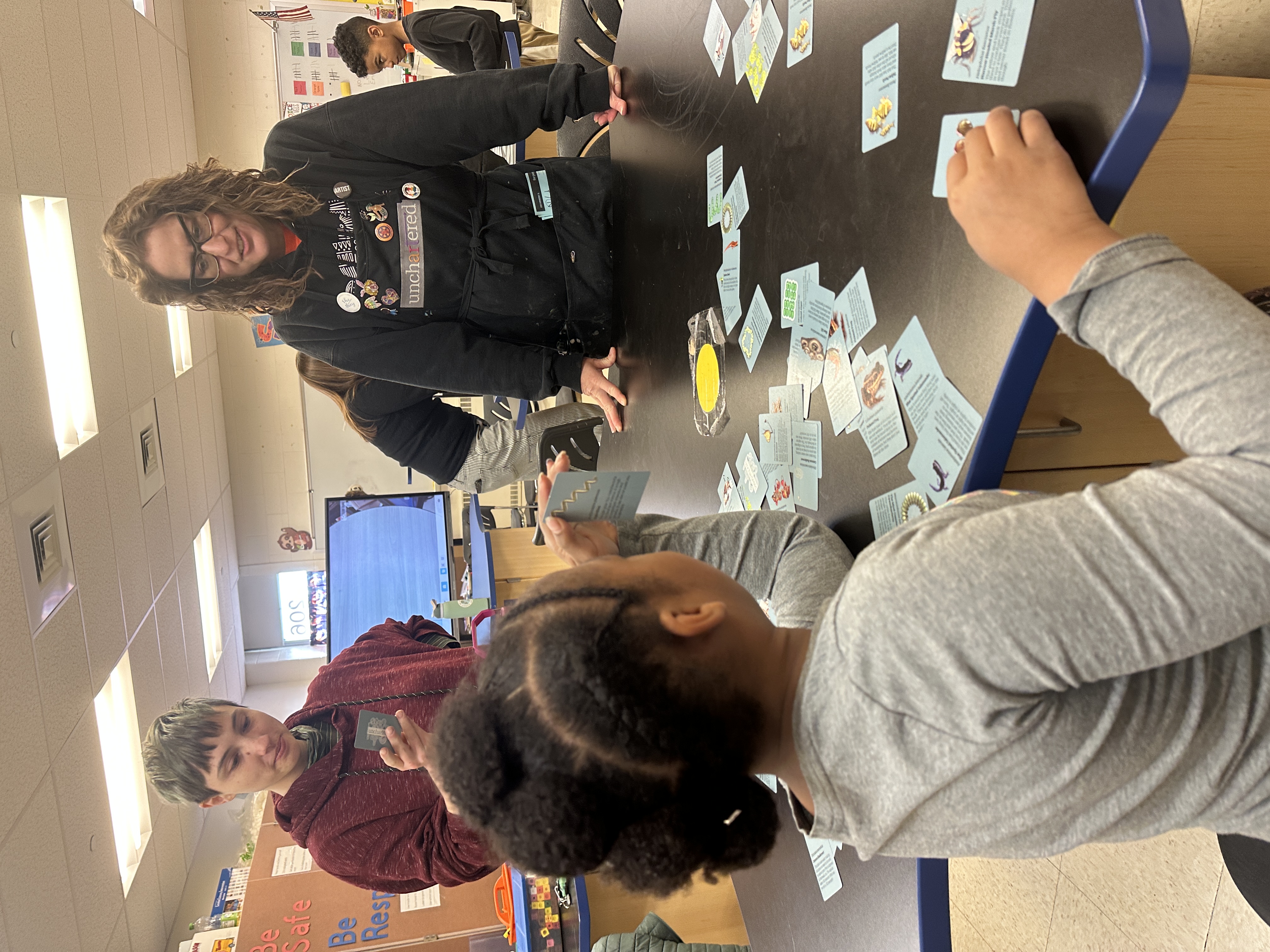
A standout experience of the Merrimack River Watershed Conservation Project has been our partnership with Unchartered Tutoring, a relationship-based learning organization founded by Amber Nicole Cannan. Her vision—to empower students as scientists and stewards of their communities—shaped a program that brought watershed science to 60 students in Manchester and Nashua.
Over eight weeks, students engaged in hands-on environmental science, including water filtration experiments, moss microscopy and mapping exercises that connected their experiences to broader conservation goals. Students identified and recorded flooding zones and tree locations in their neighborhoods. This data was incorporated into the Merrimack River Watershed Conservation Plan, ensuring youth perspectives and community voices were meaningfully represented in shaping the future of their neighborhoods.
Amber Nicole’s approach centers on emotional safety and scientific relevance. She introduced mapping by inviting students to locate their homes and reflect on local flooding. One student, upon realizing that his observations could help protect his family, dove into the project with purpose. Students saw themselves not just as learners, but as contributors to real-world solutions.
“Our students captured wild tardigrades (waterbears), sculpted landscapes and filtered water to learn about individual impacts they could have on their community via water interactions,” says Amber Nicole. “On a personal note, it stretched me creatively and showed Unchartered what kind of growth potential we truly have.”
The program’s success is evident in both the data and students’ transformation into confident community scientists. As Unchartered Tutoring expands programming to new schools and students, the impact of this collaboration continues to grow—like the trees these young scientists mapped.

Merrimack Watershed Conservation Plan
Learn more about the plan, including the vision and partnership that came together to help chart the way forward for conservation and community throughout the watershed.

Project Goals
The 2025 update to the Merrimack River Conservation Plan aims to do the following:
-
Create standalone themes from the previous plan’s major conservation targets. These will allow organizations to focus on subjects that meet their organizational missions and priorities, identify places where projects can create benefits across multiple themes and support collective efforts for conservation within the watershed.
The 2025 update incorporated all the data from the 2014 version, with four themes representing priorities and challenges in current conservation. These four themes were determined through partnership member and community input. Alone, each of these themes highlights priority areas for projects which meet a specific need; together, they highlight places where projects can provide multiple benefits for nature and people.
Explore the Plan's Themes
-
The community climate resilience theme identifies focus areas and supporting lands within the Merrimack watershed and ranks community perspectives and priorities for flood risk reduction, need for trees and heat island relief, and increased access to new and existing green space. The spatial data that shaped this theme included heat severity, flood storage and risk mitigation, access to recreational opportunities and green space, census blocks identified to be at higher risk for flooding, heat severity and need for improved or additional green space, and local assets and experiences identified through community engagement.
-
The wildlife habitat and connectivity theme identifies priority focus areas for protecting and restoring habitats, resilient and connected lands, and wildlife corridors within the Merrimack watershed.
-
The working lands theme identifies priority agricultural and forestry landscapes for protection. The priority agricultural resources data were generated based on an analysis using data from the 2020 Farms Under Threat study, which identified productive, versatile and resilient agricultural soils. Forestry lands data identify high-priority areas for protecting and managing timber forests using prime forest land soils, land cover and large, intact forest blocks.
-
The water resources theme identifies priority areas where protection, restoration and renaturing can improve water quality and quantity. This includes places where renaturing strategies like green infrastructure and pavement removal can help filter and remove pollutants, where locally important wetlands and buffer areas should be prioritized for protection and restoration, and areas where actions can safeguard public water supplies. This was determined by analyzing riparian and wetland buffers, hydrologic soil types, land cover data, public water supply areas, surface water and groundwater resources.
The updated plan is a series of spatial outputs representing the partnership and communities' shared vision and conservation priorities within the watershed. The spatial products are intended to help organizations and communities select projects that are within the plan’s focal areas. These spatial outputs will be used to review which projects will result in the greatest environmental benefits to the river and the community.
Want more stories like this?
Sign up for our monthly e-newsletter to get the latest stories, news and updates right to your inbox!
More Resilience Stories

Four Ways to Conserve New Hampshire’s Waters for People and Nature
Our Freshwater Program is reconnecting waterways, restoring floodplains, improving river flows and helping ensure clean water for all.

Climate Action in New Hampshire
TNC is taking meaningful action to address the impacts of climate change on the Granite State.

Proactive Relocation Away from Rising Waters
What can we do for Massachusetts communities on the front lines of flood risk to set them up for a safer, more resilient future?