
Resilient and Connected Plains
How we're saving nature's stage in the Great Plains.

Nature is on the move as warmer temperatures, increased flooding and other climate impacts alter and destroy habitat, forcing species to search for new places to live. As nature faces growing threats, so do people who rely on healthy lands and waters for food, jobs and quality of life.
The Resilient and Connected Network
Working with non-government, government and academic partners, scientists at The Nature Conservancy (TNC) have identified and mapped a network of lands across the United States with unique topographies, geologies, and other characteristics that can withstand climate impacts, called the Resilient and Connected Network.
This roadmap of “natural highways and neighborhoods” shows where plant and animal species have the best chance to move away from growing climate threats and find new places to call home.
Give Them Room to Roam
As our changing climate continues to take a toll on wildlife habitat, we're working on ensuring safe and resilient natural highways for migrating wildlife.
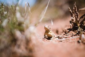
Texas Horned Lizard: A Texas horned lizard spotted in the short grass at Four Canyon Preserve, OK. © Going West Productions
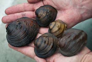
Mussels: The Meramec River supports several species of mussels. © Mark Godfrey/The Nature Conservancy
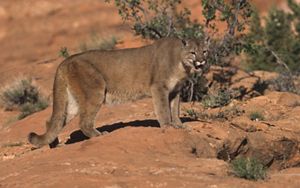
Mountain lion: Mountain lion © Paul Berquist
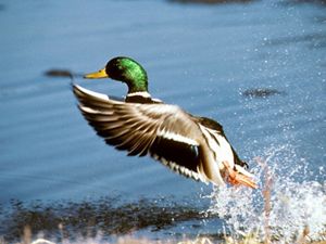
Mallard Drake: Courtesy of America's duck factory, the Missouri Coteau © U.S. Fish and Wildlife Service
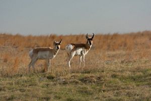
Pronghorn: A pair of pronghorn at Niobrara Valley Preserve. © Amanda Hefner/TNC
Black Hills


Blackland Prairies


Davis Mountains


Flint Hills


Oklahoma Canyons


Loess Hills


Meramec River


Missouri Coteau


Nebraska Sandhills


Superior National Forest


Resilient & Connected Story Map
Not in the Great Plains? Check out our story map to learn more about your area.
Explore the Story MapThe Resilient and Connected Network is a starting point for conversations with local communities, Indigenous communities, land trusts, agencies, corporations and funders on how we can coordinate our conservation efforts to increase our collective impact and sustain nature.
In order to achieve conservation at the scale that is required, collaboration with people and organizations across the public and private sectors is a must.
Get involved and learn more about the resilient and connected lands near you!
Speak Up for Nature!
Understanding environmental issues and how we can solve them is hard. Allow us to make it a little easier with our Issues Guide.
Related Stories

Natural Highways and Neighborhoods: Conserving a Network of Climate-Resilient Lands
This remarkable new mapping tool provides a roadmap for conserving places where plants and animals can thrive in a changing climate.

Saving the Future for Biodiversity
As species keep moving to escape the growing threats of climate impacts, Nature Conservancy scientist Dr. Mark Anderson says conservationists should focus on their future habitats. A new mapping tool shows how to protect climate-resilient natural highways and neighborhoods.

Site Renewables Right
To help accelerate the deployment of wind and solar energy in a way that helps people and nature thrive, The Nature Conservancy is providing the award-winning Site Renewables Right map.