A growing population doesn’t have to threaten natural habitats and native species.
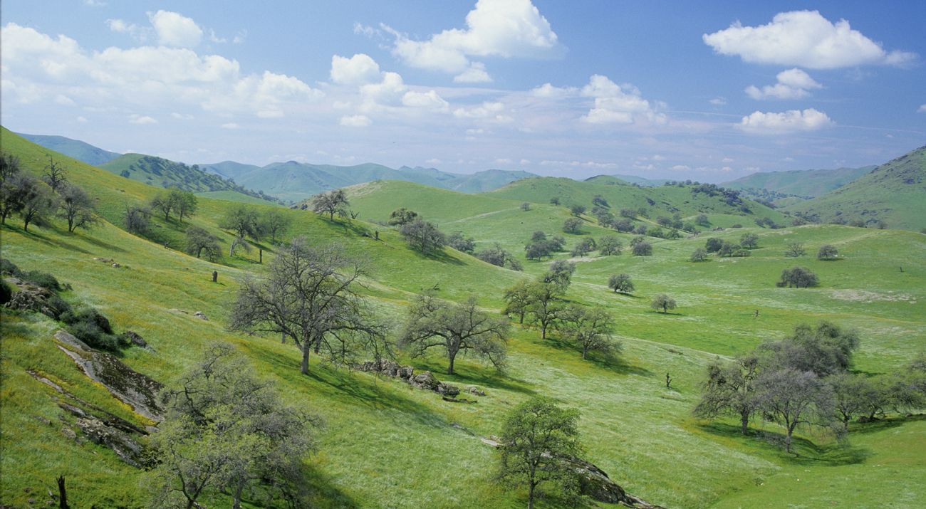
Gateway to some of California's most spectacular national parks, forests, and monuments, the Sequoia Foothills Project Area stretches from the headwaters of the Kaweah and Tule rivers in the Sierra down through the foothills. Few other places have such extensive blue oak and interior live oak woodlands flanking high-quality riparian (river) habitat corridors.
The project area begins approximately 30 miles southeast of Fresno. It extends to the floor of the San Joaquin Valley along several key river and stream corridors, including the lower Kaweah River, lower Tule River, Dry Creek, and Deer Creek.
Plants and Wildlife
The area supports the greatest biodiversity of native vegetation and the second-highest concentration of rare and endemic plants in the Sierra Nevada. The watersheds of the Kaweah and Tule rivers in eastern Tulare County extend from alpine headwaters, through montane coniferous forests and expanses of oak woodlands, to grassland-vernal pool complexes along the floor of the Great Central Valley. The finest stands of giant sequoias are found here.
Justly famous for its sequoias, the area also contains a wide range of other native species, including a host of rare plants and unusual mammals, such as:
- Pacific fishers
- Kaweah brodiaea
- San Joaquin kit foxes
The natural habitats include:
- conifer forests high in the mountains, blue oak woodlands in the rolling foothills
- rare riparian communities like the sycamore alluvial woodland, the largest in the Sierra, and third largest anywhere
- streams and rivers cutting through the foothills, flanked by groves of blue oak and interior live oak
- grasslands dotted with vernal pools on the valley floor
Why TNC Selected This Site
The principal threat to the natural habitats and native species of the Sequoia Foothills Project Area is development driven by population growth. The population is growing faster in the Central Valley than in most other parts of California.
In recent years, the Central Valley has seen a steady conversion of farmland to "ranchettes" and other forms of rural sprawl. To accommodate potential population pressures and protect prime agricultural lands, the county has designated more than 50,000 acres as development corridors designed to draw suburban development into the foothills. Without careful planning on the appropriate scale within these corridors, they are a concern for conservation because they can encourage land use changes harmful to natural habitats and native species in the foothills. The extremely steep terrain in this part of the Sierra pushes development towards the flat areas flanking sensitive rivers, where small parcel sizes increase the likelihood for fragmentation of the landscape, with negative consequences for biodiversity.
What TNC is Doing
In December 2000, The Nature Conservancy was awarded a grant from the David and Lucile Packard Foundation to develop a conservation plan for the Sequoia Foothills area in conjunction with the newly formed Sierra Los Tulares Land Trust (now the Sequoia Riverlands Trust). This collaborative planning process, completed in April 2002, succeeded not only in producing a compelling vision for regional conservation in Tulare County, but in forging a strong partnership between The Nature Conservancy and the land trust. Moving forward, TNC and the land trust are building on this partnership through an innovative approach that integrates staff resources, jointly raises operating and acquisition funds, and coordinates implementation of strategic acquisitions and land-use planning efforts.
This approach will significantly leverage TNC's staff resources while providing the support and mentoring necessary to build the land trust into a powerful agent for conservation in the region.


