
- Phone: +1 404-873-6946
- Email: TNCGAOperations@tnc.org
-
Follow

Three headwaters, three distinct geographical areas flowing through three states.
Unique among the nation’s river basins, the Upper Coosa consists of three headwater rivers, the Conasauga, Coosawattee and Etowah, dozens of tributaries and all the land drained by these waters.It encompasses three distinct geographical areas: Blue Ridge Mountains, Ridge and Valley, and Piedmont. The Nature Conservancy is working with key stakeholders to protect, preserve and restore this important river basin.
Water’s Journey
The Upper Coosa River Basin begins as small springs in the Cohutta Mountains and in the Blue Ridge Mountains of north central Georgia. It flows through some of the most picturesque and iconic landscapes of the north Georgia mountains. The Oostanaula, which is formed by the confluence of the Conasauga and Coosawattee, joins the Etowah in downtown Rome, Georgia, about an hour northwest from metro Atlanta.
Nearly 20 counties in northwest Georgia lay within the river basin, and others in Alabama and Tennessee, all benefitting from the river and its many tributaries. The river basin’s waters are used in local farming and industry, but one area most dependent on the river isn’t even within the basin’s boundaries. Metro Atlanta relies on the Upper Coosa River Basin to provide some of its fresh, clean drinking water.
Creatures of the Upper Coosa River Basin
As it winds through such varied geographic areas as mountains, valleys and piedmont, it’s not surprising that this river basin supports the highest percentage of native species of any other basin in North America.
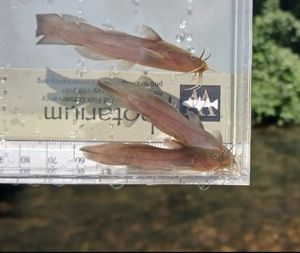
Amber Darter on the Etowah: Amber Darter on the Etowah. © Robert Lamb
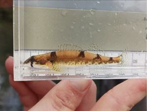
Madtom Catfish: Madtom Catfish on the Chattahoochee River © Robert Lamb
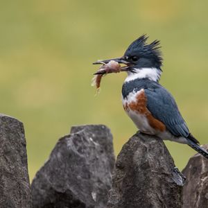
Belted kingfisher: Belted kingfisher Coosa River © Coosa River Basin Initiative
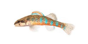
Trispot darter: Trispot darter, Murray County, Georgia © Alan Cressler
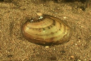
Alabama Rainbow mussel: A mussel in the Coosa River Basin © Alan Cressler
The Story of the Trispot Darter
Trispot darter depend on free-flowing rivers to lay their eggs. Read about one family’s journey in our family-friendly coloring book, a partnership with Georgia Department of Natural Resources.
Threats and Solutions
Despite our dependence on the waters of the Upper Coosa River Basin, manmade forces are altering the lands and waters of the area. Factors such as air pollution, industrial water use and incompatible farming practices are combining with increased population and development, putting pressure on the river, its tributaries and the myriad life it supports.
Some of these manmade changes may seem small at first, almost inconsequential. But even the smallest disturbance on a rural tributary has a cascading effect, like the eroding power of a waterfall on the rocks beneath it.
But partners throughout the basin’s reach are working together, through land acquisition, protection agreements and diverse management practices. With The Nature Conservancy’s help, partners are shifting engineering practices away from stormwater ponds to infiltration practices that mimic natural hydrology and trying new ways to filter nutrients and pesticides from agriculture and drainage ditches before they enter the water. It’s our way of ensuring the river is there for us to enjoy today and for all those who follow.
Upper Coosa River Basin of North Georgia


Get Impact in Your Inbox
Sign Up for Monthly Nature News Emails
Related Articles

Securing Georgia’s Fresh Water
We’re working on multiple fronts to secure clean water for drinking, recreation, wildlife habitat and more.

Visit Holly Creek
A hidden preserve near the Chattahoochee National Forest and see if you can spot one of at least 25 fish species found in the creek.

Conasauga Conservation
The Nature Conservancy protects rivers, creeks and forests in Georgia's Southern Blue Ridge.