Fishpond Detectives
The Conservancy's Marine Fellows search for and map Hawaiʻi's historical fishponds.
Three Nature Conservancy marine fellows are working to identify and digitally map the various fishponds in the Hawaiian Islands. It’s a daunting task because many of the ponds now exist only in old maps and documents, in early historical photographs and in the memories of island kūpuna.
“I look at historical maps and pictures as gold nowadays,” said Kanoelani Steward, 26, of Lahaina, who learned during her research that Mala Wharf and boat ramp, near where she grew up, was once the site of a fishpond.
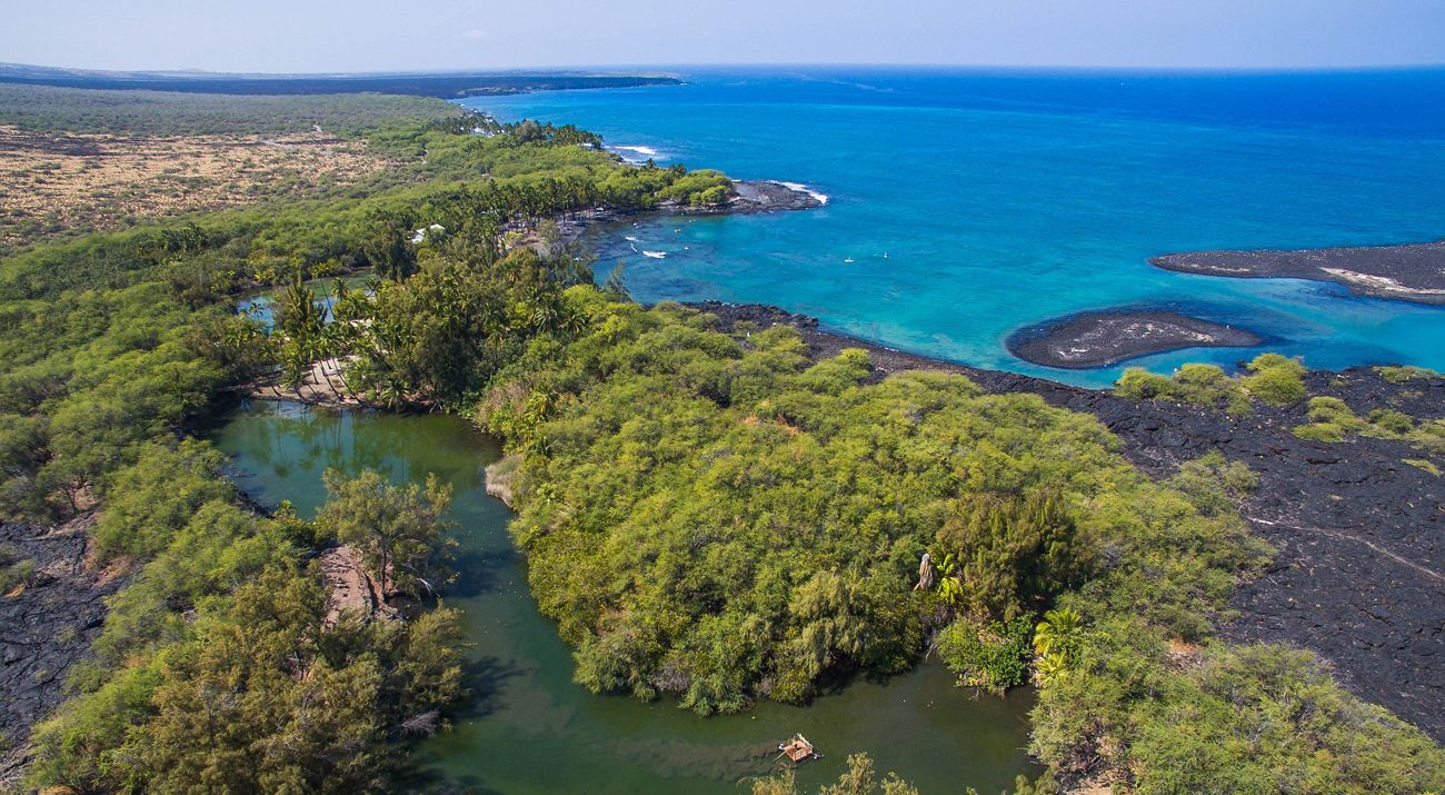
Hawaiian fishponds, or loko, are an advanced form of aquaculture unique to the islands. At one time, there were hundreds of them. But as Steward discovered, most have been destroyed—overgrown, covered by lava, filled in and built upon, or replaced by other uses.
Fortunately, some still survive and there is increased statewide interest in restoring them.
Quote: Bert Weeks
"The project requires a lot of detective work because there is no comprehensive statewide database."
Project Partners
Bert Weeks, 26, from Aiea, Oʻahu and Nakoa Goo, 30, from Puna, Hawaiʻi Island are Steward’s project partners. Together, they are the fifth cohort of the Conservancy’s Marine Fellowship Program, an intensive two-year apprenticeship begun in 2008 to produce a new generation of marine stewards.
The trio is building on work previously done by others, including former fellows Brad Wong and Nahaku Kalei. To complete it, they are filling in gaps and focusing their efforts on the fishponds of their home islands: Weeks on Oʻahu, Goo on Hawaiʻi Island and Steward in Maui County. They will take on Kauaʻi County together when the other islands are complete.
Their goal is to document fishponds of every type, and to record them on a digital mapping system called GIS (Geographic Information System), which allows for multiple layers of information to be displayed on a single map. GIS training is part of their fellowship and provides them with a practical way to apply their fishpond research.
Sourcing Information
“The project requires a lot detective work because there is no comprehensive statewide fishpond database,” Weeks said. “We use the state Archives, the records of the Hawaiian Historical Society, Bishop Museum and old maps from the state Department of Accounting and General Services.”
They also look at satellite imagery, talk to area kūpuna and study vegetation patterns for clues about former uses of land for aquaculture. But even with all those sources, the data is often incomplete.
Hawaiian fishponds are typically thought of as shallow nearshore areas enclosed by rocks walls, or loko kuapā. But there are other types of ponds, including the pu`u one, a pond behind a natural coastal sand dune; and the loko wai, a more inland, generally freshwater pond.
Many loko wai were converted more than a century ago to rice cultivation after fish production was given up. Some famous ponds have been destroyed by natural forces, like lava flows. In 1801, Pāʻaiea, the great Kona fishpond complex of Kamehameha, was destroyed by an immense flow.
Oʻahu’s Pearl Harbor once had 20 to 40 fishponds, and while most are gone, a few are being restored. Other ponds are remembered culturally by area residents, but are not on any map.
“Sometimes, you can identify a body of water, but can’t tell whether it was used as a fishpond,” Goo said. “There are a few with names, but with no other evidence of their existence.”
Multiple Uses
Hawaiʻi staff member Stephanie Tom, who is providing GIS training to the fellows, says the information being collected has multiple uses and is of great interest to groups like Hui Mālama Loko Iʻa, a statewide consortium of fishpond practitioners and organizations with whom the Conservancy is working.
One use is assisting in potential restoration to enhance local food production. There is also cultural and historical value to knowing former land uses. And since most fishponds had a source of fresh water, knowing their location can help identify different types of water resources.
“The demand is there for this kind of information. We’re already getting requests for it,” Tom said.
In the meantime, the fellows continue the difficult task of mining that information, scouring the archives and pouring over old maps in search of gold.
