Discover the Legacy of Land Protection at TNC
For more than 70 years, The Nature Conservancy has been at the forefront of land conservation, safeguarding and restoring vital landscapes across the globe. From the beginning, our mission has been rooted in protecting the lands and waters on which all life depends. Today, our network of nature preserves represents this legacy—places where wildlife thrives, ecosystems are restored and people can connect with nature in meaningful ways.
Join Us in Protecting the Land We Love
The Nature Conservancy’s preserves are more than destinations—they are legacies of conservation and hope. Subscribe to Nature News to stay informed about protected places near you and discover other ways to get involved to ensure these places remain protected for generations to come.
What is a Nature Preserve?
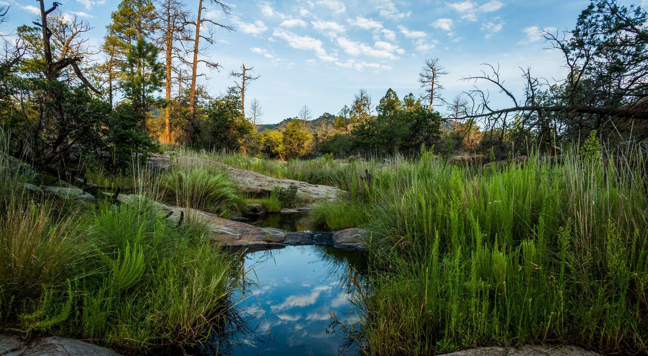
A nature preserve is a protected natural area dedicated to safeguarding species and the habitats they need to thrive. Some of TNC’s preserves protect the last remaining natural habitats for rare and endangered plants and wildlife. Others serve as living laboratories where TNC and our many partners can explore land stewardship strategies and inspire local communities to play their part in conservation. Unlike parks that usually prioritize recreation, preserves are designed to protect our most climate resilient and biodiverse landscapes while offering visitors an opportunity to experience nature responsibly.
Whether you’re hiking, birdwatching or exploring TNC’s efforts to protect and restore local habitats, each preserve highlights the importance of conservation. Every place we protect—and every species kept from harm’s way—is made possible with support from caring people who value nature’s treasures. And the impact of these preserves extends far beyond their boundaries, providing clean air and water, building community resilience against climate change and offering critical refuge for species facing habitat loss.
Discover TNC Preserves for Every Kind of Nature Lover
Nature is closer than you think. With more than 800 nature preserves across all types of landscapes, open to visitation across the United States, there’s a preserve near you waiting to be explored. Each site is as diverse as the people who visit. Whether you’re a solo adventurer looking for a thrill, a family looking for nearby nature preserve trails to enjoy together or someone who simply seeks to escape the hustle and bustle of urban life, there’s almost certainly a place that aligns with your interests.
For the Adventurers
If you crave excitement and physical activity, explore the best nature preserve trails near you that offer opportunities for hiking, biking or kayaking. Many trails throughout TNC preserves are perfect for those looking to challenge themselves while surrounded by stunning landscapes and scenic vistas.
For the Seekers of Solitude
For those seeking a little solace and solitude, our preserves provide a serene setting for reflection, mindfulness and quiet time. From winding trails through ancient woodlands to sandy shorelines amidst crashing waves to the gentle hum of pollinators in open prairies, you can reconnect with the restorative power of nature at one of our nearby preserves.
For the Curious Explorers
If you love discovering new things, TNC preserves are treasure troves of biodiversity. Join local TNC staff and volunteers for a guided hike or simply roam at your own pace. In the process, you might uncover the stories of rare plants, native wildlife and the intricate ecosystems that make each preserve unique.
For Families and Friends
Looking for a nature preserve near you to enjoy with loved ones? Our preserves offer family-friendly trails and open spaces that are perfect for wildlife watching or simply exploring and enjoying the outdoors together. And many preserves offer family-friendly educational programs hosted by trained volunteers and TNC staff.
For Conservation Stewards
For those inspired to take action, TNC preserves provide opportunities to support our mission through volunteerism. No matter how you get involved. Whether you help maintain trails, plant native trees, remove invasive plants or participate in community science initiatives, your engagement makes a world of difference. Learn about volunteering with TNC.
Plan Your Visit to a Nature Preserve Near You
Ready to discover the best local nature preserves in your area? Start by exploring the map above to learn more about the places we protect near you. We hope each new outdoor experience helps renew your passion for nature and allows you to experience the gifts that only nature can provide.


The Nature Conservancy values diversity—with regard to race, ethnicity, gender identity, sexual orientation, and more—and encourages everyone to visit our preserves. The Nature Conservancy has a zero-tolerance policy for discrimination.