interstitialRedirectModalTitle

interstitialRedirectModalMessage

Places We Protect

Clay Head Trails

Rhode Island

Tall bluffs on the left rise high above a rocky beach with the light blue ocean stretching to the horizon.
Clay Head Clay Head was conserved and opened to the public through the generosity of the Lapham family. © Matthew Stigliano

Enjoy the beach or follow the path along the bluffs for sweeping ocean views.

Overview

Description

The majestic Clay Head bluffs rise up to welcome Block Island visitors and provide a glimpse of the incredible natural beauty that awaits. Beyond the bluffs lies a wonderful network of rambling footpaths that are beautiful in all seasons.

The Clay Head Trails are located three miles north of Old Harbor, starting from a parking area off Corn Neck Road. (See below for details.) You can take a short walk out to the beach and back or follow the path up to the bluffs for a spectacular hike along the ocean, with several overlooks down to the waves crashing below. Unmarked side trails open into the wooded interior of the property, inviting further exploration.

Dogs must be leashed at all times. Bikes are not allowed on the Clay Head Trails.

Clay Head is owned and managed by the Lapham Family, in close partnership with The Nature Conservancy, the RI Department of Environmental Management and the U.S. Fish and Wildlife Service.

Access

OPEN TO THE PUBLIC

12 miles of nature trails connecting the beach and bluffs with fields and thickets.

Hours

Open year-round during daylight hours.

Highlights

Hiking, birdwatching and ocean views

Size

190 acres

Explore our work in Rhode Island

Things to consider when visiting

  • The main parking area is located about three miles from Old Harbor. Driving or riding north on Corn Neck Road, look for the words “Clay Head Trail” in red vertical lettering mounted on a pole, across from the transfer station sign. The 0.4-mile-long dirt driveway leads to the trailhead, with a kiosk and bike racks.

    Additional parking is available at the Hodge Family Wildlife Preserve, 0.3 miles north on Corn Neck Road. Cross the road to access Clay Head via the Long Lot Trail. Or park at the end of Corn Neck Road and explore Clay Head from north to south.

  • Note: Clay Head is open to the public through the generosity of the Lapham family. Please respect their privacy and follow the signs marked “Walkers Welcome.”

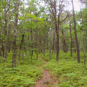
    Clay Head Trail (2.8 miles one way): Park at the trailhead, 0.4 miles from the intersection of Corn Neck Road and the driveway into the preserve. The first section of trail leads you through dense shrubs and into a meadow dotted with large trees, mostly sycamore maples and wild black cherries. Enjoy the view over Clayhead Swamp out to the ocean.

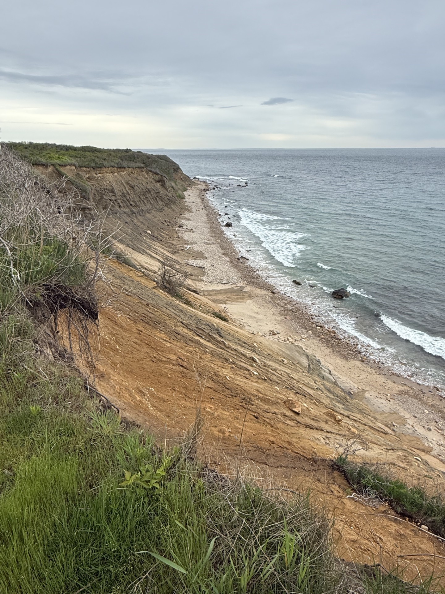
    Proceed downhill and cross a small footbridge, observing changes in the surrounding habitat as you approach the beach. Just 0.3 miles from the trailhead, Clayhead Beach is a great spot to take a break and explore the shoreline. When ready, backtrack slightly and follow the trail to the left to explore the bluffs.

    Once you climb the bluff, the trail flattens out and takes you to the north end of Clay Head, and to Sachem Pond and the North Light beyond it. The path weaves in and out of fields and bayberry shrublands, past several overlooks with views of the ocean, the mainland and Old Harbor.Please take care to stay back from the edge, as the top of the bluff is fragile and undercut in places.

    Long Lot Trail (0.6 miles): Park at the Hodge Family Wildlife Preserve and cross Corn Neck Road. Enter Clay Head through a wide gap in the stone wall.

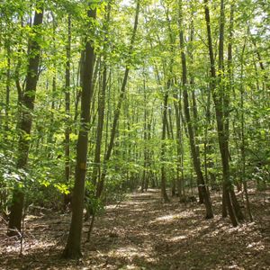
    Marked with yellow blazes, this trail skirts the Maze (see below), passing through small groves of black walnut and tamarack trees, interspersed with milkweed meadows. Some areas have an enclosed feeling, due to the surrounding vegetation, but high spots provide views of the Great Salt Pond and other landmarks. The Long Lot Trail provides a great connection to the Hodge Preserve for a longer loop.

    Other Clay Head Trails: Another 10 miles of trail—known by many as the Maze—wind through the interior of the property. Look for unmarked paths leaving the Clay Head Trail at various points to enter this area. The trails are unmapped to preserve their enchantment. If you get disoriented, walk to the east or listen for the sound of crashing waves and head in that direction.

  • Clay Head's abundant shrubs and thriving wetlands combine to make it one of most important places for songbird migration on the Atlantic Coast.

    Plants: Clay Head features a diverse, second-growth forest community with native red maples and wild black cherries growing alongside planted sycamore maples and black walnuts.

    Along the bluff, the shrub layer is largely comprised of northern bayberry and poison ivy.

    Birds: The Clay Head bluffs provide nesting habitat for bank swallows and barn owls, which nest nowhere else in Rhode Island. Other common birds include yellow warblers, common yellowthroats, Carolina wrens and gray catbirds.

  • We hope you enjoy visiting TNC’s preserves in any season. We ask that you please observe the following guidelines:

    • Stay on established trails.
    • Dogs are permitted but must be leashed at all times.
    • Bikes are not permitted.
    • Respect preserve hours (one hour before sunrise to one hour after sunset). Overnight camping is not allowed.
    • Do not ride horses or any motorized vehicle through the preserve or on the trails.
    • Do not remove plants or other living materials from a preserve, and do not disturb any stone walls or other historic features.
    • Remove any trash you create and, if possible, any garbage that you see left by someone else.
    • In the spring, summer and fall, dress in long pants and socks to avoid ticks. After any walk on a preserve, it is a good idea to check for ticks when you return home.
    • Be careful! Your safety is your responsibility.
At left, a tall, steep bluff with exposed orange and brown soil rises above a rocky beach and the ocean under overcast skies.
Trail Through Time A rainy night deepens the colors and textures of the bluffs the next day. © Tim Mooney/TNC

History

The Clay Head Trails are part of the traditional homelands of the Manissean people and other Indigenous tribes.

Block Island’s network of walking trails began here in the 1960s, when F. David and Elise Lapham cut paths through the property and opened them to the public. The Laphams formally conserved the land in the late 1970s through the gift of a conservation easement, and we are deeply grateful for their generosity and foresight.

In 1967, Elise Lapham established the Block Island bird banding station at Clay Head, making it one of longest continuously running banding stations on the Atlantic Coast. Licensed bird banders collect information on migrating and resident songbirds every spring and fall, expanding our understanding of migration patterns and informing habitat restoration practices.

Nearby Preserves

Need more nature? Visit The Nature Conservancy's other preserves.

Find More Places We Protect

The Nature Conservancy owns nearly 1,500 preserves covering more than 2.5 million acres across all 50 states. These lands protect wildlife and natural systems, serve as living laboratories for innovative science and connect people to the natural world.

See the Complete Map

Support Our Work

Your contributions help us continue our conservation work in Rhode Island.