National Flood Insurance
Accurately assessing and communicating risk and Investing in natural infrastructure will reduce flood risk.
Ensuring flood risk is accurately mapped and communicated and investing in nature are smart solutions for reducing the nation’s risk from floods while also providing other economic, environmental and social benefits to communities.
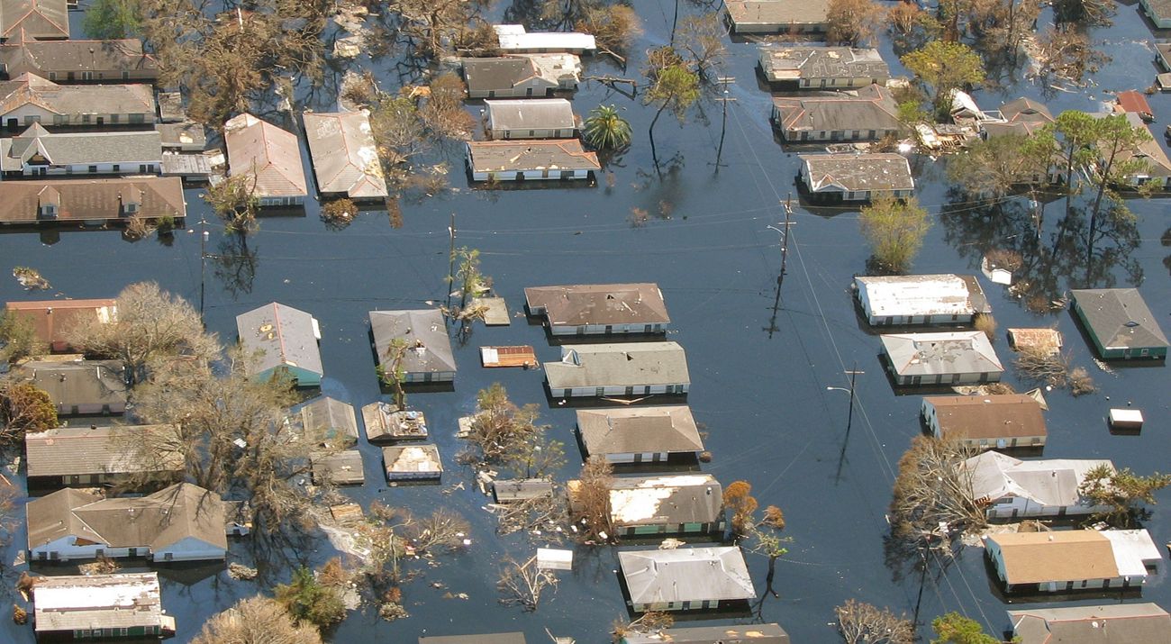
The last several years have brought multiple catastrophic flood events to the United States and its territories, most recently hurricanes Dorian, Florence and Michael and flooding in the Great Plains and Midwest. Flooding is the costliest type of disaster in the country, causing more than $1 trillion in estimated losses since 2000, according to the National Oceanic and Atmospheric Administration. Dollar losses due to tropical storms and other flood events have risen tenfold since the 1980s, with the federal government bearing much of the financial responsibility. Scientists are increasingly confident climate change worsens extreme weather events.
Properly preparing, planning for and acting to reduce flood risk are investments that yield a $7 return for every $1 spent, according to a 2018 study by the National Institute of Building Sciences. And a 2017 study led by The Nature Conservancy (TNC) shows salt marsh wetlands saved more than $625 million in property damages during Hurricane Sandy and reduced annual property losses by nearly 20% in Ocean County, New Jersey, alone.
Opportunity for Nature-Based Solutions
Nature is a smart solution to help reduce flood risk. It is an investment that can yield measurable flood benefits as well as many economic, environmental and social benefits, such as clean water and air, sustainable land for food production and enhanced recreation opportunities and wildlife habitat.
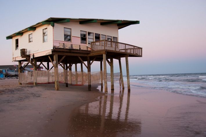
For example, people are safer during floods when rivers have more room for floodwaters to disperse and slow down rather than rise and threaten communities. Along coasts, natural features such as sand dunes, marshes and reefs reduce wave heights and absorb storm surges. Investing in these types of natural infrastructure can be done alone or alongside gray infrastructure such as seawalls, dams or levees.
National Flood Insurance Program: Challenges
The National Flood Insurance Program (NFIP), administered by the Federal Emergency Management Agency (FEMA), is more than $20 billion in debt. This amount is likely to increase with continued catastrophic flood events becoming more common.
The flood insurance rate maps that delineate special flood hazard areas and varying risk levels are out of date, based only on historic data and do not use the latest science and methods. A 2018 TNC study found that 41 million Americans, some 13% of the population, are at risk from flooding rivers—more than three times the current estimate based on regulatory flood maps. In addition, the program does not result in actions that effectively minimize risk, especially for properties that repeatedly flood.
National Flood Insurance Program: Recommendations
The NFIP should provide effective incentives and tools for restoring natural defenses to flooding. It should also use the best available science for flood mapping and risk reduction. Specifically, Congress should take the following actions:
Incent mitigation programs to more effectively reduce risk, including investing in protection and restoration of the natural features of rivers and coasts proven to aid in flood risk reduction.
- Prioritize mitigation actions in highest flood risk areas, especially to facilitate voluntary permanent structure removal.
- Allow funds to be used on natural infrastructure community-scale projects.
- Improve process and effectiveness of voluntary buyouts.
- Incentivize development of flood risk mitigation plans detailing actions and investments to reduce risk over time.
- Continue to place greater emphasis on increasing investments in pre-disaster mitigation.
- Provide technical assistance to communities to bolster participation in the Community Rating System Program.
- Reduce administrative complexity and requirements associated with FEMA mitigation programs, and speed delivery time of assistance and grants.
Ensure maps draw on the most up-to-date, scientifically sound data and information using the most advanced methods.
- Include information on future risks such as sea level rise, heavy precipitation events and erosion rates.
- Incorporate other data relevant to risk reduction planning such as land use information, location of critical facilities and demographic and socioeconomic information.
- Develop methodology for mapping risk of areas behind unaccredited levees and dams.
- Incent elevation certificates for all property located in the 100-year floodplain.
- Expand mapping coverage to capture more of the United States’ flood risk, including flood risk from smaller streams, in urban areas and in areas with a 0.5% risk of flooding (also known as the 500-year floodplain).
- Disclose and make accessible to prospective property buyers—early in the sale process—full data on past flood insurance claims.
Case Study
Demonstrating Success at South Cape May, New Jersey
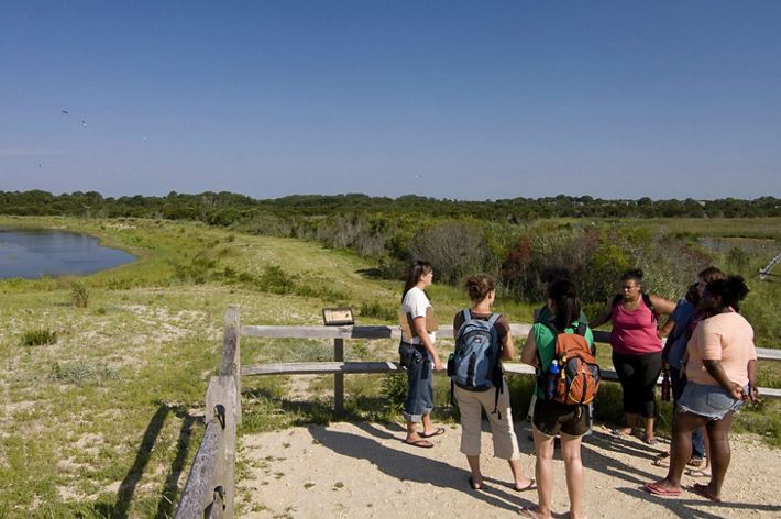
In partnership with the U.S. Army Corps of Engineers and the State of New Jersey, TNC undertook a $15 million restoration project at South Cape May Meadows Preserve that combined natural features, such as dunes and wetlands, with levees and other engineered structures to control water.
Completed in 2004, the restored preserve has since withstood a series of severe storms, including Irene in 2011 and Sandy in 2012. Storm waves didn’t breach the dunes, wetlands remained intact, and the preserve helped protect neighboring communities.
A TNC-conducted study demonstrated that flood insurance claims from homes in the adjacent Cape May Point community will be lowered by $9.6 million over the next 50 years as a result of this project. And that figure is an underestimate, since it does not include additional savings from uninsured homes, damage avoided to other infrastructure or estimated savings from another adjacent community, West Cape May, for which data were not readily available.
Mapping Tool That Drives Effective Risk Reduction
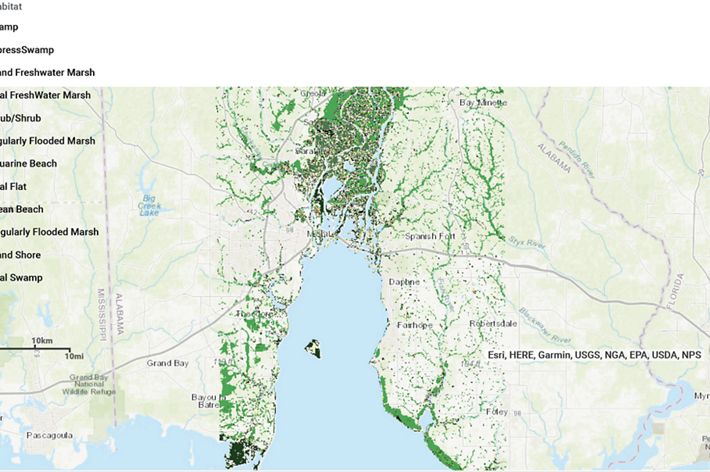
TNC and partners created a mapping tool that provides key information to help communities assess vulnerability and develop effective nature-based risk reduction strategies.
The tool allows a view of sea level rise and storm surge, combines information on coastal habitats and socioeconomic data to assess where greatest risk reduction can take place and examines natural and built coastal risk reduction strategies.
