Strengthening Maryland's Coasts
Helping Maryland’s critical coastal habitats and historic communities adapt to the effects of climate change.
Sea levels in the Chesapeake Bay have risen about a foot in the last century—an alarming rate at more than twice the global average. By 2050, models project that we could see an average of two feet of sea-level rise. With more than 7,000 miles of Atlantic and Chesapeake Bay shoreline, our communities across the state are already experiencing flooding, marsh loss and saltwater damage to agricultural fields.
Crisfield, Maryland
Building a Model For Resilient Communities
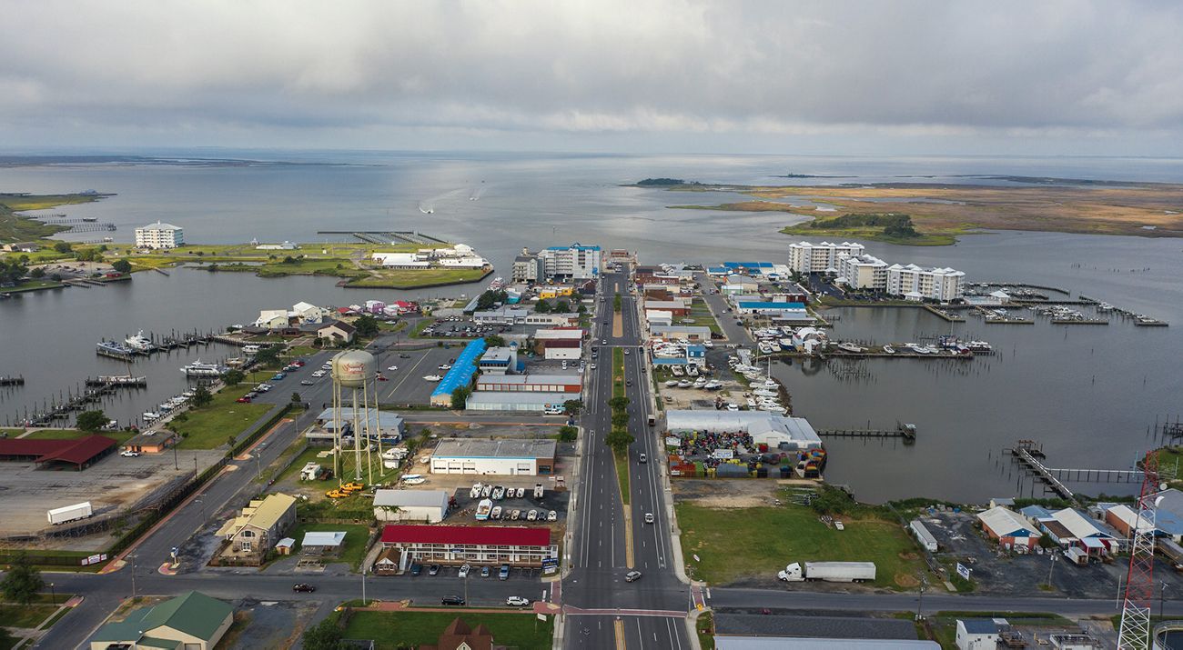
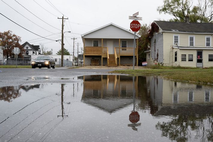
The Nature Conservancy and a variety of partners are working with the Town of Crisfield and members of its community to address challenges due to its low elevation and proximity to the Chesapeake Bay. In recent years, the town has become increasingly vulnerable to flooding, which is impacting the community and hampering economic growth. Tides have become more extreme, leading to more frequent nuisance flooding on roads that impede access to important parts of the community. Even smaller storms are having a more severe impact, often forcing schools and businesses to close and leaving property owners with expensive damage and losses. As in many small coastal communities, the severity of these impacts has been disproportionate to the resources available to address them.
For TNC and our partners, Crisfield represents a place that can serve as a model for improving community resilience to flooding. Starting in 2022, this led to a National Oceanic and Atmospheric Administration (NOAA) funded project to assess the benefits of potential new flood adaptation strategies to support the city’s planning efforts.
The partners are also working with the town to build local capacity for supporting resilience-improvement projects that include an early flood warning system and an effort to map all of Crisfield’s drainage infrastructure. They are also exploring how nature-based solutions such as green infrastructure and marsh restoration can support the community’s long-term resilience.
High tide flooding in Crisfield, Maryland.
Toward a Resilient Coastline in Maryland: COEF addresses barriers to coastal resilience funding
Building upon the Supporting Equitable Access to Funding for Adaptation Resources (SEAFARE), a series of workshops TNC conducted with practitioners, partners, and residents, the Maryland/DC Chapter just released Toward a Resilient Coastline in Maryland, a new report that seeks to highlight the barriers that many coastal communities face in addressing impacts of climate change. This new report offers a roadmap for building resilient coastal communities in Maryland and marks the culmination of extensive collaboration.
The effort, led by Community Outreach and Engagement Forums (COEF), brought together leaders from Maryland’s coastal communities, local governments, community-based organizations and academic institutions to discuss the new and worsening challenges posed by climate change. COEF partners identified flooding and infrastructure needs as their most pressing concern. The lack of readily accessible funding streams, capacity gaps in local governments, and hard to understand state and federal processes have created a large gap between Maryland’s stated climate goals and communities facing the first impacts of climate change being able to see themselves reflected in this vision for a resilient state.
To address the key issues and cross cutting themes identified, COEF partners proposed 15 policy development areas, leveraging U.S. Army Corps of Engineers funding, applying for resilience funding under the Whole Watershed Act in Maryland, local governments working together to utilize private sources of funding, and partnering with state agencies for infrastructure repair projects. TNC’s Maryland/DC Chapter will continue organizing COEF meetings to keep building on the policy recommendations and moving our state towards implementation of climate adaptation solutions.
Studying the Ecological Effects of Sea-Level Rise
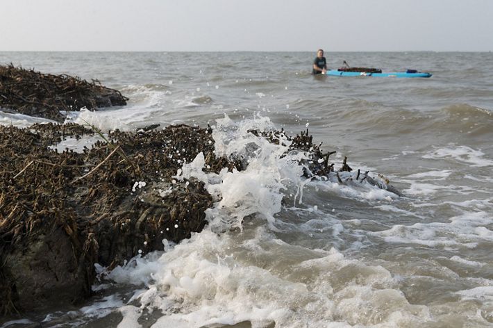
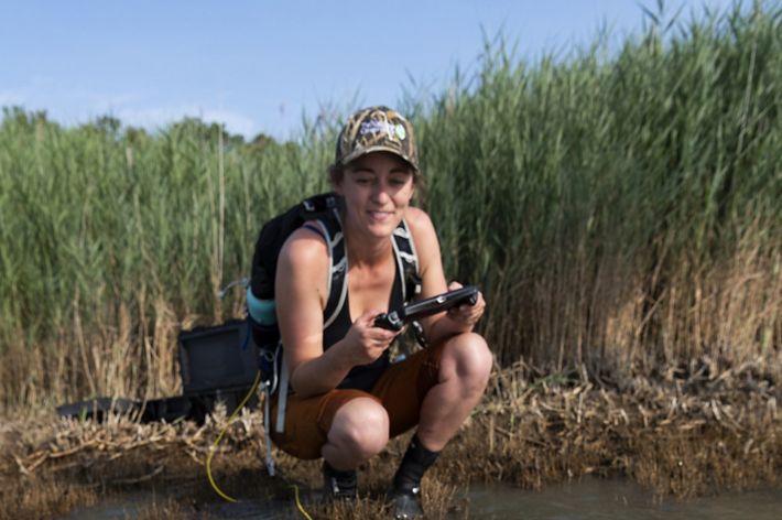
Along Maryland’s Chesapeake and Atlantic coasts, tidal wetlands act as the first line of defense against storms and rising seas. To better quantify how these natural coastal features reduce the impacts of storm surge, TNC partnered with George Mason University (GMU) and the Maryland DNR on a wave attenuation study in 2018. After collecting data for one year from sensors installed on a Deal Island marsh, researchers found a striking data point: the first few feet of tidal marsh reduced wave height by up to 90%.
The success of the Deal Island wave attenuation study led to a three-year grant from NOAA’s Ecological Effects of Sea Level Rise (EESLR) Program to study and quantify the benefits of coastal habitats across Maryland's Chesapeake and Atlantic coasts. Now complete, the data from this study are being fed into models that are driving coastal conservation efforts led by state and federal agencies, and other NGO partners, around the Chesapeake Bay. TNC understands that demonstrating ways that nature provides value to people and communities is the best way to get real conservation results on the ground.
Grant Funded Restoration
Coastal habitat restoration has traditionally addressed single sources of degradation, such as sea-level rise, erosion, invasive species, etc. However, sites are usually impacted by a myriad of human-caused stressors. To better catalogue all potential sources of marsh degradation, TNC is partnering with experts to develop an innovative marsh management decision framework model, thanks to a one-year grant from the National Fish and Wildlife Foundation (NFWF). With current and projected rates of habitat loss, the Chesapeake Bay can no longer afford to continue business as usual. TNC and our partners will create an innovative decision framework that will help inform holistic tidal marsh management and restoration.
REPI Challenge
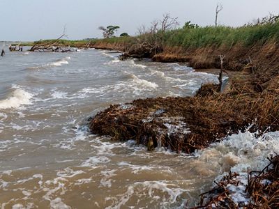
In late 2020, The Atlantic Test Ranges and Naval Air Station Patuxent River were awarded a $3 million grant from the Department of Defense’s Readiness and Environmental Protection Integration (REPI) Program to protect land on Maryland’s Eastern Shore. The funds will be used to purchase easements on 4,000 acres of land, establishing a resilient and connected marsh migration corridor and preventing incompatible development within the Navy’s fly zone. The U.S. Navy will partner with TNC, the U.S. Fish and Wildlife Service and others on the protection effort.
Since the award was announced, TNC has completed a land prioritization mapping exercise to identify the parcels that will provide the highest return on investment for people and nature. With TNC staff working on the ground with landowners, the Maryland REPI partnership is ready to begin the ambitious work of protecting 4,000 acres of critical coastal habitat.
Resilient Protection Frameworks
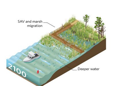
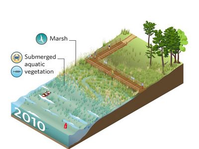
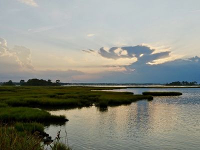
With sea-level rise transforming landscapes, TNC is aiming to address the intersection of marsh migration and landowner resilience. Building on the foundation established by the Maryland Department of Natural Resources (DNR), TNC has designed a project to lead marsh protection, coastal management and environmental finance experts in the development of resilient protection frameworks.
The frameworks will update protection easements and management plans to account for the impacts of sea-level rise. The goal of these frameworks are to ensure the healthy landward migration of Maryland’s tidal marshes while simultaneously preserving the cultural and financial interests of communities and landowners.
A $2 million partnership with Lockheed Martin is funding the development of the resilient protection frameworks. This generous grant is also helping to fund our efforts to strengthen natural ecosystems, engage communities in adaptation planning and protect 4,000 acres of critical wetlands by 2025.
Contact
Joseph Galarraga
Coastal Resilience Project Manager
email: joseph.galarraga@tnc.org
Humna Sharif
Climate Adaptation Manager
email: humna.sharif@tnc.org
Elizabeth Van Dolah
Environmental Anthropologist
email: e.r.vandolah@tnc.org
Resources
-
Resilient Coasts Program Factsheet
Helping our coastal communities plan for and adapt to rising seas.
DOWNLOAD -
Maryland Coastal Resiliency Assessment Factsheet
The statewide assessment results include a Natural Features Analysis, Community Flood Risk Analysis, Marsh Protection Potential Index, and the identification of Priority Shoreline Areas for conservation or restoration actions.
DOWNLOAD
Stay In Touch
Sign up to receive monthly conservation news and updates from Maryland/DC. Get a preview of Maryland/DC's Nature News email.
