
The Jack and Laura Dangermond Preserve
Preserving the last wild coast for the advancement of science, education and inspiration.

Download
Big Picture
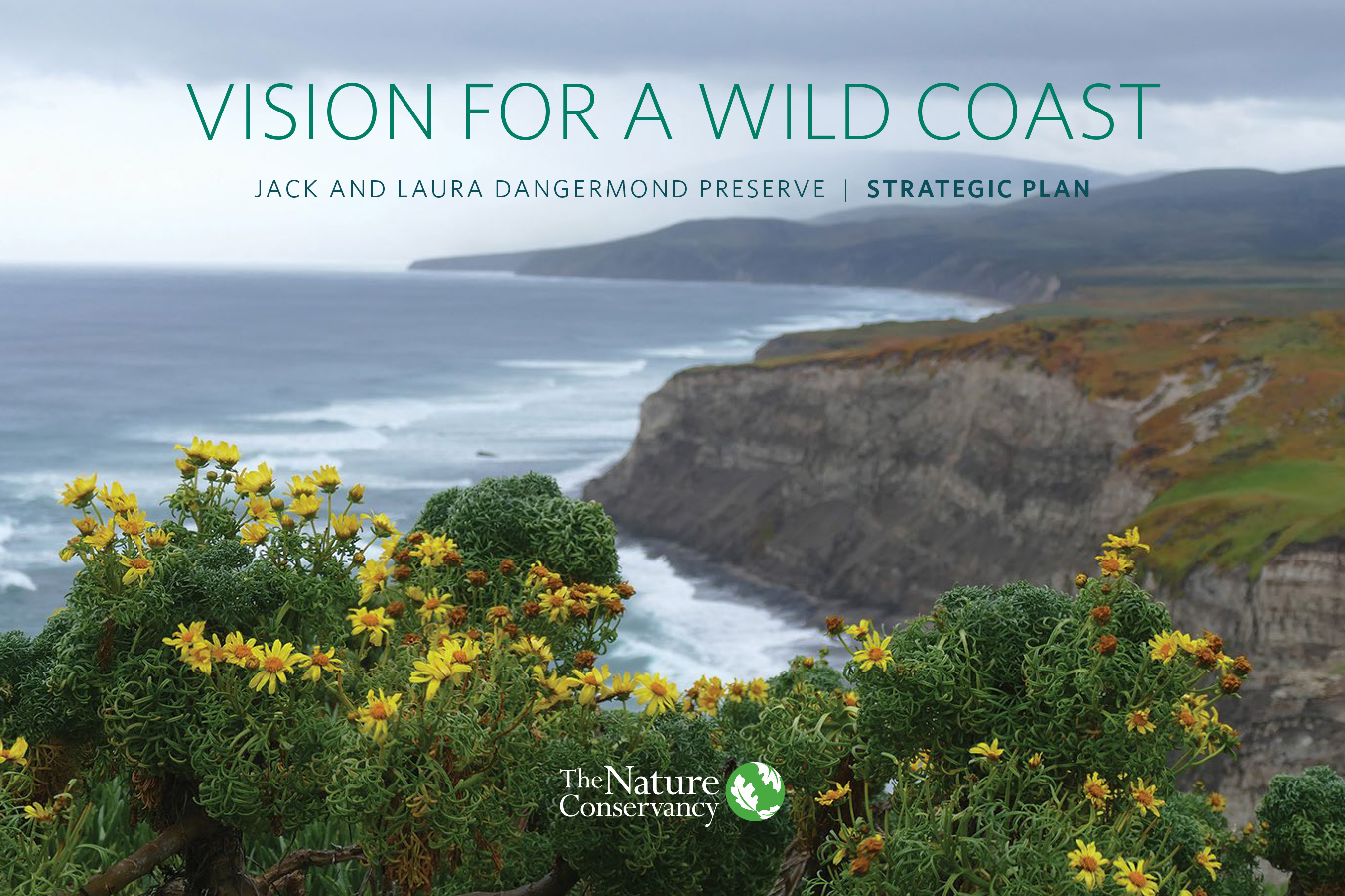
There aren’t many places on the Southern California coast that remain largely untouched by development. The Nature Conservancy’s Jack and Laura Dangermond Preserve is one of them—exceptional in size, location and biodiversity. The preserve is a 24,364-acre property that sits at Point Conception—the sharp corner of coastline that gives California its distinctive crook. The land has been kept intact, free from significant development for nearly 100 years.
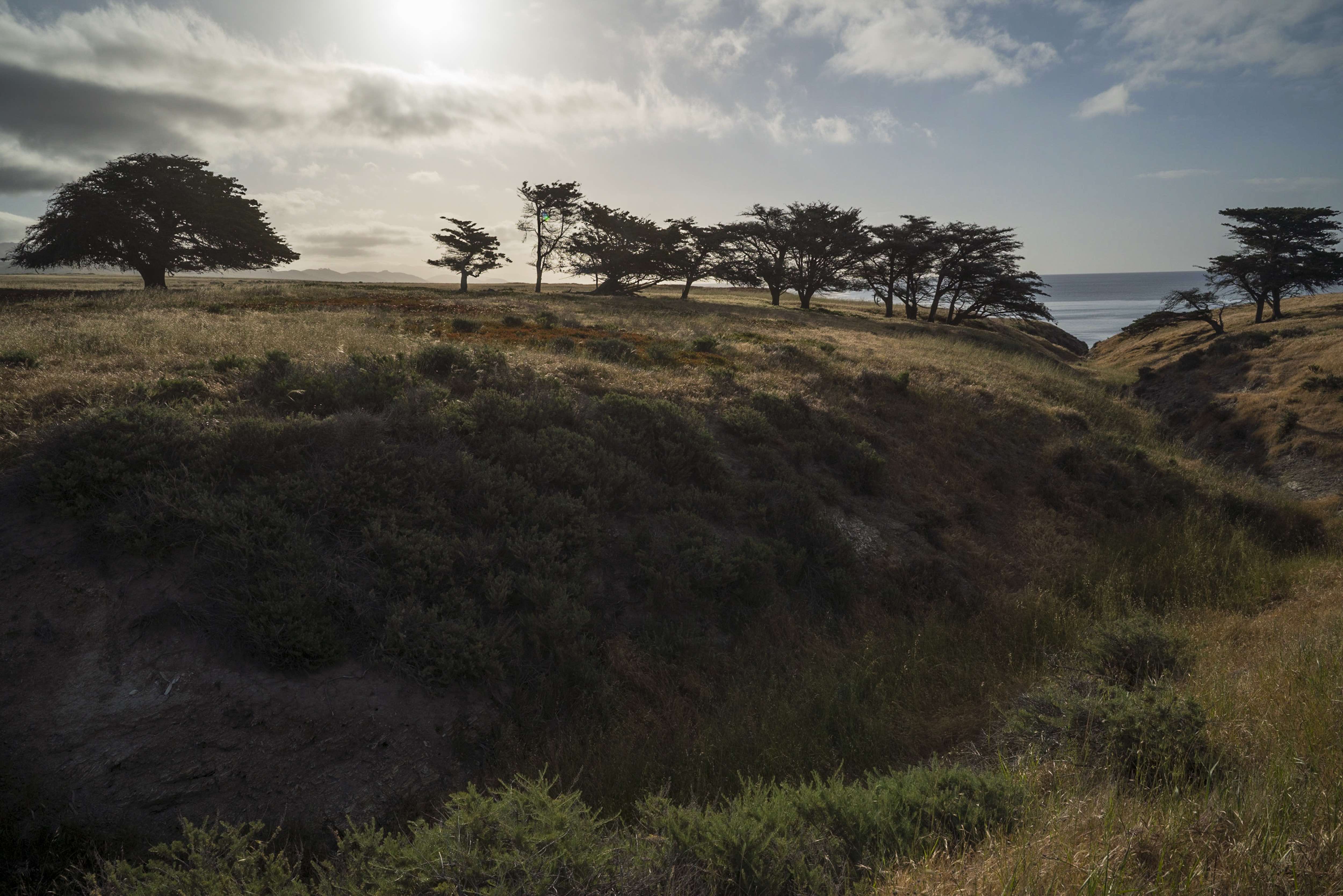
The preserve’s unusual geography makes it a globally important site for conservation. The coastline runs north-south above Point Conception and east-west below it; cold water currents from the north collide with warm water from the Santa Barbara Channel, creating diverse marine and terrestrial habitats unlike any other in the state. The preserve stretches from the coast to the Santa Ynez Mountains and includes chaparral, grassland, oak woodlands, coastal scrub and closed-cone pine along eight miles of wild coastline.
We aim to learn from this special place with a research agenda that delivers insights for conservationists around the world.
The Jack and Laura Dangermond Preserve was established at a pivotal moment, a time when the world is waking up to the vital need for environmental action. Countries around the world are seeking solutions and insights into how to rebalance human interaction with the natural world and set the planet on a path to a more hopeful, sustainable future.
The preserve can serve as a platform for demonstrating how conservation can rise to this challenge. Our work is about more than just protection—this unique landscape will serve as a living laboratory, one that will facilitate the scientific research and environmental education needed to change the planet’s trajectory.
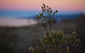
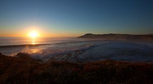
The Jack and Laura Dangermond Preserve in Pictures
As a family-owned cattle ranch for over a century, the lands of the Dangermond Preserve have retained near-wilderness conditions. The preserve is a haven for last-of-their-kind natural and cultural resources, and a place where mountain lions still hunt marine mammals on the beaches.
Dangermond Preserve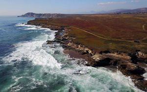
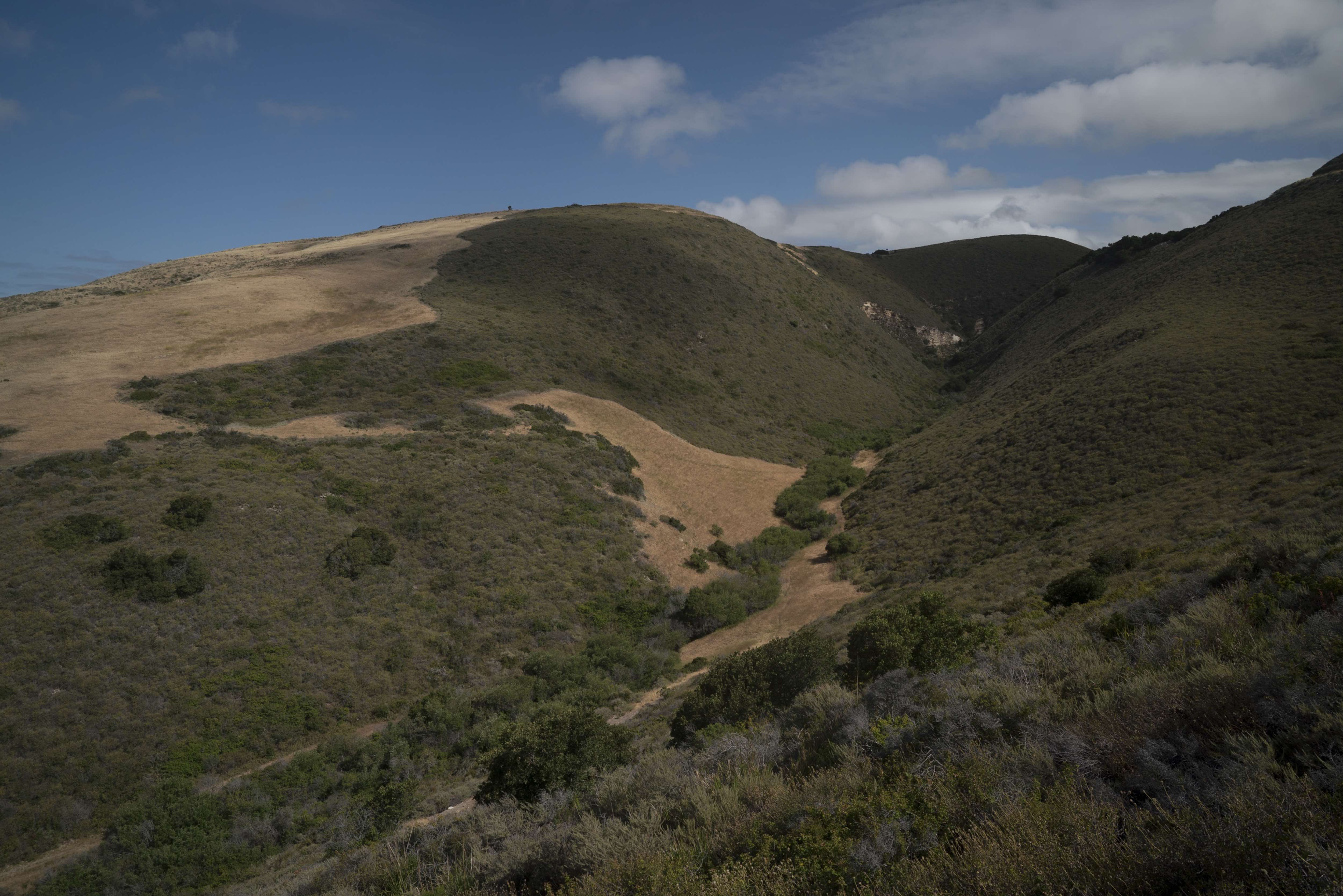
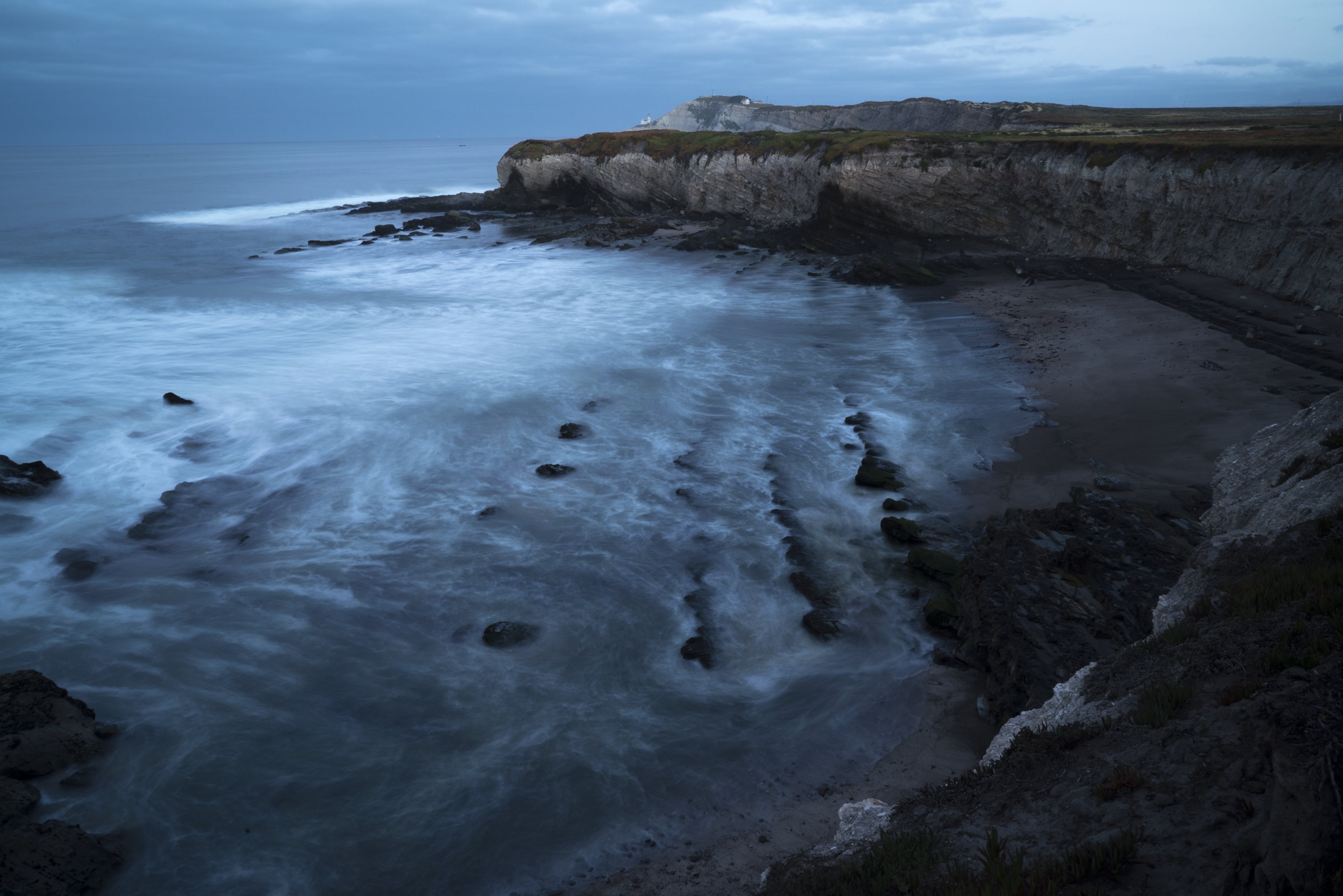
Dangermond Preserve Coast: Cold water currents of the northern Pacific collide with warmer waters of the Santa Barbara Channel to create a rich and diverse habitat unlike any other in the state. © Peter Floyd
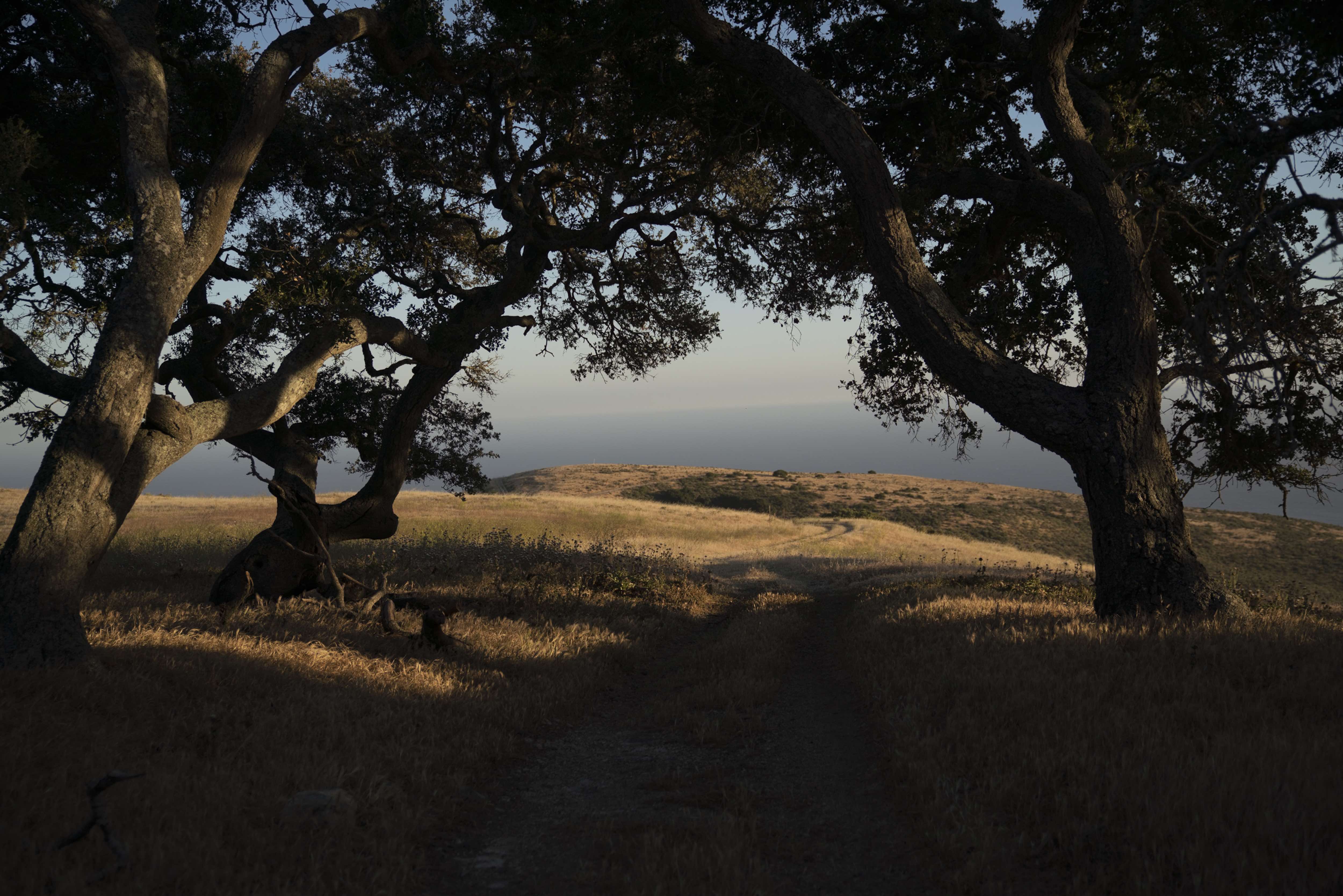
Sunrise at Dangermond: The sun rises over the Jack and Laura Dangermond Preserve. © Matthew Davis
Sunset at the Dangermond: The sun sets on the Jack and Laura Dangermond Preserve. © Ian Boyle
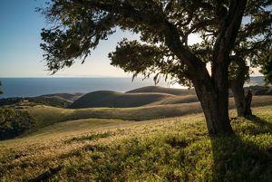
Dangermond Preserve, CA: Coast oak woodlands along a ridge overlooking rolling hills that descend to the Pacific Ocean on the Dangermond Preserve. © Bill Marr/TNC
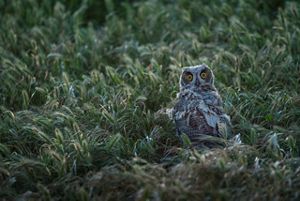
Dangermond owl: Great horned owl near entrance to Cojo Headquarters at Dangermond Preserve. © Bill Marr/TNC
Dangermond Preserve Vision
We envision a wild and dynamic coastal landscape, protected and restored; a living laboratory of exceptional natural and cultural assets for scientific conservation research; a hub for technology and tools that allow us to share findings to scale globally; a site for discovery to engage the leaders of tomorrow, and widespread public commitment to conservation.
Key Goals:
CONSERVE NATURAL RESOURCES ensuring the future of biodiversity.
CONSERVE CULTURAL RESOURCES connecting human ecology and nature.
CONDUCT APPLIED CONSERVATION RESEARCH developing innovative solutions for a changing world.
ADVANCE CONSERVATION TECHNOLOGY leveraging 21st-century capabilities.
EDUCATE AND ENGAGE providing transformative experiences in the natural world to youth and the community.
Conserve, Protect and Restore Natural Resources
The Point Conception region straddles a major ecological boundary where California’s Northern and Southern terrestrial and marine ecoregions meet. These ecoregions are some of the most biologically diverse in the world and have some of the highest concentrations of imperiled species in the country. The boundary between regions is an exceptionally rich zone of ecological transition and convergence with many species occurring at the northern or southern limits of their ranges. Offshore, two major oceanic currents meet and create especially rich marine systems, further elevating the region’s ecological and conservation significance.
Explore the Preserve
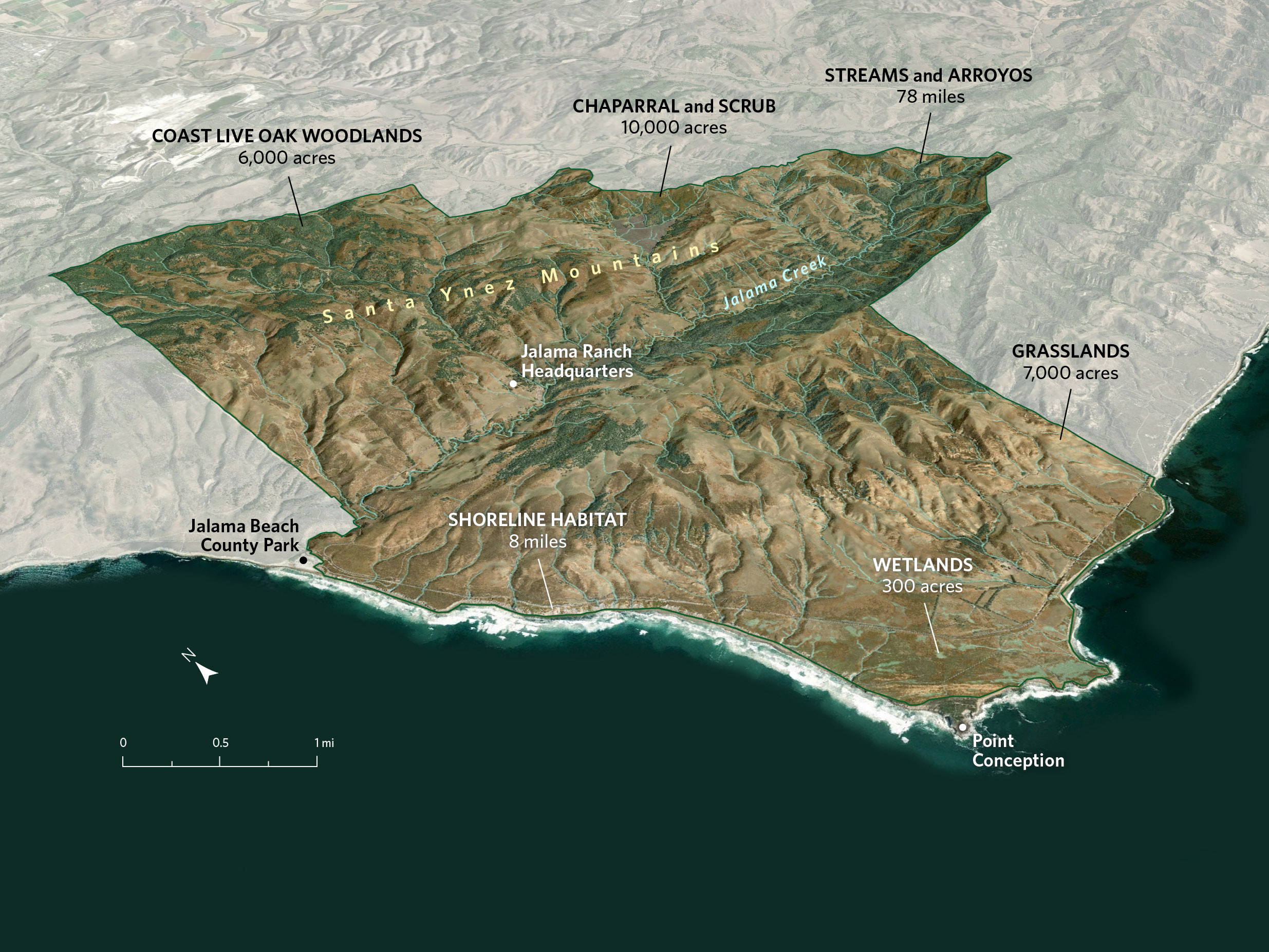
The Nature Conservancy’s Jack and Laura Dangermond Preserve sits at the intersection of two ocean currents, and its topography ranges from sea level to 1,900 feet. Those rare combinations—plus the absence of residential development—make it a trove of biodiversity. Click through this map to learn more about each of the distinct habitat types that exist within the preserve.
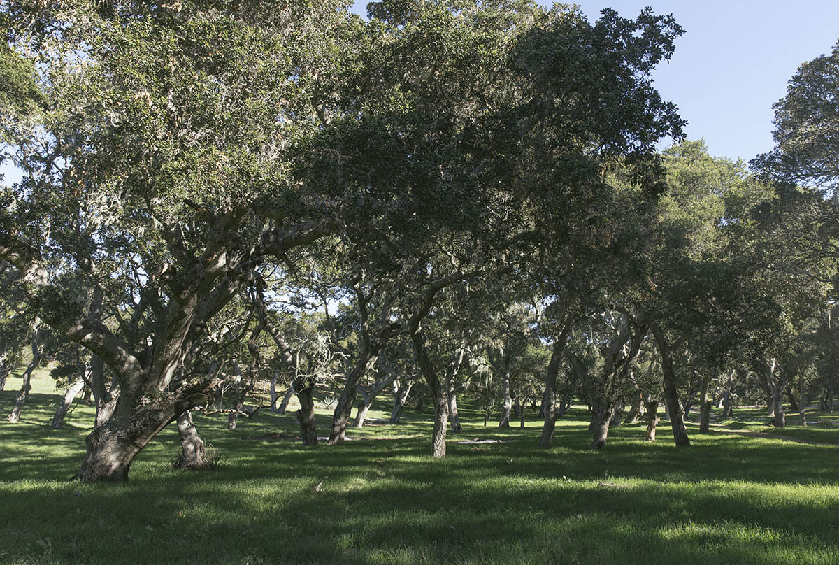
Oak Woodlands
Coast live oaks are unique among California’s oak trees in their ability to thrive near the ocean. They are drought-resistant and adapted to fire, and they support acorn woodpecker, western scrub jay, western gray squirrel and dusky-footed wood rat.
Chaparral and Scrub
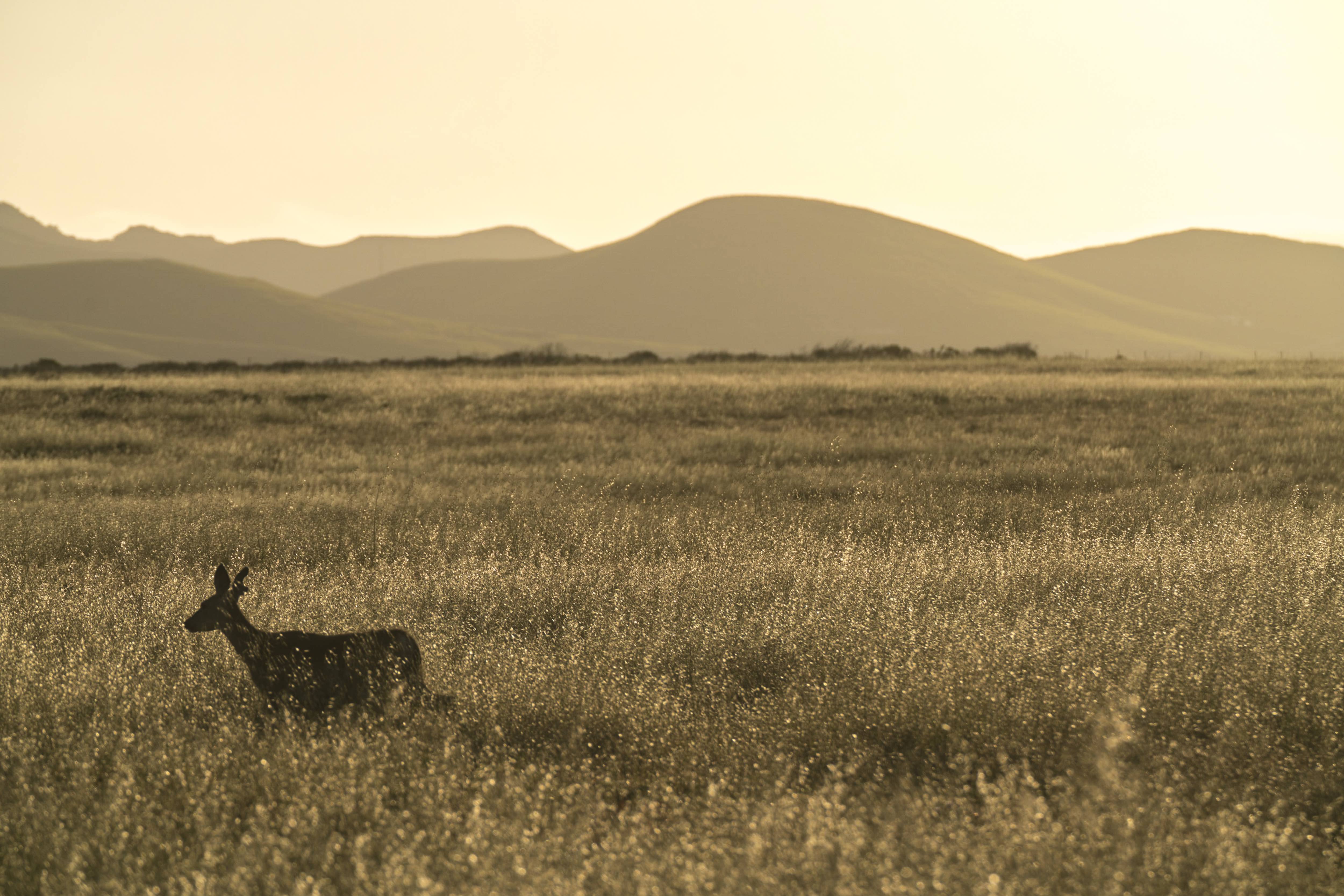
The coastal hillsides are blanketed by extensive coastal sage scrub and chaparral shrub communities. These are biodiversity hot spots that support badgers, bobcats, mule deer, mountain lions, pack rats, lizards, snakes and a variety of avian species.
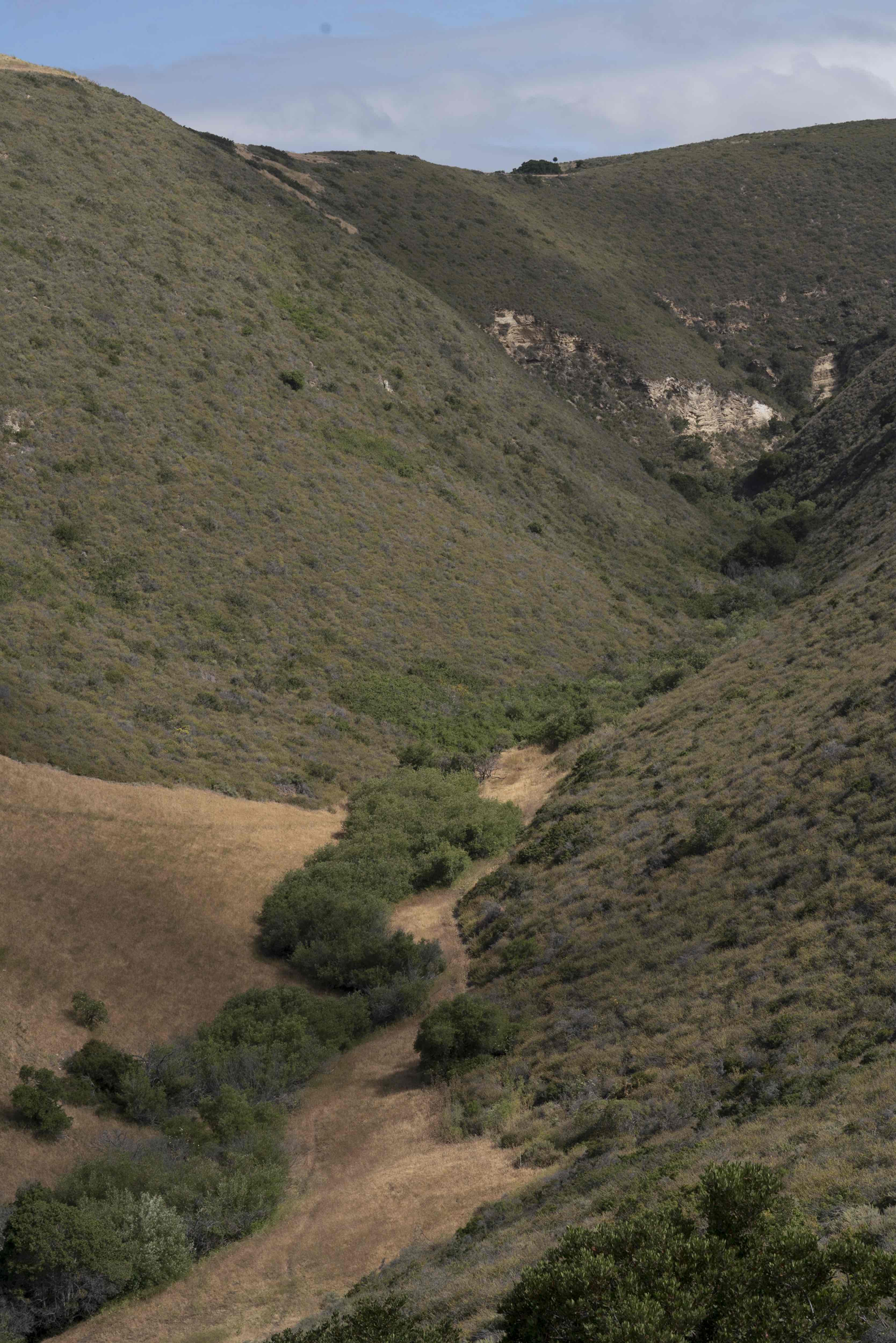
Streams and Arroyos
Precipitation that falls on the preserve eventually flows to the ocean. In addition to Jalama Creek, the preserve contains major perennial streams, coastal wetlands, and smaller unnamed seasonal short-run streams, locally known as “arroyos.”
Shores and Marine
Point Conception sits at a marine intersection, where ocean currents from the north and south overlap, bringing a diverse mix of plant and animal life. The ecosystem is supported by the offshore upwellings that bring nutrients from deep in the ocean.
Wetlands
The 328 acres of wetlands include seeps, springs, seasonal wetlands, wetland swales, in-stream wetlands, perennial marshes and artificial ponds. These extensive habitats support abundant freshwater biodiversity.
Grasslands
The grasslands are used by a large, diverse group of plants, mammals, birds, reptiles, amphibians and insects. Cattle grazing and prescribed burning play an essential role in making sure these grasslands continue to provide plant and animal habitat.
TNC uses a science-based approach to preserve planning and management. Our efforts focus on adaptively managing ecosystems to boost their resilience to catastrophic events and climate change, as well as supporting high levels of native plant and animal diversity, habitat structure and ecosystem function. There are three components to conservation of the outstanding natural resources at the Dangermond Preserve:
- Protection of intact natural systems,
- Restoration of impaired ecosystems, and
- Adaptive management.
Over the last two years, TNC staff and partners have made major progress inventorying the preserve’s plants, wildlife and other natural features. New findings are made every year. We’ll update this list with each new discovery.
Dangermond Natural Resources by the Numbers
-

24,364
24,364-acre coastal property
-

8
Over 8 miles of undisturbed coastline with sandy beaches
-

50
50 miles of streams
-

300
300 acres of wetlands
-

9,000
9,000 acres of native and annual grassland
-

6,000
6,000 acres of oak woodland and forest
-

200
More than 200 wildlife species
-

600
Nearly 600 plant species
Conserve and Learn from Cultural Resources
Dangermond Preserve’s rich cultural history extends back more than 9,000 years to some of the earliest human settlements in North America.
The preserve protects a confluence of historical and cultural resources across Native American, Spanish and U.S. histories. This part of the coastline is culturally and spiritually important to Chumash people, who once integrated the preserve’s unique resources into many aspects of everyday life. For example, offshore reefs’ unique tar seeps, born from ancient oil deposits, served as caulking for canoes and baskets.
In 2020, TNC and the Santa Ynez Band of Chumash Indians (Elders Council) entered into a Memorandum of Understanding that lays out first steps for working together on collaborative projects. This work will provide pathways for members of the Santa Ynez Band of Chumash Indians and other Chumash to be part of the re-discovery, protection and celebration of the extraordinary cultural record at the Dangermond Preserve. To learn more about resource management plans for the preserve, check out the Dangermond Preserve Integrated Resource Management Plan.
Pioneer Conservation Research and Technology Innovation
The Dangermond Preserve’s setting—an exceptionally diverse near wilderness area just a few hours’ drive from dense urban population centers—presents extraordinary opportunities for science and learning. Through formal research, citizen science and transdisciplinary collaboration, the preserve can play a pivotal role in understanding, quantifying and promoting the value of wildness in an increasingly human-dominated world. TNC is partnering with research institutions to foster leading-edge collaboration, tech innovation and data science to increase the efficiency and effectiveness of conservation.
Technology for 21st-Century Conservation
At the Dangerond Preserve, we are leveraging 21st-century technologies to advance conservation. Below is a selection of the conservation science that technology is enabling on the preserve.
Dangermond Preserve Wildlife Photo Tour: We are using motion-operated wildlife cameras to understand how wildlife populations use the preserve. By capturing images of wildlife, we can learn more about the population size and spatial and temporal distribution of some of the preserve’s most important species. We plan to scale our work with wildlife cameras by combining this tool with other conservation tools like telemetry and GPS collars to gain an in-depth understanding of animal behavior in this unique place. Check out this photo tour for a glimpse of the many species that frequent the Dangermond Preserve.

Wildlife at the Dangermond Preserve
The preserve serves as core and migratory habitat for wide-ranging mammal species. Check out this photo tour.
Restoration Dashboard: In spring 2018, we embarked on a large-scale restoration project to re-plant over 150 acres of oak woodland. We collaborated with nearby nurseries and used coast live oak acorns and seedlings gathered from the preserve. This ongoing work is updated live in the operations dashboard where any user can check on the growth and health of each individual tree. This project depends on quick, reliable data capture and delivery, and it’s one of many exciting projects that technology is enabling on the preserve.

Oak Restoration Dashboard
Check out our coast live oak restoration project that is transforming 150 acres of former agricultural fields back to oak habitat which supports a suite of plants and animals that depend on these iconic trees.
Create a Platform for Education and Inspiration
The preserve offers unprecedented opportunities to inspire a new generation of conservation leaders, and we are excited to share the ecological and cultural significance of this extraordinary place through a growing calendar of public programs. From interacting with top researchers on the effects of climate change to experiencing global marine animal migrations firsthand, the preserve engages visitors in the power and importance of nature.

A Story Map: At Nature’s Crossroads
Check out the Jack and Laura Dangermond Preserve, the last vast tract of coastal wilderness in Southern California that is protected for future generations.


Visiting the Preserve
We welcome the public to visit the preserve for one of our volunteer environmental restoration work days. We are also exploring partnerships to provide expert-led walks on the preserve for the members of the public. If you are interested in volunteering on and/or visiting the Preserve, please complete this form and we will be in touch with future opportunities.
We have begun piloting public learning and volunteer opportunities at the Dangermond Preserve in order to reach a wide variety of audiences and inspire action and service. All opportunities have been designed to ensure that the preserve continues to serve as a critical refuge for plants and wildlife and support the controlled conditions necessary to support scientific research of natural systems.
Volunteer environmental restoration workdays are offered throughout the year, giving the public opportunities to actively join in restoration efforts through planting, invasive plant removal and seed collection. Our environmental education programs are focused on providing experiences to youth who might not otherwise have the opportunity to visit wild places, with a goal of supporting the development of the next generation of conservation leaders. The preserve has also begun exploring partnerships with local organizations, including museums and botanic gardens, to provide docent-led hikes for the members of the public. Please look for these opportunities on our calendar later this year.
Staff Stories
How Long-term Data can Turn the Tides for Coastal Conservation
By Erica Nielsen, Anthony LaFetra Point Conception Institute Fellow
Reflections on my first year as a PCI Fellow
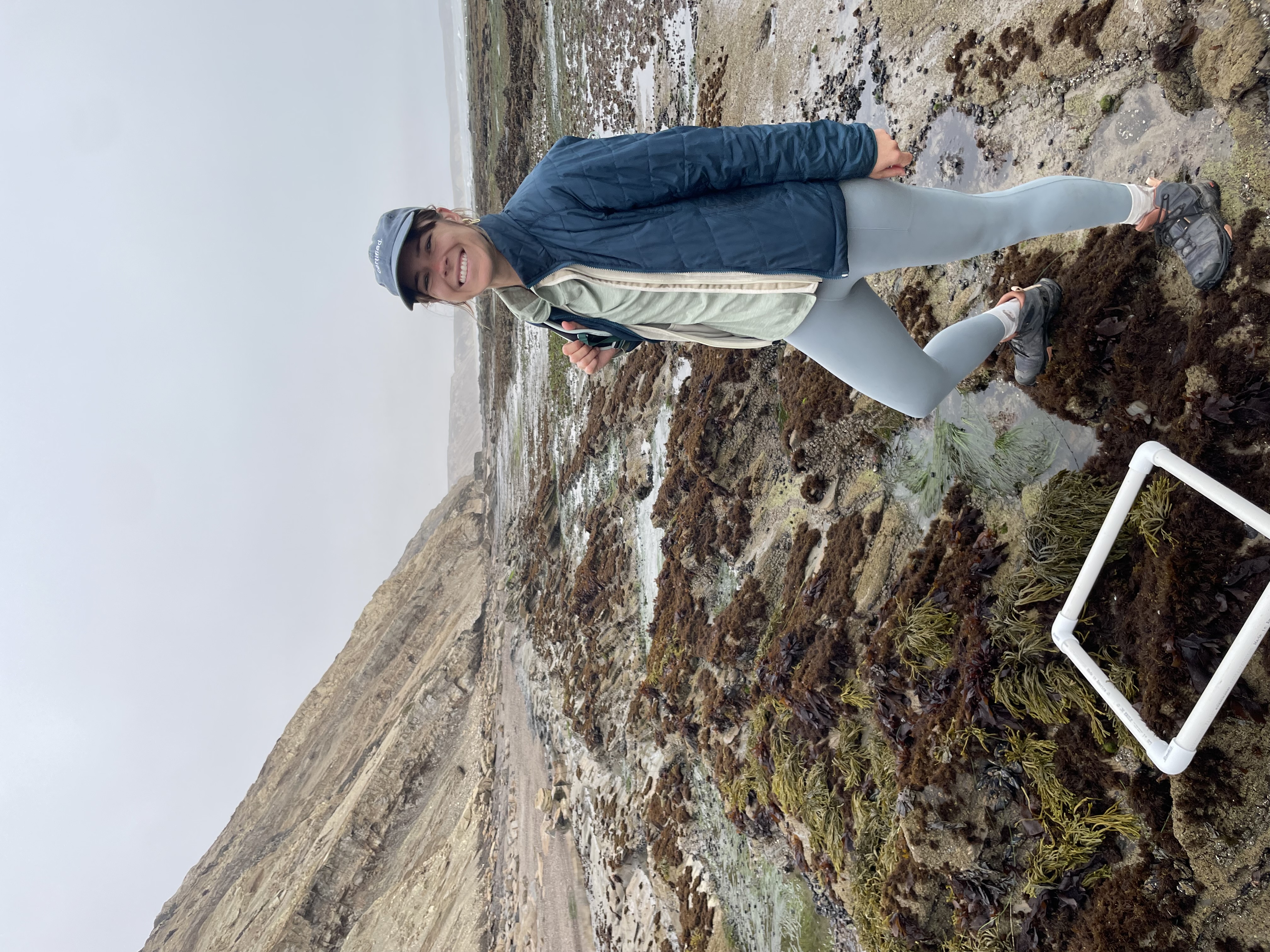
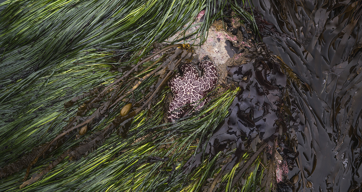
Coastal areas, where land meets the sea, are some of the most dynamic and diverse ecosystems on earth. Accounting for less than 5% of Earth’s land area, coastal ecosystems are highly productive and concentrate disproportionately high values for biodiversity and ecosystem services – and threats. Globally, coastal ecosystems are threatened by changing climate, sea level rise, development and other stressors. Today, just 15.5% of coastal areas worldwide are considered ecologically intact and having low human pressure. We urgently need scalable approaches to restoration and conservation of coastal ecosystems, which will require developing new methods, research partnerships and syntheses of existing knowledge. The Nature Conservancy’s Point Conception Institute (PCI), at the Jack and Laura Dangermond Preserve, is an ideal platform for developing these new approaches. I’m thrilled to have been selected as the inaugural Anthony LaFetra Point Conception Institute Research Fellow and explore questions related to conservation of coastal biodiversity in a changing world.
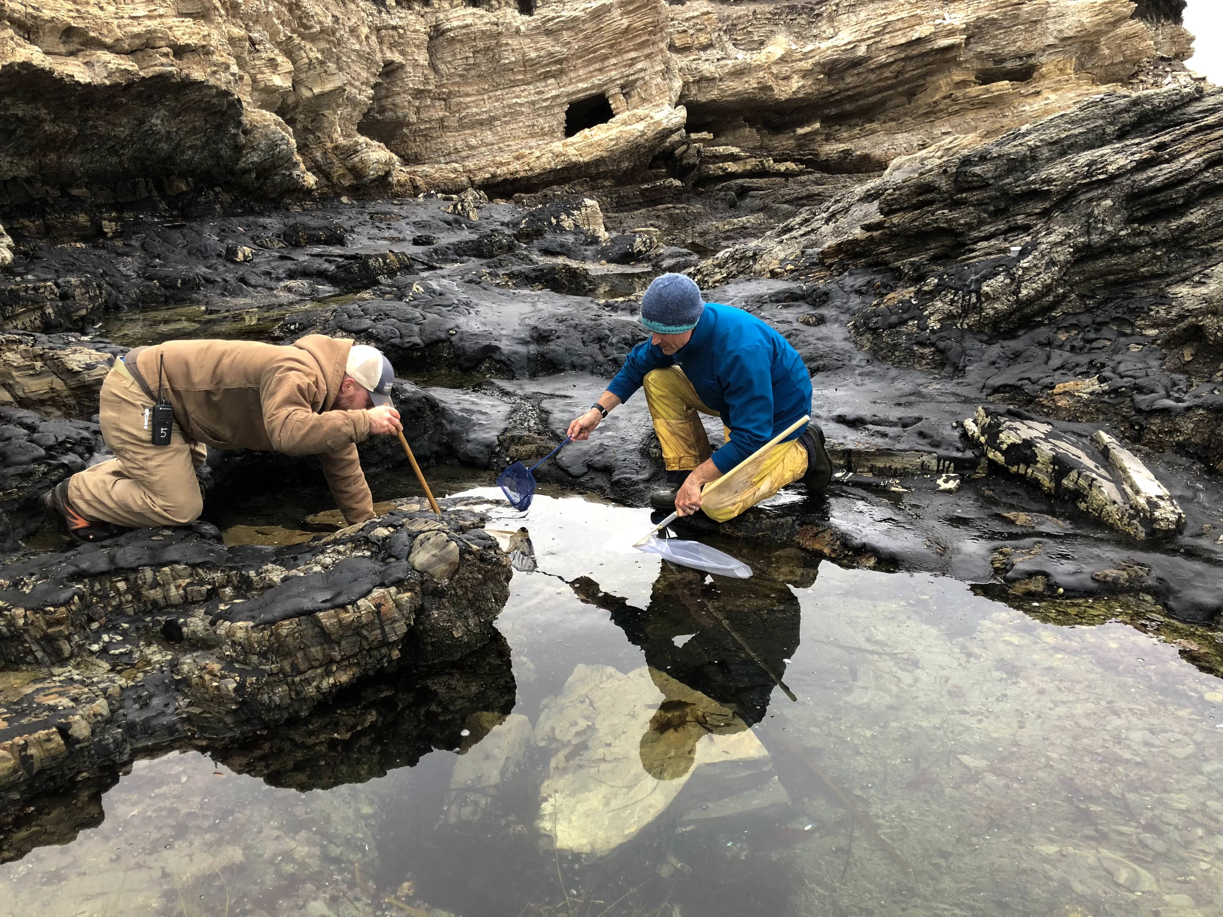
Within my first few months working with TNC's Jack and Laura Dangermond Preserve, I found myself climbing down coastal bluffs, decked out in waterproof overalls and rainboots, looking out to the vast Pacific Ocean and imagining all the marine life under its surface. Yet my attention was quickly drawn to life closer to shore – on a rocky reef just below me, bursting with a cornucopia of organisms covering rocks and filling tidepools. It was in this natural laboratory that I assisted a team of taxonomic experts from the Multi-Agency Rocky Intertidal Network (MARINe) who are tasked with cataloging rocky shore species along the western U.S., from Alaska to Baja California. This long-term ecological dataset offers a window into the biodiversity patterns along our dynamic coastline, as well as the changes that have occurred over the past few decades. As climate change continues to alter species distributions, these types of datasets are of increasing importance to guide conservation efforts in a changing world.
One area of particular significance in terms of how climate change will alter marine communities is Central California’s Point Conception – where the Jack and Laura Dangermond Preserve protects roughly 24,000 acres and 8 miles of coastline. My role as the Anthony LaFetra PCI Fellow is to synthesize existing data, such as the long-term biodiversity monitoring by the MARINe team, to help prioritize conservation efforts that best counteract anthropogenic threats and climate change impacts.
Prior to joining TNC, my research focused on characterizing how coastal species are responding to climate change, and how we can best use this information to safeguard ecological integrity into the future. My passion for science and conservation led me to do a Master’s and PhD at Stellenbosch University, South Africa. There my research combined novel tools such as DNA sequencing and climate models to create a marine protected area plan for the South African coastline that encompasses species’ climate resilience and adaptive potential. Following my graduate work, I was a postdoctoral researcher at the University of California, Davis, where I studied how extreme events such as heatwaves can cause rapid range shifts in marine species with unique ecological consequences.
One of the main questions throughout my work is how to best identify ‘climate refugia’, or areas in which natural systems are more likely to persist due to lower vulnerability and/or exposure to climate change. As the U.S. and other countries set conservation targets such as the ‘30 X 30’ initiative that aims to protect 30% of their lands and seas by 2030, it is important that these targets are met strategically and with species redistributions in mind. This idea is particularly relevant for the area around Point Conception, as it is one of the largest ‘transition zones’ along the West Coast, where coastal communities transition from predominantly warm- to cold-affiliated species. The natural environmental variability of this region may render species more resilient to future environmental change, thus making it a possible climatic refugia. I hope that by using biodiversity trends of the recent past to predict changes into the future, we can make more informed conservation decisions on the Preserve and beyond its borders. So, while I enjoy days out in the field such as the one with the MARINe team, you’ll also find me excited to dive deep into my computational analyses, searching for biological answers hiding amidst the ocean of rows and columns of datasheets. I’m looking forward to sharing insights from this research as TNC works to restore and protect our planet’s coasts.
Collecting Drops of Data at the Dangermond Preserve
By Jinsu Elhance, Conservation Technology Associate at the Jack and Laura Dangermond Preserve
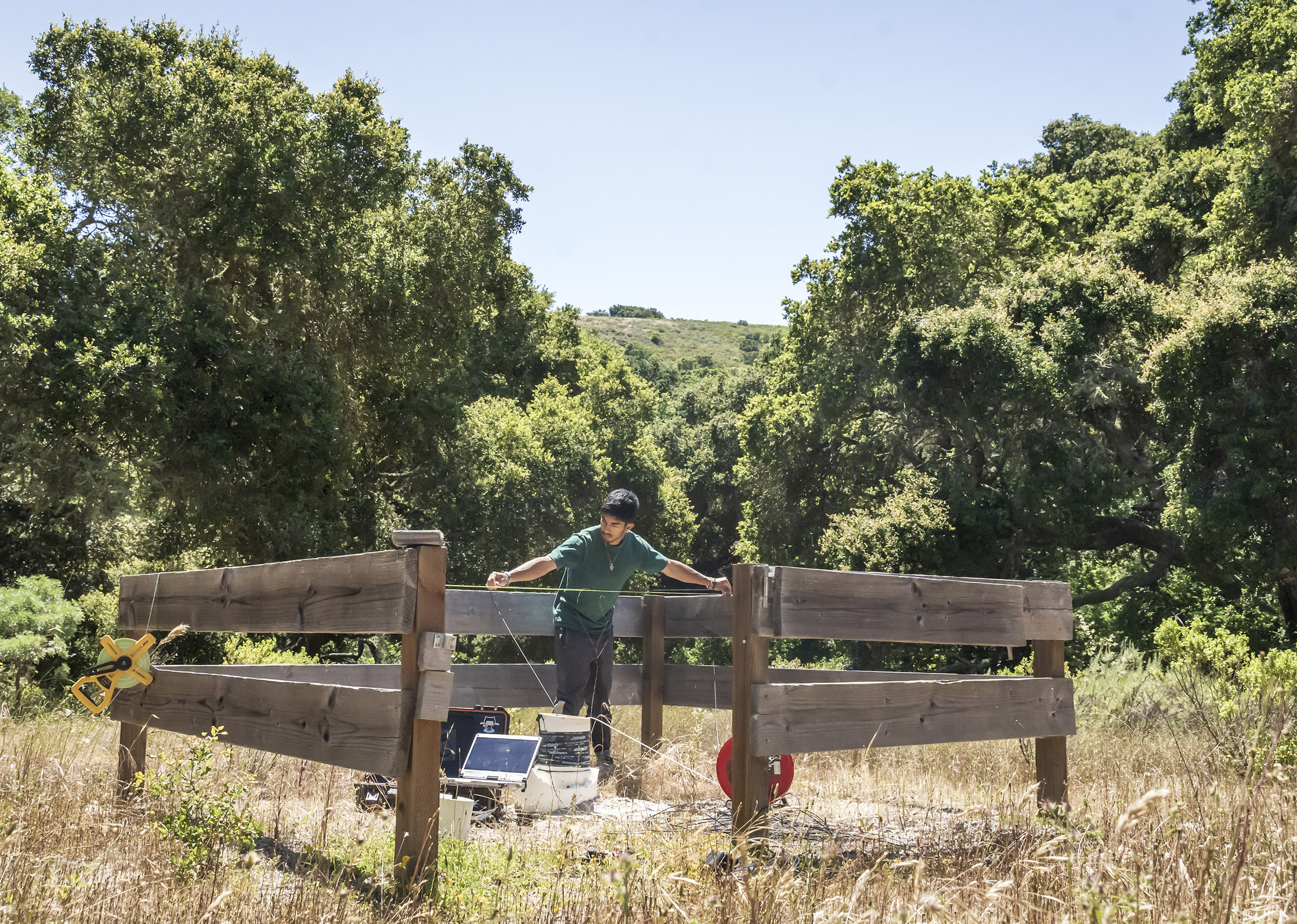
Every drop of water and every byte of data has a story, interwoven with the tapestry of our environment. Both possess the power to shape the world around them at each stage of their life cycles. As rainwater disappears into the earth before flowing through creeks and rivers, its journey parallels the flow of data among conservationists, researchers, land stewards, and policymakers. Each step in this data cycle contributes to our understanding of water and its conservation. At the Jack and Laura Dangermond Preserve, The Nature Conservancy’s preserve in Santa Barbara County, where native ecosystems have been protected from extensive development, scientists are pioneering a concept known as the Freshwater Digital Twin — a groundbreaking tool that merges the narratives of water and data into a transformative whole.
A Digital Twin is an interactive 3D map of a system. While these models have been developed primarily for urban infrastructure, the Dangermond Preserve is pioneering their application to complex natural environments. The Freshwater Digital Twin is an online map on which researchers, land managers, and other conservation workers can observe a real-time representation of the preserve’s hydrology. Users can click on points representing sensors installed in streams, tanks, and wells to download the most current data. Users can also view how the preserve changes under different climate scenarios, as the map visualizes potential future water dynamics.
The Dangermond Preserve, encompassing 24,346 acres of protected land, serves as a living laboratory where scientists delve into the mysteries of California's ecosystem dynamics. Nestled at the convergence point of marine and terrestrial ecosystems along the state's coastline, it holds the key to unraveling the intricate relationship between water and life. Within the preserve lies the Jalama watershed, meandering through hilly canyons and lush vegetation before ultimately merging with Jalama Creek and the vast ocean. This setting presents an unparalleled opportunity to study the water system holistically. It is here that I embark on a mission to collect data throughout the basin, constructing a digital model that captures the preserve's water dynamics. This distinctive interpretation of the Digital Twin concept enables us to observe and study the natural environment through a digital abstraction. The future of groundwater in California hinges on the quality of analysis conducted in such invaluable initiatives.
In my prior life as a data scientist, my curiosity was immersed in theoretical models and algorithms. However, I yearned for data science applications that facilitated meaningful contributions to our planet. In my job as a Conservation Technologist at the preserve, I draw upon my knowledge of environmental science, statistics, and technology to address broader questions about how to achieve a sustainable future. Now that I work in the field, I spend my days surrounded by the captivating beauty of untouched landscapes. Venturing into the field allows me to collect data that will underpin the construction of the Freshwater Digital Twin. Our digital twin relies on a water budget model to enhance our comprehension of the intricate relationships between precipitation, streamflow, and groundwater storage.
Today, my journey takes me deep into the chaparral, surveying wells and deploying sensors in riverbeds, capturing the unique stories within every droplet of water. By collecting data from precipitation patterns observed by weather stations, estimating streamflow through an intricate model developed by the Nature Conservancy, and monitoring groundwater levels with pressure transducers installed in wells, we weave together the threads of water's narrative. I embark on an early morning expedition, traversing winding roads in an ATV laden with well-survey equipment. As I arrive at each well, I carefully brush away foliage to deter rattlesnakes before removing the cap from the casing. Spending hours meticulously recording the conductivity, temperature, and depth of the water, alongside details about the sensor, the surroundings, and any noteworthy observations, I capture the essence of each well's story. When I’ve finished, I download the data onto a field computer, from which I’ll later upload it into the models within the Digital Twin. Finally, the sensor is redeployed or replaced, continuing its data collection until the following year.
Like my personal journey intertwining data science and environmental science, the development of valuable digital abstractions like the Digital Twin hinges on ground truth. The data we collect in the field, much like a drop of water, possesses its own unique story. It flows among conservationists, researchers, land stewards, and policymakers, informing their work and thereby creating an impact at every step of its journey. Just as water is essential to life, this data will ultimately contribute, in its own right, to preserving the well-being of our planet.
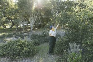
Dangermond Oak Tree Survey: Preserve Scientist Dr. Elizabeth Hiroyasu and Stewardship Manager Moses Katkowski, leaders of the Dangermond Preserve TREX program, survey the oak trees at Army camp. © 2022 Erin Feinblatt
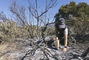
Controlled Burn Preparation: Elizabeth takes live fuel moisture samples to understand how vegetation will burn to prepare for the controlled burn. © 2022 Erin Feinblatt
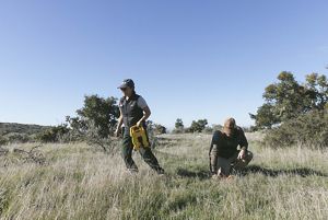
Controlled Burn Preparation: Elizabeth and Moses set up a 50-meter transect or controlled area to assess the number of plants and soil quality before lighting the controlled burn. © 2022 Erin Feinblatt
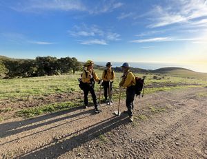
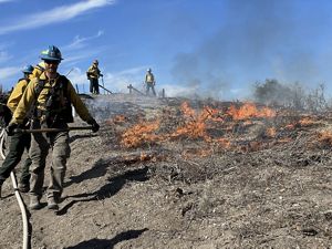
Squad Goals: Some of the squad assembles at Dangermond Preserve before the burn begins. Their shovels are designed for digging fire breaks. © Jenna Allred
Controlled Burn: Jeremy Zagarella, Natural Resources Planner in the Pala Environmental Department for the Pala Band of Mission Indians, lights a controlled fire with the team. © Jenna Allred
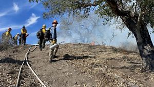
Controlled and Contained: Firefighters walk the control line to make sure the burn area is contained. © Emily Aiken
Soil Samples: Elizabeth collects soil samples to study the effect of burning on soil characteristics. © 2022 Erin Feinblatt
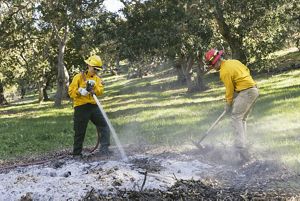
After the burn: Elizabeth and Moses perform “mop up,” making sure that the controlled fire is out and the burn piles are safe, under Army camp oaks. © 2022 Erin Feinblatt
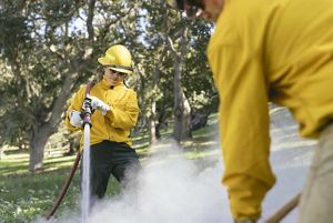
After the burn: Elizabeth places the hose over her shoulder for better control of the stream. © 2022 Erin Feinblatt
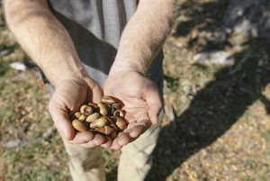
Fighting Fire with Fire: Controlled burns may help keep oak woodlands free of pests, resulting in a more robust acorn crop. © 2022 Erin Feinblatt
5 Years of Conservation at the Jack and Laura Dangermond Preserve
As we near the five-year anniversary of the Jack and Laura Dangermond Preserve, we would like to take a moment to reflect on the progress we have made at this 24,460-acre living laboratory. This is my first year as director of this amazing place and it is an honor to help chart the course to so many groundbreaking conservation goals. Take a look at this video to learn about our work at the preserve directly from scientists and staff.
Welcome to the Point Conception Institute; December 16, 2021
Introducing the Point Conception Institute
As climatic shifts give way to global conservation challenges, it’s critical for scientists around the world to exchange insights and strategies for protecting natural lands and waters. But despite new technology, conservation data from remote preserves are notoriously hard to capture and share. The Point Conception Institute is changing that.
Led by Director Mark Reynolds and supported by Director of Conservation Technology Kelly Easterday, the institute is building a Digital Twin of the Dangermond Preserve—a working model of the 25,000-acre protected area, updated in near real-time by a vast network of sensors strategically positioned across land, water, even air. This digital rendering is built for distribution and will be available online, allowing researchers to study every aspect of the preserve from anywhere in the world.
TNC scientists and research partners have already turned this amazing landscape into an engine of knowledge generation, from sampling environmental DNA for shark detection to modeling wildfire behavior. The Point Conception Institute will function as a research institution and a hub for collaboration across disciplines and organizations. With the Digital Twin to put these ecological insights into context for a global audience, the work done at the institute will be even more meaningful and effective.
But a conservation data-sharing revolution can’t rely on a single preserve, even one as special as Dangermond. That’s why the Point Conception Institute will openly share the systems and technology that make its digital monitoring possible, with the goal of catalyzing similar efforts in new locations. These technological advances would have been unachievable without the work of Jack and Laura Dangermond and Esri.
The Dangermond Preserve is truly a living laboratory. The landscape represents the ecological nexus of north and south. It encompasses an entire watershed along with eight miles of pristine coastal wilderness. Because of the preserve’s unique ecology, the information we gather can function as a crystal ball for climate adaptation around the world. The Point Conception Institute is creating a future where that world is connected by conservation.
By Diego Ortiz, Environmental Education Program Manager; November 8, 2021
California Environmental Education Program
As an environmental activist and youth advocate, my passion is inspiring the young generation of environmentalists through programs that integrate science, education, action, and advocacy. Environmental education can address significant challenges in the conservation field and create opportunities for young people, particularly those from underserved communities.
I am relatively new to The Nature Conservancy (TNC) and will be based at the Jack and Laura Dangermond Preserve, where I am building a partner-based, scalable model for transformative educational experiences for youth, leveraging TNC’s iconic protected lands. The program aims to develop infrastructure to catalyze environmental education at the interface of nature preserves and local communities that leverages the preserves’ science, stewardship, and innovation to understand and advance the pipeline of diverse future environmental leaders.
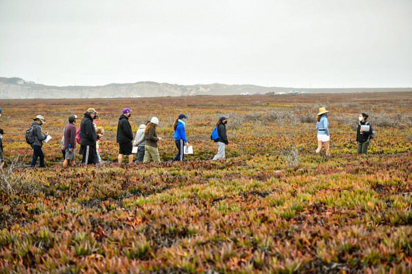
This fall, we kicked off our program with a weekend of hikes with local families in partnership with NatureBridge, our environmental education partner, and the Lompoc YMCA. We hosted families for eight educational hikes through Dangermond’s Live Oak woodlands and Coastal Bluffs. From plein air watercolors, to plant and animal identification cards, and activities to understand the Chumash’s seafaring prowess, participants experienced our Environmental Education Program and connected to one of TNC’s most special places.
Imagine if students who visit the preserve could interact with our research partners, such as NASA or the Smithsonian Institute as they develop conservation science for the future. In the years ahead, we envision a program where students work with scientists and stewardship managers on conservation projects, experience the landscape through hikes and hands-on lessons, learn about career paths in conservation through panels and internships, and develop key leadership and teamwork skills through overnight trips.
By Mark Reynolds; May 18, 2021
Science For A Wild California Coast
The vast expanse of the Dangermond Preserve is unlike any other region in California. North truly does meet south both on land and in the waters surrounding the preserve. Many Southern California species reach the northern edge of their habitat ranges here, only to pass the baton to the species of the North Coast. But to fully understand this dynamic, we must first know who and what is using the preserve.
Working with researchers from UCSB, UCSC and Point Blue Conservation Science, we are finding that the beaches, tidepools, and nearshore environments of the Preserve are extraordinarily biodiverse. These areas provide safe haul outs for harbor seals, resting and feeding areas for migrating shorebirds, and varied habitats for fish, crabs, barnacles, mussels and other invertebrates.
To further investigate wildlife on the preserve, we deployed a Mobile Marine Monitor Radar system known as M3 with our partners at Protected Seas. The system is solar powered and sited in locations that overlook areas of increased biodiversity like the Point Conception State Marine Reserve. We’re also using M3 to study human activity in the area. The system is equipped with radar to monitor offshore boating in the Marine Protected Area that abuts the preserve, as well as a weather station and additional cameras trained on nearshore wildlife.
Our goal is to build a comprehensive picture of this wild coastline and generate datasets that scientists and conservationists worldwide can use. Each day uncovers new patterns and intersections in the ways that humans and wildlife share this remarkable place.
In the News
- Los Angeles Times: Couple donates $165 million to preserve 24,000 acres at Point Conception
- ABC TV: A Big Piece of Good News
- National Geographic: Rare Swath of Pristine Southern California Coastline Protected
- Forbes: In Largest Ever Gift To Nature Conservancy, Tech CEO Preserves Pristine Stretch Of California Coast
- The Atlantic: A Historic Gift of Pristine Land to Inspire Tech's Elite
More Dangermond Stories
Connect With Us
If you would like to learn more about our work or have questions about research, environmental education or public learning opportunities at the Dangermond Preserve, please contact us at dangermond-preserve@tnc.org.
Dangermond Preserve
By investing in the Dangermond Preserve, you will not only promote land protection within California’s Central Coast; you will be promoting conservation innovation that begins locally and impacts globally. Please join us.