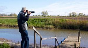
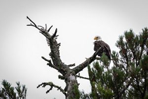
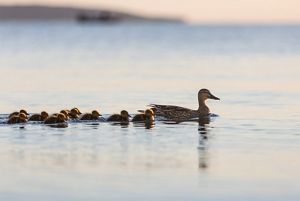
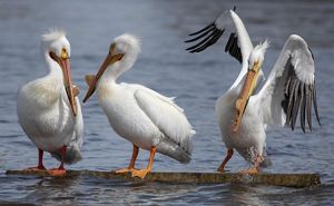
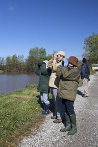
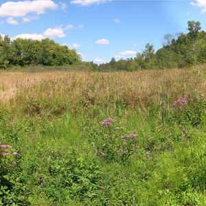
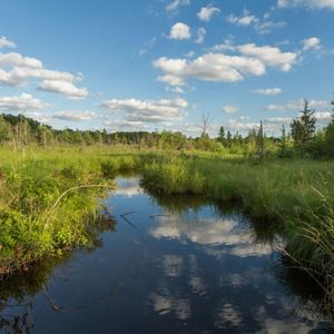
Michigan

Erie Marsh Preserve

Erie Marsh contains 11% of the remaining coastal wetlands in southeast Michigan.

Open to the Public

Yes

Things To Do

The preserve will be closed to the public starting June 1 for a major wetland construction and restoration project. View All

Plan Your Visit

Located in Monroe County in the Lower Peninsula View All

Get Directions

Erie Marsh is one of the largest coastal wetlands on Lake Erie, supporting numerous animals and plants that would otherwise be hard-pressed to find suitable habitat. The most significant feature of this area is its role as a migratory and nesting area for shorebirds, waterfowl, landbirds, and in the fall, raptors. It also harbors some of Michigan’s few remaining colonies of American lotus, and swamp rose-mallow, both listed as state-threatened.

In 2006, Erie Marsh Preserve became a privately-owned component of the Detroit River International Wildlife Refuge, established in 2001 as North America’s first International Wildlife Refuge. The refuge, which includes islands, coastal wetlands, inland marshes, shoals, and riverfront lands along 48 miles of the Detroit River and western Lake Erie, protects habitat for 65 species of fish, 29 species of waterfowl, and 300 species of migratory birds in Michigan and Ontario, Canada. Erie Marsh Preserve is managed through a collaboration of The Nature Conservancy, U.S. Fish & Wildlife Service and other partners.

Why the Conservancy Selected This Site
The Nature Conservancy received the donation of Erie Marsh from the Ottawa Bay Development Company in 1978. It supports numerous animals and plants that would otherwise be hard-pressed to find suitable habitat.

What the Conservancy Has Done/Is Doing
The Conservancy works with the Erie Shooting and Fishing Club to manage the site to continue to protect its wetland values. The Club has managed a portion of the property for more than a century. As part of the terms of the donation, the Club leases the site from the Conservancy for waterfowl hunting in the fall and continues to own the cottages at the southern end of the preserve.

During late 2011 and 2012, The Conservancy implemented a large-scale restoration project at the preserve. The ultimate goals of this project are to provide fish access to the diked area, improve water management capacity to increase wetland quality and control invasive plants such as Phragmites.

Erie Marsh Map 450x300

The preserve will be closed to the public starting June 1 for a major wetland construction and restoration project.

Many dabbling ducks, shorebirds, and marsh-loving songbirds can be seen in March and early April as they rest and refuel on their way to northern breeding grounds for the summer. They will return to this site in the fall on their way back to their Latin American and Caribbean winter homes. The marsh also provides a summer range for the great egret, great blue heron and black-crowned night heron.

Dress warmly for spring visits to this preserve as the wind coming off Lake Erie can be brutally cold. Be prepared for muddy and uneven terrain walking along the series of dikes. Be sure to bring along binoculars or a spotting scope if you have one. Closure of certain trails is possible during eagle nesting periods, therefore watch for posted closure signs.

Things To Do

Permitted Activities

  • Foot access for hiking, snowshoeing, bird watching, etc.
  • Educational studies

Prohibited Activities

  • No motorized and non-motorized vehicles, including but not limited to automobiles, off-road vehicles (ORVs), all-terrain vehicles (ATVs), motorcycles, snowmobiles, amphibious vehicles, and bicycles.
  • No Pets
  • No removal of trees, plants or animals (alive or dead)
  • No removal of rocks, water or other non-organic materials
  • No camping, bonfires, fireworks or other fires
Plan Your Visit

Please see "Preserve Visitation Guidelines."

Directions

From Monroe, Michigan:

  • Take I-75 south of Monroe, to Exit 2 (Summit Road).
  • Head southeast on Summit Road approximately one half-mile to the first place on the left where you can execute a U-turn to head north.
  • Make the U-turn to head north on Summit Road.
  • Follow Summit 0.2 miles to Bay Creek Road, turn right (northeast) on Bay Creek and follow it 0.8 miles to Dean Road.
  • Dean Road will be the first road on the right. Turn right (east) on Dean and follow it until you see the Erie Shooting and Fishing Club cottages.
  • Park here and head north on the trail to access the dike area trails.
Discussion

Have you been to this preserve? Are you thinking of visiting? See what others are saying about their experiences and add your comments below.

Add Your Comments

Time for you to join the discussion. Tell us about your experience at this preserve. What plants and animals did you see? When did you go? You can help others plan their visit when you share your thoughts. And thank you for visiting one of our nature preserves!

Read our guidelines on posting comments

Read More

Close Encounters with Nature

Nature Matters

Explore Related Content

Investing in Nature
This Land is Your Land