We're working with you to make a positive impact around the world in more than 35 countries, all 50 United States and your backyard. Support our work
Yes
The Trail View All
Interested in taking a weekend trip to the region? View All
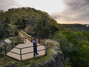
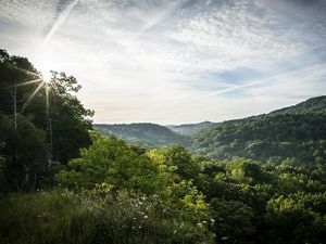
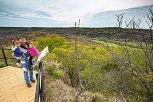
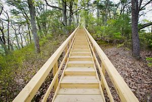
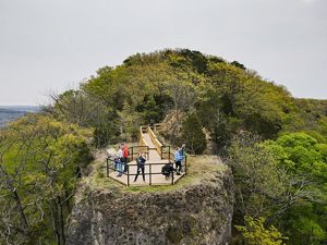
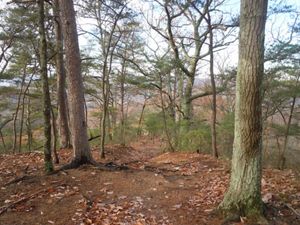
The most popular of all trails in the Edge of Appalachia Preserve system is the one that leads to Buzzardroost Rock, which stands like a giant limestone monument far above the waters of Ohio Brush Creek. The panoramic scene from this hilltop has been called Ohio’s most spectacular view.
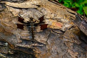
The 465-acre protected area is named for the turkey and black vultures (buzzards) frequently seen soaring above or roosting on the rock. This dolomitic outcrop towers 300 feet above the valley and provides habitat for a number of rare prairie plant species, including the plains muhlenbergia grass, which is classified as an endangered species in Ohio.
The following activities are not permitted at Buzzardroost Rock:
Please note that there are no facilities of any kind on the trail.
Bring a copy of the Buzzardroost Rock Trail Guide and Map on your trip! (pdf, 428KB)
The trail at Buzzardroost Rock passes through a number of plant communities and provides the opportunity to witness the area's diverse geologic history. The trail crosses four separate rock strata, including Estill Shale (gentle slopes with moist forests) and Lily, Bisher and Peebles dolomites (cliff and steep sides with oak-maple forests and primary cedar barrens), and Ohio Shale (Appalachian oak forest dominated by chestnut oak).
Buzzardroost Rock trail is not a loop, and the round trip hike of three miles is considered moderately difficult, with steep grades and steps. Preserve naturalists suggest that hikers plan to spend a minimum of two to three hours for the round trip, allowing time to observe the natural features along the way and enjoy the scenic view from the top of the rock.
Check out the Appalachian Discovery Trail, a guide to southern Ohio’s rich nature, culture and history.
From the north:
• Travel south on U.S. Route 23 to Waverly
• Take State Route 104 south
• Take State Route 32 (the Appalachian Highway) west for about 25 miles to State Route 41 at Peebles
• Follow SR 41 south to West Union
• Turn left (east) onto State Route 125
• Travel east on SR 125 for about 7 miles toward the village of Lynx
• The public access to the Buzzardroost Rock trail is a small parking lot on Weaver Road, which is entered from SR 125 just west of Lynx. The trail begins at the parking lot, crosses south over the highway and continues on.
From the west:
• Travel east on State Route 32 to State Route 41 at Peebles.
• Follow SR 41 south to West Union
• Turn left (east) onto State Route 125
• Travel east on SR 125 for about 7 miles toward the village of Lynx
• The public access to the Buzzardroost Rock trail is a small parking lot on Weaver Road, which is entered from SR 125 just west of Lynx. The trail begins at the parking lot, crosses south over the highway and continues on.
Have you been to this preserve? Are you thinking of visiting? See what others are saying about their experiences and add your comments below.
Time for you to join the discussion. Tell us about your experience at this preserve. What plants and animals did you see? When did you go? You can help others plan their visit when you share your thoughts. And thank you for visiting one of our nature preserves!
Whether scary or exciting, nature has a way of sneaking up on you. See stories
Hear some of nature's success stories and see how nature matters to us all. Watch videos