Mollicy Farms
In the largest floodplain restoration in the Mississippi River Basin, TNC reconnected miles of floodplain forest back to Louisiana's Ouachita River.
Floodplain Reconnection
The $4.5 million restoration project at Mollicy Farms, the largest in the history of the Louisiana Chapter, reconnected 25 square miles of former floodplain forest back to Louisiana’s Ouachita River.
Believed to be the largest floodplain reconnection project in the Mississippi River Basin and one of the largest in the entire United States, the project removed portions of a 17-mile-long, 30-foot-tall levee constructed more than 30 years ago. The project has helped alleviate flooding downstream, improved water quality, and restored valuable fish and wildlife habitat.
“We believe the values associated with this type of restoration are many—from wildlife habitat and water quality improvement to floodwater storage—and we hope to prove that here at Mollicy,” says Keith Ouchley, director of The Nature Conservancy in Louisiana.
Reconnecting the Ouachita River and Its Floodplain
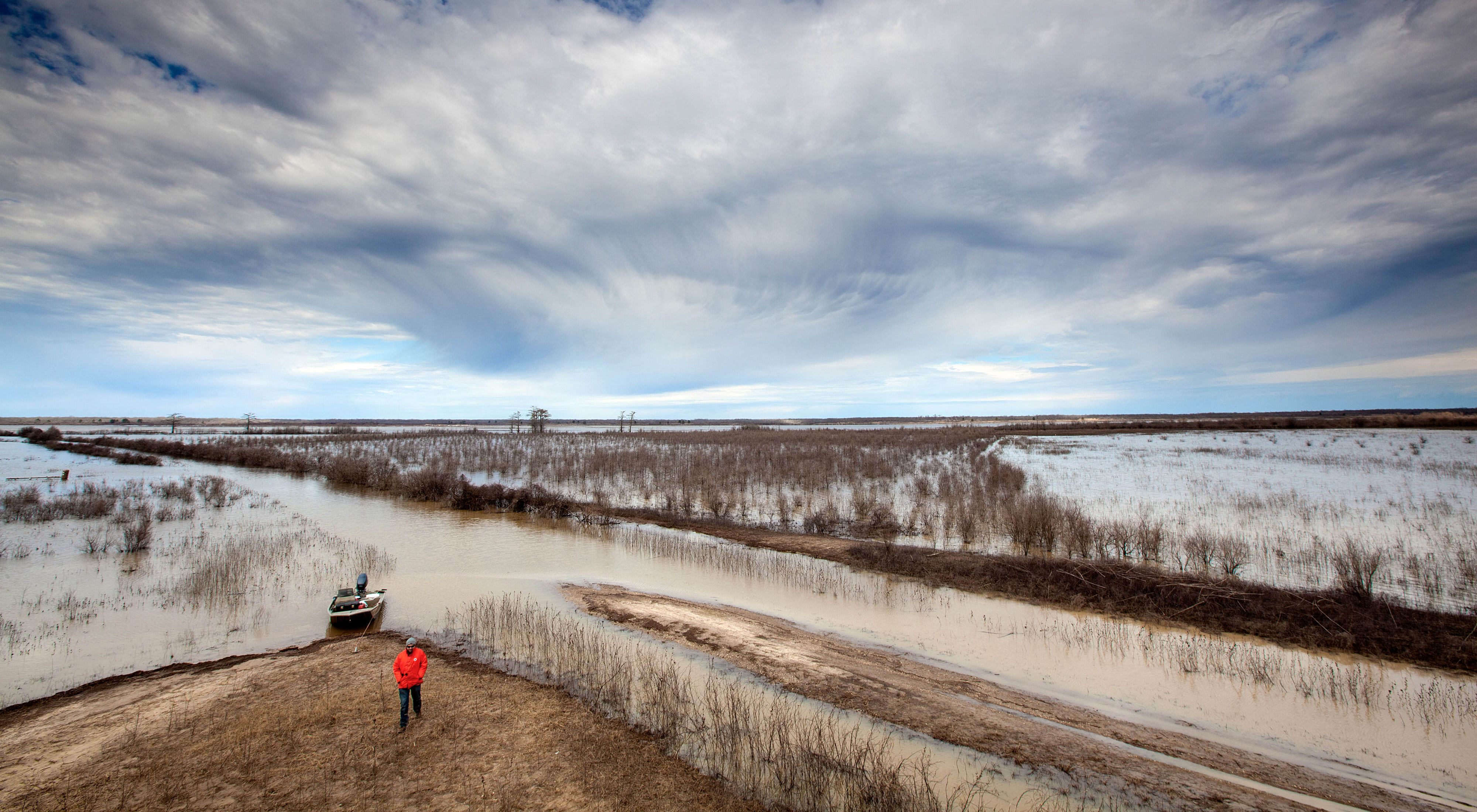
Mollicy Farms was once part of a vast expanse of bottomland hardwood forest seasonally inundated by the floodwaters of the Ouachita River. It was deforested and separated from the river by the levee in the late 1960s so that the land could be used for agriculture.
In 1998, the Conservancy helped the U.S. Fish and Wildlife Service acquire much of Mollicy Farms and add it to the Upper Ouachita National Wildlife Refuge. The Fish and Wildlife Service planted more than three million bald cypress, oak and ash trees on almost 11,000 acres of the refuge to restore the floodplain forest.
TNC and USFWS planned to breach the levee in 2009 to restore the connection between the river and the floodplain that is not only critical to the long-term health of the forest but to the fish and other aquatic life in the Ouachita River.
“Before the levee was constructed around the Mollicy Farms unit, the river would flood each year in late winter and early spring, overflowing its banks and seeping through the bottomland hardwood forest,” says Ouchley.
“Fish would come into the floodplain to spawn in the spring, and the area was a mecca for waterfowl and other wildlife,” Ouchley adds. “With the levees in place, fish are cut off from the floodplain and rainwater gets trapped inside the levee where it sits on the trees for too long, which can kill young trees like those planted at Mollicy in recent years.”
The Restoration
After an extremely wet spring in 2009, the Ouachita River rose to a historic flood stage on May 23 and spilled over several low spots on the levee. The levee failed catastrophically at two locations and water rushed into the 16,000 acre Mollicy unit.
A levee breach was just what The Nature Conservancy and the U.S. Fish and Wildlife Service had in mind, except that the partners had spent more than a year planning a $4.5 million project to permanently breach the Mollicy levee themselves.
The restoration plans adapted: they widened the natural breaches and cut in new ones, for both intake and outtake of floodwater. The next phase of the restoration involved restoring the internal hydrology of the floodplain to recreate a semblance of the network of bayous and embedded wetlands that historically held water on Mollicy. By holding water longer and slowing its flow back to the river as floodwaters recede, we see that fewer nutrients and sediments flow into the Ouachita.
Many species are using the historic floodplain again. Birds, especially waterfowl and wading birds, have come back to Mollicy Farms in great numbers (one winter survey indicated over 70,000 geese and ducks on the site).
This was a great example of private-public partnership that relied on diverse funding sources. This model for restoration will inform developing and future floodplain restoration projects in Louisiana and beyond.