Playing with Fire: My View from Prescribed Burns in the Allegheny Highlands
Eli Beech-Brown shares his new understanding of “good fire” for healthy forests gained during a summer interning in the mountains of Virginia.

As I walked a narrow, overgrown trail, I felt like I was in between two worlds. To my right, a wall of green as far as I could see: rhododendron, sassafras and flowering dogwood under a ceiling of maple, oak and pine. To my left lay burned limbs, dead plants and fire-scarred trees. At first, I thought this ash-ridden landscape was lifeless, but as I continued into the forest, my perception shifted dramatically.
While the unburned area teemed with diverse plants, the burned area attracted a whole different collection of life. Myriad birds swooped among the scarred trees, each singing its own song. Squirrels and other small mammals scurried through the maze of fallen limbs searching for food, and deer sauntered about. This surprisingly active habitat was the result of a recent prescribed burn undertaken by The Nature Conservancy (TNC), the U.S. Forest Service and other collaborators by the Mills Creek area in the Blue Ridge Mountains.
Quote
While the unburned area teemed with diverse plants, the burned area attracted a whole different collection of life.

Together, TNC and partners now commonly use fire to support life in the Appalachian forests of Virginia. As a summer 2023 GIS Technician intern with The Nature Conservancy in Virginia, I worked with the Forest Service in supporting the continued use of prescribed burns to promote healthy forests.
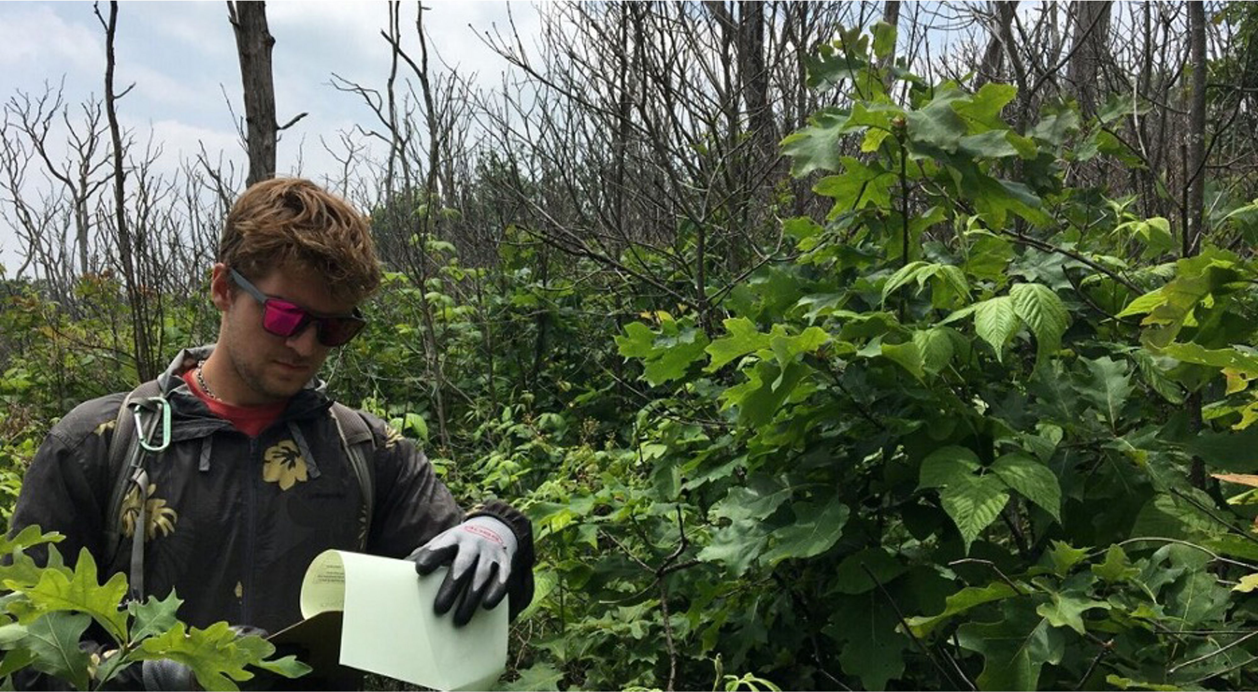
Like the trail, my work had two distinct parts. The first was my focus on GIS (Geographic Information Systems). This part of the job involved big-picture thinking—understanding how best to manage forests for resilience, biodiversity and connectivity, especially in the face of climate change.
After my first week of getting up to speed on the past 10,000 years of natural history in the area, I jumped in. My first task was to assess the severity of all past controlled burns in the George Washington and Jefferson National Forests and the impact they had on forest composition. In fire ecology, the term “severity” is defined as the level of damage left behind in a burn; in my case, I was measuring how much of the canopy was affected. After a few days filling my workspace with enough scribbled-on Post-it notes to make someone question my sanity, I figured out a process. With a few hundred lines of code and the click of a button, I had analyzed every burn conducted by TNC.

A green map that provides a time-series depicting vegetation vigor inside a controlled burn, from immediate post-burn (left) to 2 years post-burn (right). The data was extracted from satellite imagery and analyzed using Google Earth Engine. The patches of orange and yellow are desired outcomes of the burn, representing early-successional and open woodland habitat that is missing from the modern forest. These areas have been changed by burning, but new grasses, wildflowers and trees grow back quickly (almost completely back to green by year 1).

A mountain slope at Warm Springs Mountain Preserve, Virginia. Rain clouds hover in the sky over Bear Loop Trail as rhododendron blooms in the foreground.
It was great to get results. But as my supervisor, TNC Virginia’s Forest Ecologist Jean Lorber, pointed out, these new data wouldn’t mean anything until we had ground-truthed them. So into the forest we went to get slapped in the face by rhododendron bushes, but hopefully not by a different reality.
This second phase of my internship, exploring the forest, provided both an opportunity for me to learn and context for the things I was seeing on my screen. I filled pages and pages of notebooks, learning to distinguish between different species of trees, bushes and flowers by the way their branches came out or how soft their edges were.
I also had the opportunity to work alongside Jean and other colleagues and partners who had made protecting the environment their career. I found inspiration in their passion and tried to absorb as much as I could, all while dodging swing-back branches and clambering over rocks.


These field experiences enabled me to comprehend how the species in the forest were all connected and worked together. With this new understanding, I returned to the “lab” to combine all my new knowledge in a way that could increase our understanding of fire.
I finished up the summer creating presentations and materials for a wide range of partners, including TNC colleagues, the Forest Service and the public. Having worked on these projects for months, I found it incredibly rewarding to share my work with interested parties who would then apply it on the ground to enhance hundreds of thousands of acres of forests.
And just like that, my time with The Nature Conservancy had wrapped up, at least for now. But I left with new skills, experiences and relationships that will meaningfully assist me in building my career in conservation.
Learn more about TNC Virginia’s STEP internships here. 2024 summer internship applications are open until February 25, 2024.
We Can’t Save Nature Without You
Sign up to receive monthly conservation news and updates from Virginia. Get a preview of Virginia's Nature News email

Recent Stories

Accepting a Queer Nature
Exploring the discipline of queer ecology and the aim of understanding how cultural norms around gender and sexuality impact our views of the natural world.
Recovering the Past: A History That Mirrors My Own
VVCR History Intern Vanessa Moses reflects on the enslaved individuals who built what is now Brownsville Preserve, and finds connections across time in her own family's history.
Nikole Simmons: Sparking Change
She co-founded a program dedicated to bringing more women into wildland fire management—where almost nine of 10 workers are male.