Wetlands by Design in Wisconsin
Where to protect or restore wetlands in Wisconsin? There's a web tool for that.
By Cate Harrington, Former Wisconsin Director of Marketing and Communications
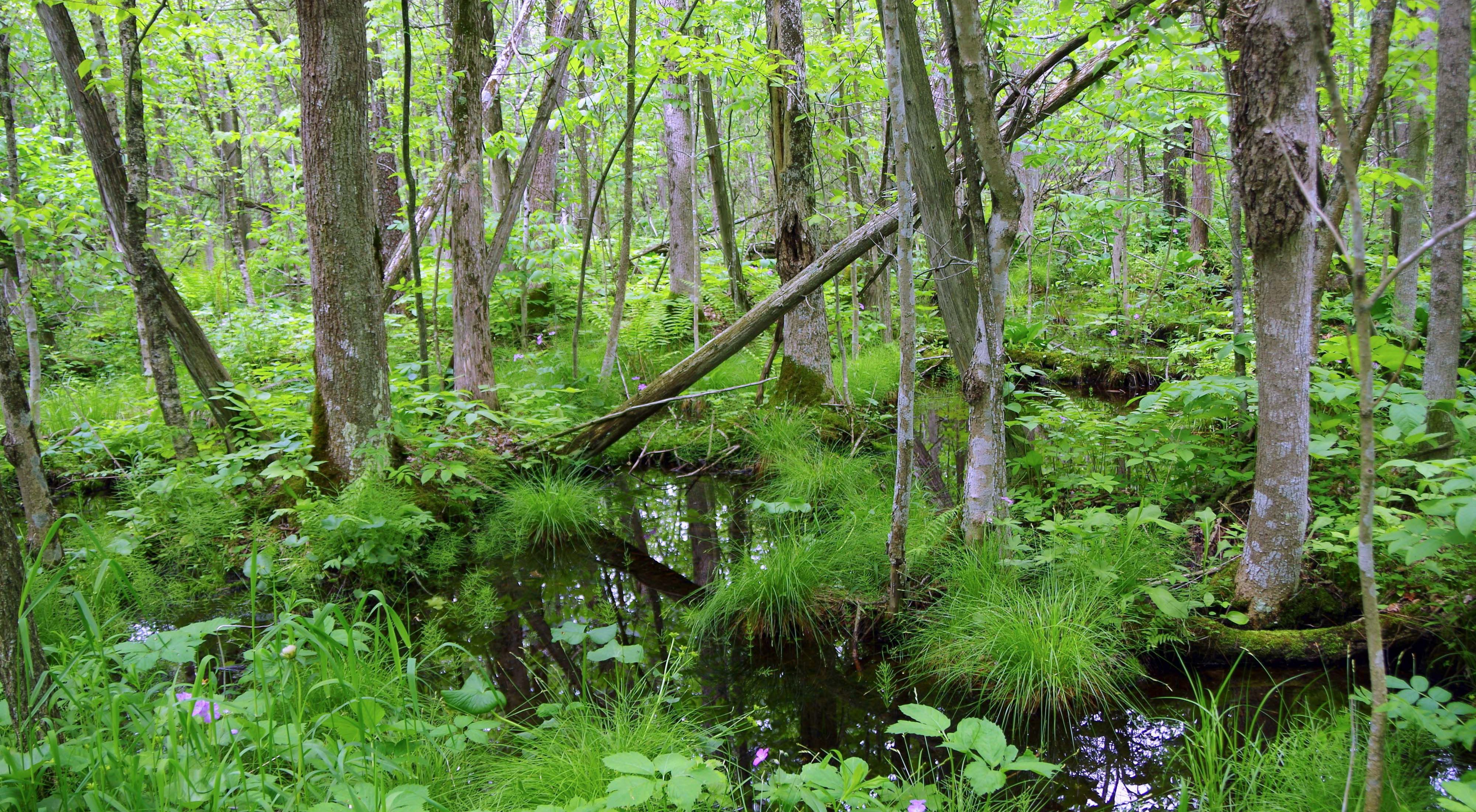
I am standing in a floodplain forest along the Milwaukee River. Tiny frogs leap madly to get out of my way. Dragonflies flit among the pondweed on the river. A willow flycatcher calls from a nearby willow or dogwood. As that songbird flies, I am just 30 miles or so from downtown Milwaukee.
I am here with Joanne Kline, a wetland ecologist with Conservation Strategies Group. Joanne was part of the team of scientists from The Nature Conservancy, along with Tom Bernthal and Matt Matrise from the Wisconsin Department of Natural Resources, that created an online tool that is helping decision-makers in this watershed and throughout Wisconsin decide where to invest in wetland protection and restoration.
DISAPPEARING WETLANDS MEAN LOSS OF SERVICES
More than half of the wetlands that greeted Wisconsin’s early settlers are gone, including here in the Milwaukee River Basin. They were filled in or drained to grow crops and build cities and roads. As we walk through the floodplain forest, Joanne tells me about the valuable functions that wetlands perform, which have been lost along with the sedges, cattails, trees and shrubs.
“Wetlands are incredibly hard-working habitats,” Kline said. “They do everything from improving water quality by removing sediment and nutrients in runoff from rainfall and snowmelt to storing water when streams overflow, which contributes to flood control. Wetlands connected to rivers and lakes are nurseries for fish reproduction, and frogs, birds and other wildlife depend on wetlands for food, shelter and places to nest.”
To replace the services that wetlands and other habitats like forests and prairies once provided for free, we have built sewage treatment plants, levees, dams and other types of infrastructure. But they are expensive and generally only perform one specific function rather than the multitude of functions that wetlands can perform.
“We invest millions in built infrastructure to make sure our towns and cities are healthy and safe,” said Nick Miller, Nature Conservancy science director. “But at some point, the cost to add additional infrastructure becomes prohibitive. If, instead, we focus on rebuilding our wetlands and other ‘natural infrastructure,’ we will protect our communities, provide habitat for wildlife and save money.”
NEW TOOL WILL HELP DECISION-MAKERS
This brings us back to the online tool that The Nature Conservancy and the Wisconsin Department of Natural Resources developed. Based on a model the two organizations and other partners developed in 2012 for the Duck-Pensaukee watershed near Green Bay, this new, improved version includes wetland information for the entire state.
“In any given part of Wisconsin, there are competing land use needs from agriculture and industry to roads and housing, and sometimes they will take precedence over protecting wetlands and other habitats,” Miller said. “This online tool can help communities decide where the best places are to protect or restore wetlands for wildlife and the many other benefits they provide before intact wetlands are converted to other uses.”
“The beauty of this tool is that it allows decision-makers to better identify the wetland-related conservation needs in their watershed, the functions existing wetlands are currently providing to society and wetland restoration opportunities. With that information, they can find the conservation opportunities most likely to provide the ‘biggest bang for the buck’ to meet their needs,” said Tom Bernthal, Water Resources Management Specialist with the Wisconsin Department of Natural Resources.
For example, if communities in counties like Ozaukee and Washington are experiencing increased flooding as they have in recent years, then county planners might decide to look upstream in the Milwaukee River Basin and see where the best places are to protect and restore wetlands that will store water and help with flood control. Water resources managers in Milwaukee who want to augment their capacity to provide clean water for fish and river-based recreation might be interested in protecting and restoring wetlands that help filter pollutants from urban and agricultural runoff as well as store flood waters.
TAKING A WATERSHED APPROACH TO WETLAND PROTECTION
“The Milwaukee Metropolitan Sewerage District services 28 communities, but to serve them well we need to look upstream to the entire watershed because what happens to the land up there impacts us down here,” said Steve McCarthy, landscape architect with MMSD. “For the past 15 years, we’ve been supplementing the work our sewage and wastewater treatment plants do by protecting and restoring more than 3,000 acres of wetlands and other habitats. Investing in protecting nature’s life support systems is cost effective and it makes good business sense.”
“Wetlands behave differently in different landscapes, and they face different challenges from burgeoning urbanization to frack sand mining,” said Miller. “Our tool was designed to capture all of that variability in this model to make it useful to local planners, elected officials and citizens who are making decisions on how to protect and restore the wetlands that are contributing immeasurably to clean water, wildlife habitat and safe communities.”
You can find the tool, a video showing how to use it and more at WetlandsByDesign.org.