Places We Protect

Warm Springs Mountain Preserve

Virginia

Drone view looking out over rolling mountain ridges and valleys. The mountain sides are thickly forested. Sunlight dapples over the trees. Small clearings and farms are visible in the distance.
Warm Springs Mountain Drone's eye view looking east from Warm Springs Mountain Preserve, 300 feet above the Dan Ingalls Overlook parking lot. Bath County, VA. © Doug Rogers

Three public trails offer an introduction to one of the most ecologically significant forests in the Central Appalachians.

Overview

Description

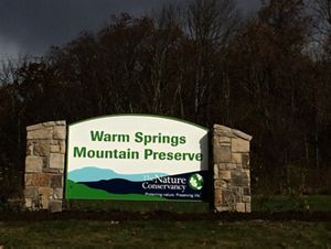
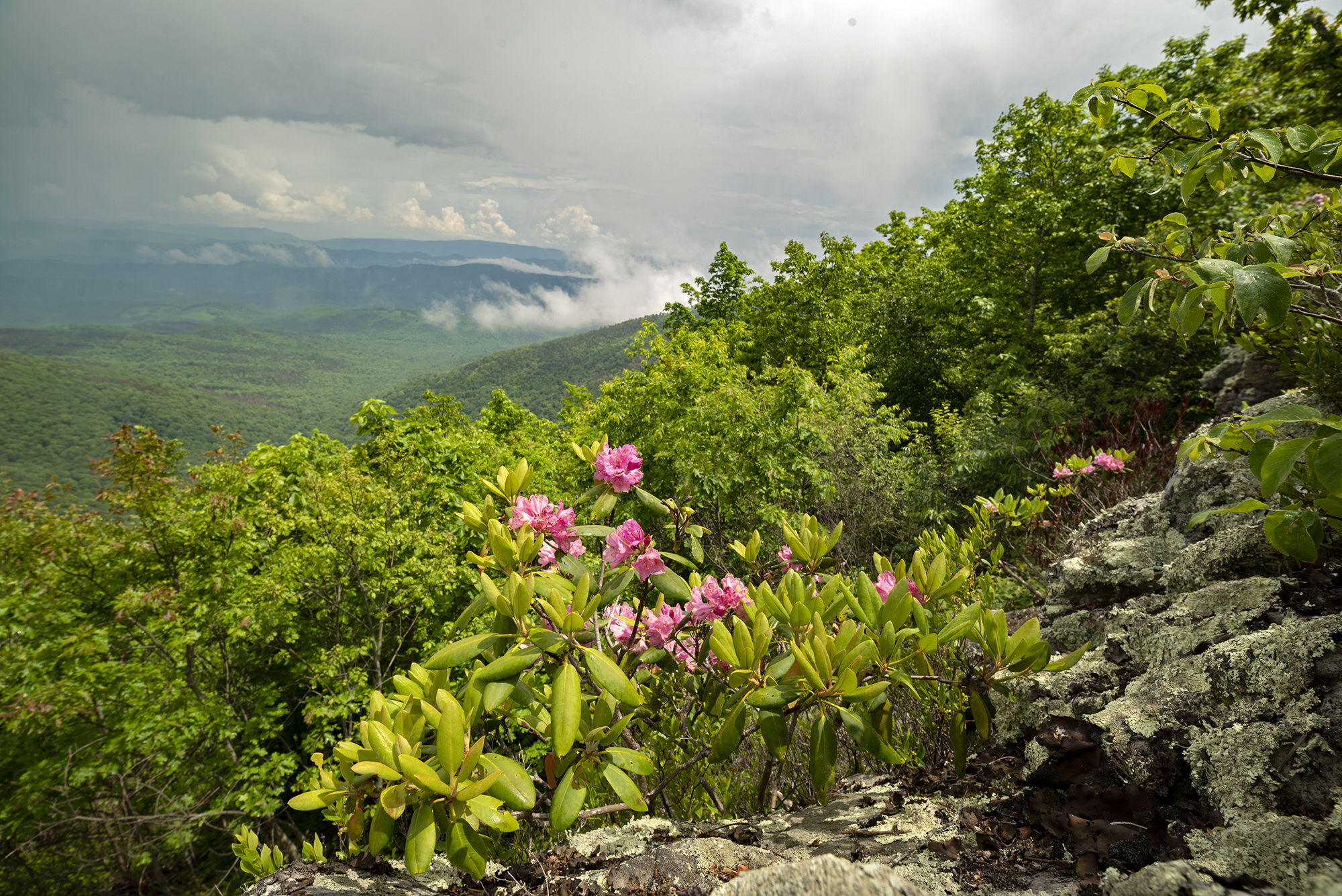
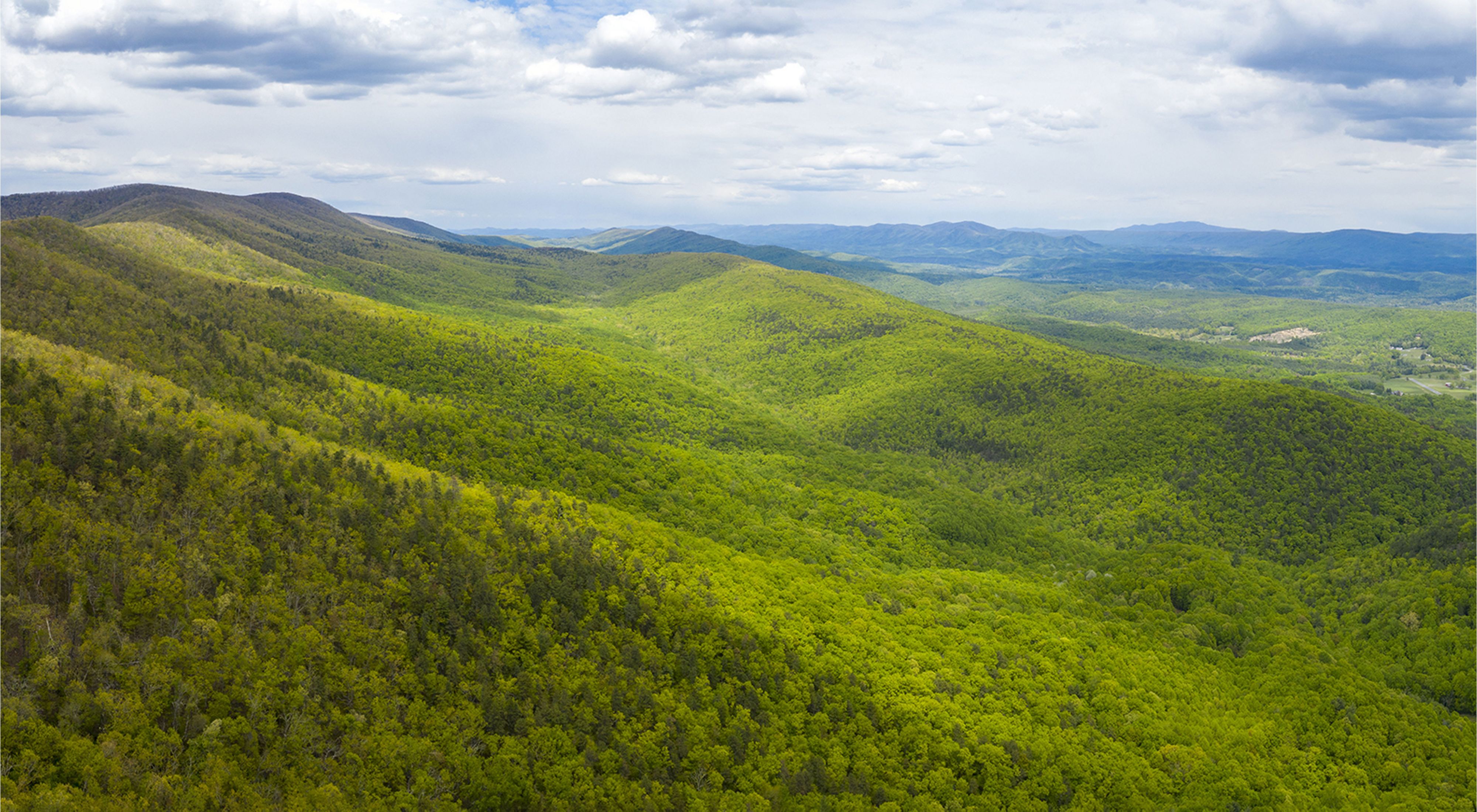
Warm Springs Mountain Preserve helps stitch together thousands of acres of forest and conservation lands in western Virginia’s Allegheny Highlands. The preserve anchors our efforts to protect and restore a key wildlife corridor and habitat for an amazing diversity of natural communities, plants and animals.

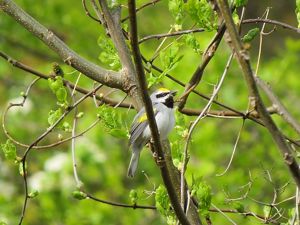
Situated within a 77,000-acre unfragmented, largely roadless forest block, the preserve helps maintain healthy, breeding populations of interior-forest-dwelling songbirds, provides key habitat for wide-ranging mammals, and protects headwater tributaries of both the Jackson and Cowpasture rivers.

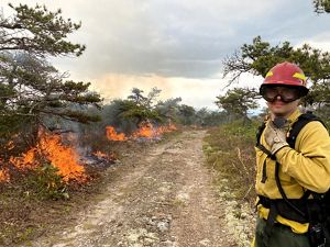
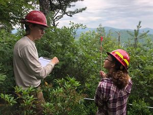
The preserve features Virginia’s only substantial montane pine barren, a globally rare, arid, fire-dependent landscape. The mountain harbors at least two other rare natural communities, three rare plants and eight rare invertebrates.

Access

OPEN TO THE PUBLIC

Leashed dogs are permitted on the public trails. Dogs must be leashed at all times.

Hours

Open during daylight hours

Highlights

Three trails are open to the public for hiking.

Size

9,269 acres on and around Warm Springs Mountain

Explore our work in Virginia

Visit

  • Spring is prime time for wildflowers and bird watching. Summer is peak season for wildlife sightings, especially during morning and evening walks. And autumn offers beautiful displays of forest foliage.

    Access

    The Ingalls Overlook, Sandy Gap and Bear Loop hiking trails are open daily. These three trails offer distinct experiences, from expansive mountain views to a close-up look at a globally rare pine barren, along with opportunities to extend your hike on adjoining public lands.

  • From the village of Hot Springs, travel US 220 South for 7.7 miles, turn left on State Route 606 and travel 2.6 miles to the crest of Warm Springs Mountain. Turn left onto State Route 703 (Airport Road) and travel 6.2 miles to the trailhead, just left of the entrance to Ingalls Field Airport.  This 3-mile loop trail is relatively flat and with several overlooks offering stunning panoramic views.  Interpretive signs highlight the mountain’s diversity of wildlife species and habitats in addition to TNC’s efforts to restore the region’s fire-adapted oak and pine forests.

  • At the northern end of the preserve, park at the Dan Ingalls Overlook, located on Route 39 just outside the village of Warm Springs. Here you will find the trailhead for the 2.4-mile (round trip) Ingalls Overlook Trail. Interpretive signs along the first mile provide an excellent introduction to Warm Springs Mountain and the region’s natural history. The trail then climbs among a series of scenic rock formations with views of Shenandoah Mountain and the Cowpasture River valley before looping back to the main trail and returning to the overlook.

  • At the southern end of the preserve, park at the small gravel lot on Route 703 (Airport Road) just past the south entrance to Bald Knob. Cross the paved road to the gravel Bald Knob service road and you will find the trailhead for the Sandy Gap Trail.  Built by the Civilian Conservation Corps in the 1930s, this 3.2-mile trail (one-way trip) features tranquil vistas and unique stone work, travels through the George Washington National Forest, and connects to the Douthat State Park trail system. This trail can be accessed directly from State Route 703 or from Forest Road 125, in which case the views of the Falling Springs valley from the trailhead overlook make this a truly rewarding climb.

  • Geocaching is a fast-growing hobby that provides an exciting way to explore the landscape and share special places with other outdoor enthusiasts. Players try to locate hidden containers, called geocaches, using a smartphone or GPS, and can then share their experiences online.

    A geocache can be found at Warm Springs Mountain Preserve, part of the geocaching trail along the Appalachian Waters Scenic Byway. Log on to www.geocaching.com to set up a free account.


    Please review our preserve guidelines before your visit, and keep these tips in mind during your outing:

    • Caches are only accessible during normal hours of operation.
    • Stay on marked trails at all times.
    • Dogs on the trail must be leashed at all times.
    • Do not litter; used marked receptacles to dispose of any trash.
    • Please respect the land; do not remove plants, animals, artifacts, or rocks.

    New geocaches are not permitted on TNC preserves. These sites were carefully selected for their accessibility and low impact to the environment. 

  • The Nature Conservancy’s preserves are set aside to protect natural plant and animal communities. We invite you to experience and enjoy preserves where we provide public access, but remember that every visitor has an impact. Please follow our visitation guidelines to protect yourself and nature.

    • Preserves are open to the public during daylight hours. 
    • Passive recreation such as walking, bird watching and photography is welcomed. 

     The following activities are not allowed:

    • Bringing dogs onto the preserve unless otherwise noted. Please visit Places We Protect to confirm the policy at each preserve.
    • Dogs are not allowed on any of the Virginia Coast Reserve islands
    • Picking flowers, mushrooms, etc.
    • Removing rocks or other parts of the landscape
    • Smoking
    • Camping
    • Fires or cookouts
    • Driving motorized vehicles, including ATV’s, except on designated access roads
    • Biking, except at Brownsville Preserve
    • Fishing, trapping or hunting, except as otherwise posted
    • Horseback riding
    • Feeding wildlife
    • Releasing animals or introducing plants
    • Disposing of trash or other waste, including biodegradable materials

    To minimize your impact, we ask that you please also observe the following:

    • Stay on trails
    • Avoid walking in wet, boggy areas
    • Inspect pant legs and shoes to remove seeds before entering and when leaving the preserve. Failure to do so could introduce invasive weeds to new locations.
    • If you flush a ground nesting bird, stop and avoid walking near the nest area
    • Observe all posted signs
    • Please do not remove stakes, signs, flagging, tape or similar objects. These may be markers for a research project.
    • Please do not trespass on private property adjacent to preserves

    For your own comfort and enjoyment, come prepared. Wear comfortable shoes for hiking, pack rain gear, and wear long pants with socks over them to protect yourself from ticks and poison ivy. Always remember to bring water, as dehydration is a serious year-round threat.

    If you observe any illegal activity on a preserve such as ATV use, do not confront the offenders yourself. However, do feel free to call local law enforcement.

Explore Warm Springs Mountain Preserve

The preserve anchors our efforts to protect and restore a key wildlife corridor and habitat for an amazing diversity of natural communities, plants and animals.

A large sign held up by two stone pillars welcomes visitors. The sign reads Warm Springs Mountain Preserve. At the bottom is stylized mountain graphic with the TNC logo in the corner.
A gray and white bird with a golden cap and yellow flecks on its wings sits perched on a tree branch.
A man wearing yellow fire gear and goggles monitors a low line of fire burning vegetation along the edge of a wide dirt road.
Two people wearing red hardhats stand in a green thicket counting stems of young pine trees at a study site.
Three girls stand together arm in arm in tall grass. A valley drops away below them ending in a line of mountain ridges.
Pink flowers grow in a rocky outcropping looking out over a cloud filled valley.
The Appalachians View of rain clouds from Bear Loop Trail with rhododendron blooms in the foreground. Warm Springs Mountain Preserve, Virginia. © Daniel White/TNC

Get Involved

Preserve Volunteer Program

Virginia's Preserve Volunteer Community Program provides a vital service to help us maintain and monitor our public preserves across the state.

How can you get involved?

  • Community Members—become involved with a preserve without committing time to stewardship work. Receive periodic updates about the preserve and special events.
  • Preserve Stewards—visit Warm Springs Mountain at least 4 times a year to assess trail and preserve conditions and perform basic trail maintenance by removing fallen branches and overgrown vegetation.
  • Preserve Leaders—demonstrated commitment to the preserve and willingness to take on additional responsibilities like managing communication & scheduling, leading workdays and guiding naturalist hikes.

Email vapreservestewards@tnc.org to learn how you can help and become a part of the program.

Download the Warm Springs Mountain Preserve Volunteer Program handbook to learn more.

Find More Places We Protect

The Nature Conservancy owns nearly 1,500 preserves covering more than 2.5 million acres across all 50 states. These lands protect wildlife and natural systems, serve as living laboratories for innovative science and connect people to the natural world.

See the Complete Map