Explore all that Arthur W. Butler Memorial Sanctuary has to offer in our trail map. There are five main trails and three connector trails at The Arthur W. Butler Memorial Sanctuary. Together, they total 6.5 miles.
Here’s what to expect on when you hit the trails:
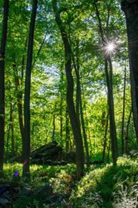
The Butler Loop is a moderate-to-difficult hike and is marked (or “blazed”) with red circles on the map and at the preserve. The trail is 3.0 miles long and begins at the main trailhead. It passes through rugged outcrops and boulder-strewn hills, deciduous forests, flowing streams, and swamps teeming with flora and fauna on a natural soil surface trail. Expect 772 feet of elevation gain and a typical trail width of 50 inches; at its narrowest, the trail is 10 inches wide. The typical grade (incline) is 11.8%, with a maximum grade of 47.6% and a typical cross slope (the incline across the trail) of 5.1%. (By comparison, an easy trail usually has less than a 5% incline, a maximum grade of 15% and a cross slope of 0). Expect natural stream crossings and some obstructions, such as rocks, roots and fallen trees.
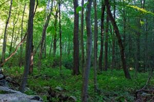
The Long Trail is a moderate hike and is marked (or “blazed”) with blue squares on the map and at the preserve. The trail is 1.5 miles long and starts at the trailhead off Byram Lake Road. The trail can also be accessed off the Butler Loop. The Long Trail takes you from one end of the preserve to the other, through deciduous forests, wetlands and rocky outcrops. Expect 291 feet of elevation gain and a typical trail width of 30 inches; at its narrowest, the trail is 19 inches wide. The typical grade (incline) is 9.6% with a maximum grade of 55.1%, and a typical cross slope of 6.0%. (By comparison, an easy trail usually has less than a 5% incline, a maximum grade of 15% and a cross slope of 0.) Expect both natural and built stream crossings and minimal obstructions, such as rocks, roots and fallen trees.
The Fern Trail is an easy hike and is marked (or “blazed”) with orange squares on the map and at the preserve. The trail is 0.9 miles long and starts from the Butler Loop. This trail takes you through a wetland that, from spring through early fall, is carpeted with several species of ferns. Expect 153.8 feet of elevation gain and a typical trail width of 23 inches; at its narrowest, the trail is 10 inches wide. The typical grade (incline) is 7% with a maximum grade of 30.9%, and a typical cross slope of 5.6%. (By comparison, an easy trail usually has less than a 5% incline, a maximum grade of 15% and a cross slope of 0.) Expect both natural and built stream crossings and frequent obstructions, including rocks, roots and muddy sections.
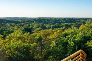
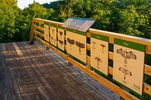
The Hawkwatch Loop is an easy hike marked (or “blazed”) with yellow triangles on the map and at the preserve. The trail is 0.5 miles long and starts at the main trailhead. The trail is a short loop that takes you to the Robert J. Hammerschlag Hawkwatch, part of a network of hawk-watching sites across the United States. Expect 139 feet of elevation gain and a typical trail width of 41 inches; at its narrowest, the trail is 10 inches wide. The typical grade (incline) is 9.7% with a maximum grade of 32.4%, and a typical cross slope of 4.9%. (By comparison, an easy trail usually has less than a 5% incline, a maximum grade of 15% and a cross slope of 0.) There are no stream crossings and only minor obstructions, such as rocks, roots and fallen trees.
The Balancing Rock Trail is a moderate hike marked (or “blazed”) with yellow triangles on the map and at the preserve. The trail is 0.3 miles long and begins at the Butler Loop. Expect 80 feet of elevation gain, a typical trail width of 29 inches and the narrowest part of the trail to be 9 inches. The typical grade (incline) is 11% with a maximum grade of 40%, and a typical cross slope of 5%. (By comparison, an easy trail usually has less than a 5% incline, a maximum grade of 15% and a cross slope of 0.) There are no stream crossings and some obstructions, such as rocks, roots and fallen trees.
The four connector trails are each less than 0.2 miles long and connect different sections of the main trails. They are blazed with white squares. Expect elevation gains between 1 to 50 feet, typical grades between 10 and 11% , maximum grades between 20 and 31% and cross slopes of 5%. Typical trail width is between 20 and 30 inches; the narrowest trail is 10 inches wide. Expect no stream crossings on any of the connector trails and some obstructions, such as rocks, roots and fallen trees.