Coastal Resilience for Long Island Sound
A new coastal resilience tool is helping our cities and towns plan for a changing climate.
- We're not waiting for the next big hurricane to help protect communities from flooding and storm surges. The Coastal Resilience Tool reveals potential problems now.
- The Coastal Resilience Tool lets communities explore different flooding scenarios, analyze the potential impacts on communities, natural resources and critical infrastructure like roads and schools and develop solutions to address these realities.
- TNC is working with decision-makers in Connecticut and New York to plan ways to protect communities and the natural features that safeguard them.
_LI%20Chapter%20©Red%20Vault%20Productions.jpg?wid=820)
_LI%20Chapter%20©Red%20Vault%20Productions.jpg?wid=1280)
Planning for Climate Change
Picture a place on Long Island Sound that you love. Do you fish there? Swim there? Do you visit once each summer, or every single day? Who goes there with you?
If you live near coastal Long Island, Connecticut or in Westchester County, you’re probably well aware of how the coast provides you with things you need and love—seafood, clean water, protection from storms and beautiful places to relax and explore.
But the coast is changing. “We’re anticipating dramatic changes in sea level with a rise of approximately 4 feet or more by 2100,” says Dr. Adam Whelchel, TNC's director of conservation programs in Connecticut. “And some coastal towns are already experiencing the impacts.”
What does this mean for the natural areas you love on the Sound? And what does it mean for the 8 million people who live here?
Anticipating Larger and More Damaging Storms
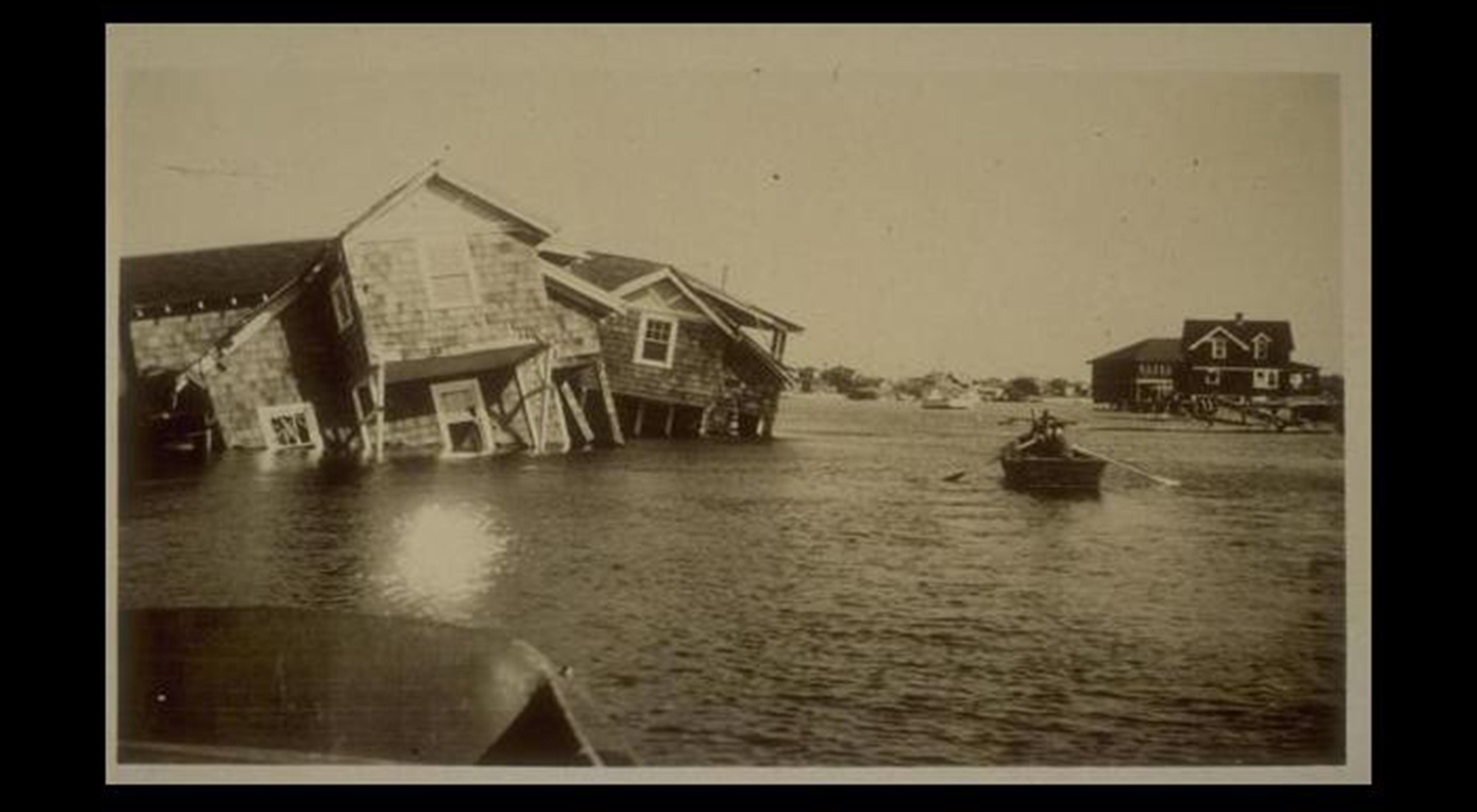
More than 70 years ago, the Long Island Express, a hurricane named for its sheer force and unprecedented speed, slammed into the coast of Long Island with an impact that registered on seismographs in Alaska. It left 600 people dead, 8,900 homes destroyed and inflicted $4.7 billion of damage.
“If a Category 3 hurricane hit the coast today, the estimated cost would be $24 billion in damages and interrupted business,” says Whelchel. And according to many experts, we’re long overdue for a follow-up. Complicating matters along this heavily developed coastline is the issue of sea level rise.
As sea level rises, coastal communities in Connecticut, Long Island and even New York City become more vulnerable to storm surge flooding. A rise of just 18 inches, combined with the storm surge from a Category 3 hurricane, would leave the entire metropolitan transportation system shut down.
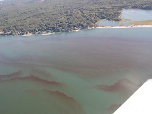
But we don’t have to wait for the next big hurricane to see the impacts. Homes were left teetering over the sea in Montauk, NY, on the eastern end of Long Island, in 2011 after a severe yet relatively routine winter storm. Valuable salt marshes in Jamaica Bay, New York City are drowning with no place left to migrate. Oyster beds are routinely smothered with silt from severe rain events in Clinton, Connecticut.
Despite the risks, communities and local decision-makers have little access to the information they need to protect people and nature from these dramatic changes. Sea level rise can be hard to understand and can seem very far away—until now.
The Power of Planning Ahead
With TNC's newly expanded and improved Coastal Resilience Tool, coastal communities and decision-makers in Connecticut, Long Island and New York City can now explore different flooding scenarios from sea level rise and storm surge, analyze the potential impacts on communities, natural resources and critical infrastructure like roads and schools and develop solutions to address these realities.
“Decision-makers and planners need a clear and compelling case for their constituents, which coastalresilience.org provides,” says Dr. Nicole Maher, TNC's wetlands specialist for Long Island. This tool will help determine which parcels of land should be preserved, how to manage land for responsible and more resilient development and how to prioritize which wetlands should be restored to protect our coastal communities.”
Some towns have already stepped up to explore how coastalresilience.org can help them be smarter today for the future, given the changes occurring along our coastlines. “As far as the public infrastructure is concerned, I think it is a critical tool,” says Branford, Ct., selectman Anthony “Unk” DaRos. “We should not be putting roads where we shouldn’t be putting roads or allowing subdivisions where they shouldn’t be allowed.”
“When it’s something of this magnitude, it isn’t something you want to be crisis managing. It’s something you’d rather be planning for.”

Coastal Resilience Tool
The Coastal Resilience Tool is now online and available to all coastal communities, including Long Island Sound. Click on Geographies, then Long Island Sound. Use the Tool
Stay in Touch
Subscribe to Nature News, our monthly e-newsletter. Get the latest news and updates about our conservation efforts locally and around the world, delivered straight to your inbox.
Explore Further
Hope For The Sound
Bruce Beebe is one of many business owners and community leaders coming together to ensure Long Island Sound remains a source of prosperity and enjoyment for future generations.
Nitrogen Pollution Isn't Just a Local Problem, and We Can Fix It.
Blog written by Chantal Collier
Protecting Seagrass In Long Island Sound
We know why a critical habitat is in decline; now we’re trying to save it.