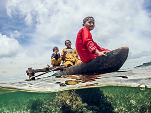
Stories in the Pacific Islands
Inclusive Planning in Pacific Island Communities
We are working with all members of communities to help them understand their natural resources and manage them effectively.
The Nature Conservancy is working to protect land and water for both people and nature. We know that readily available, cost-effective natural climate solutions really work, especially in places like the Pacific, where communities are experiencing the impacts of climate change now.
Please join our fight against climate change.
Together with local partners, we are addressing critical climate challenges, including sea-level rise. We are helping protect and restore coastal habitats, creating models that predict the impacts of climate change on those communities, and using science to develop long-term solutions. We are also finding better ways to plan and manage increasingly crowded oceans and protect coral reefs and fisheries.
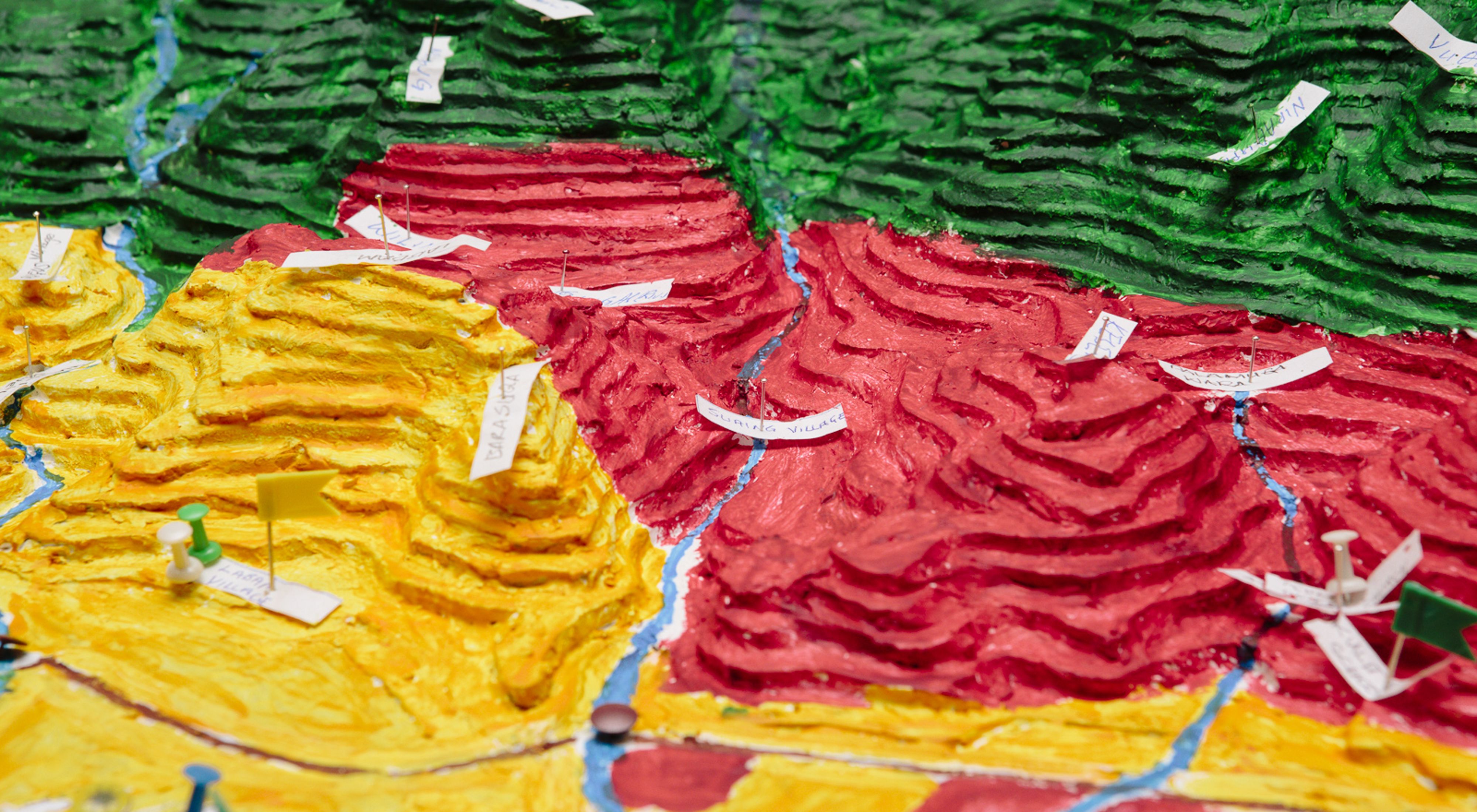
TNC in the Pacific focuses on “ridges to reefs” conservation planning, a scientific and participatory approach that considers how land and sea resources are interconnected, and it engages local communities in resource planning and protection. Participatory three-dimensional mapping (P3DM) is a tool and technique that helps communities visualize their land so they can better plan and manage their natural resources.
We have partnered with communities and governments to protect both seascapes and landscapes in the face of emerging threats from climate change, development and population growth, and we’ve helped them develop detailed conservation plans in Micronesia, Solomon Islands and Papua New Guinea.
Using three-dimensional maps and computer modeling, TNC is working with communities to create both low- and high-tech depictions of their landscapes and seascapes. Using these models, communities can identify important natural areas, predict current and future climate risks, and develop response scenarios that help protect their natural and cultural resources.
P3DM produces a stand-alone scaled relief model that provides a clear picture of the area. It is a user-friendly and relatively accurate planning, research and management tool. The 3D map helps communities and governments visualize the impacts of climate change and development and track changes over time. It locates where natural resources are, such as watersheds, and helps to plan ways to best manage them.
Read More
_4000x2200.jpg?crop=533%2C0%2C2933%2C2200&wid=300&hei=225&scl=9.777777777777779)
Climate Change in the Pacific
Here’s how The Nature Conservancy works in the Pacific Islands and beyond to address the challenges associated with climate change.
Oneisomw: How a Community United to Protect Their Small Island Home
Oneisomw is one of nine islands within the Faichuuk region of the Chuuk State—one of the four states that make up the Federated States of Micronesia.
Sustainable Development In The Pacific Islands
We are committed to ensuring that governments and communities are equipped with the best available information to make informed and inclusive decisions.