Elephants Will Have a Say in Mapping Kenya’s Future
Elephant movement data is helping the Kenyan government site big development projects.

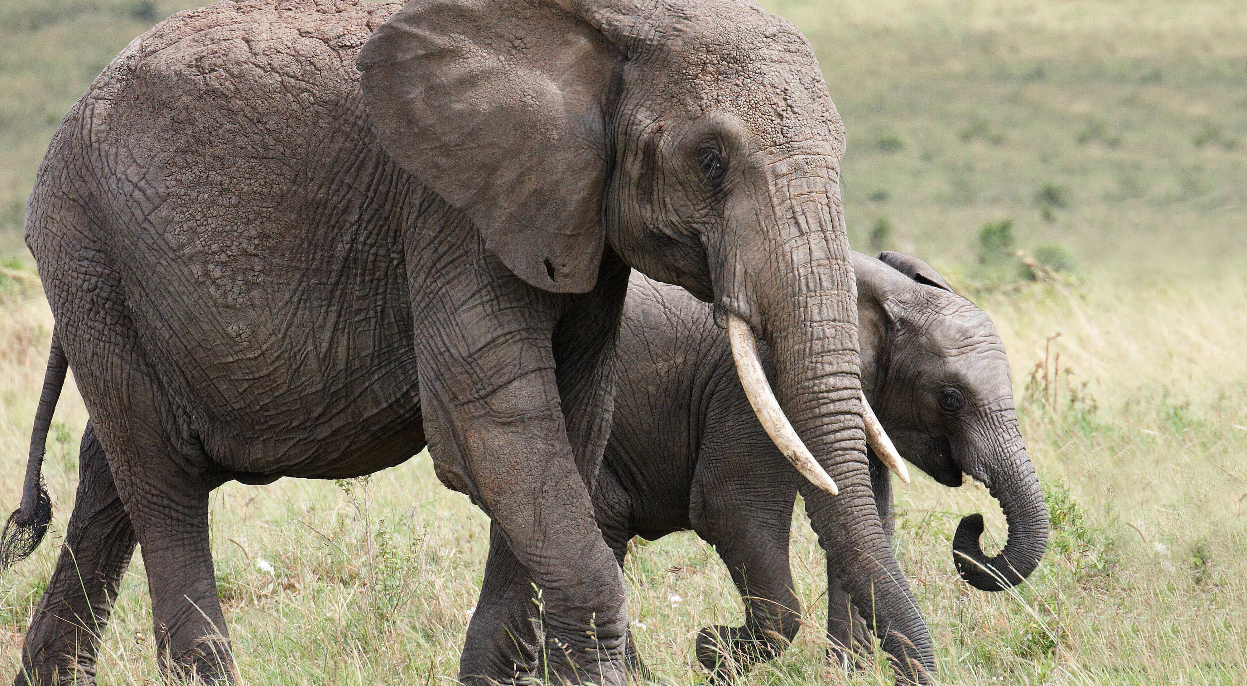
If we could all be a bit more “elephant,” there might be fewer of us walking into lamp posts as we check Google Maps. Elephants have it all in their heads: complex maps of vast landscapes that include water points, saltpans, and even danger zones. Youngsters learn these routes from their mothers and, in turn, pass it on to their own offspring.
As Kenya pursues national development goals, the maps being drawn by urban planners and businesses could look very different to those of the elephants. Kenya’s “Vision 2030” looks to create a country with a strong economy, world-class transport links, and improved energy infrastructure—where citizens have secure job prospects, and access to good education and healthcare. Development is inevitable, necessary, and happening.
The Kenyan government is increasingly looking for opportunities to achieve this prosperity while minimizing damage to the wildlife and natural resources that are essential to its economy and the livelihoods of its citizens. Could elephants, with their complex mental maps of rivers, forests, and fertile grassland, contribute to smarter growth for Kenya?
With a little help from TNC’s scientists, we can make this happen.
Data Translator
Our partner Save the Elephants has collared and tracked 144 individual elephants in the Samburu region of north Kenya since 1998, providing one of the most comprehensive datasets on elephant movements in any area in Africa.
Save the Elephants is analyzing this data to help define key elephant habitats and the corridors that link them. As well as funding this work, TNC is helping to package this data in a way that can help inform large-scale development. This could make the difference between a new highway cutting off a vital elephant refuge, or being built away from wildlife at a site that opens up business opportunities for a rural Kenyan town.
As Kenya sketches its future, we want to bring elephants to the table.
Kenya’s National Environmental Management Authority (NEMA) has a mandate to ensure all development projects have taken environmental considerations into account. TNC’s new partnership with NEMA, led by our Director of Smart Growth Anne Trainor, will enable us to use the wealth of data from Save the Elephants and translate it into maps that show elephant routes alongside human settlements and planned infrastructure all in one. This will help NEMA make more informed decisions on where to site future development projects.
This is important because, unlike Google, elephants don’t have route options with less traffic—all they know is straight. A herd will plough through most fences, roads, or farms in their way. This is leading to an increasing number of elephants being killed as people try to protect their livelihoods.
Development, Designed
The team from NEMA have chosen a pilot site in Isiolo County, north Kenya, to trial this new use of animal movement data in infrastructure planning. This region is dotted with community conservancies and wildlife reserves, and acts as a vital corridor for thousands of elephants as they move from the fertile slopes of Mt. Kenya to the open grasslands farther north.
It is also the site of a newly built international airport, and marks the beginning of one of the best tarmac roads in the country. There are high levels of interest in this area from the energy, hospitality, and business sectors, and NEMA will be required to balance their complex needs with the integrity of Isiolo's precious natural resources.
Prove the Model, Scale it Up
In April, TNC signed a formal agreement with NEMA to move forward with this pilot. The agreement sets out the scope of the spatial mapping work in Isiolo, as well as how TNC will share scientific and technical skills with NEMA staff so that they can capitalize on a host of other available data.
There are multiple NGOs collaring and tracking different animal species across the country, generating a wealth of information just waiting to be tapped. This pilot project has the potential to prove that animal movement data can be a key piece of the puzzle for Kenya’s smart, sustainable development.
Let's get a bigger table, because the elephants are coming.