Minimizing Sediment at the Upper Little Red River
We are working to reduce erosion and sedimentation in the Greers Ferry Watershed.

During the summer of 2009, The Nature Conservancy completed a project to stabilize a stream bank on the Upper Little Red River that was losing tons of sediment to erosion every year, kicking off almost a decade of dedication to reducing sediment in the Greers Ferry Lake Watershed.
Excess sediment within a stream can fill in gravel beds, choking out insects, larvae and small fish at the bottom of the food chain, which, in turn, affects game fish near the top of the food chain.
At the Middle Fork of the Little Red River in Van Buren County, the Conservancy stabilized 375 feet of stream bank that had eroded as much as 16 feet in one year, dumping some 850 tons of sediment into the river. The project was on private land enrolled in a multi-agency program designed to provide habitat protection for the endangered speckled pocketbook mussel, which is found only within the watershed of the Little Red River.
Funding was provided by a U.S. Fish and Wildlife Service Private Stewardship Grant, which was matched in part by the Conservancy in Arkansas. Other partners in the project include the Arkansas Game and Fish Commission, the Natural Resources Conservation Service and Riggs Caterpillar of Arkansas.
“This project was to benefit people,” said Joy Wasson, River Conservation Program Director. “The landowner at the site benefited from improved roads that were needed for us to bring in the heavy equipment we used to complete the project. The loss of their land has also hopefully been stemmed. The Little Red River flows into Greers Ferry Lake, which provides drinking water for dozens of communities, and attracts lake recreation and fishing that help support the local economy.”
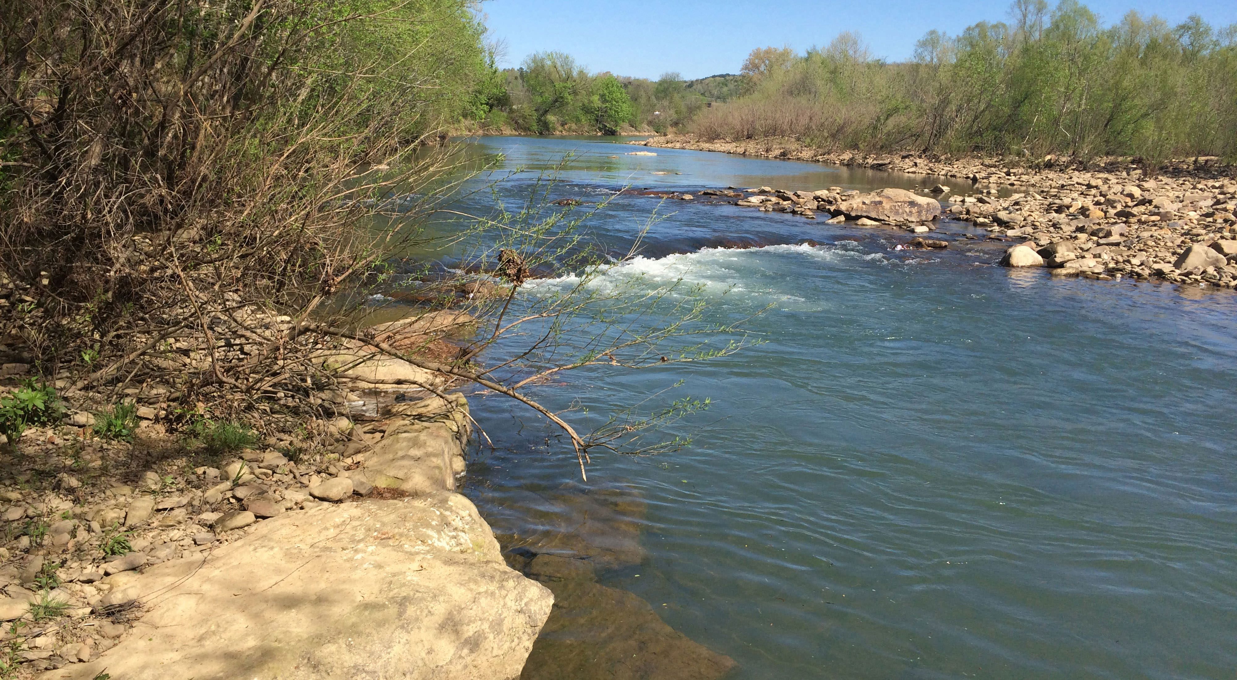
Every year, people flock to Arkansas' Ozark Mountains from around the world to enjoy the clear-flowing rivers and streams. The beautiful Little Red River in north central Arkansas is a recreation hotspot, and it has long been known to conservationists for its impressive suite of rare and imperiled species. The river empties into Greers Ferry Lake, a source of drinking water for more than 200,000 people and a recreational lake that is both cherished by the local community and an important economic benefit to the area.
Big Changes Challenge the Little Red
The Little Red River has endured some big challenges over the past half century. With the construction of Greers Ferry Lake during the 1960s, three of the river's four forks north of the lake were isolated from each other. This eliminated a large portion of prime habitat for endangered species such as the yellow cheek darter fish and the speckled pocketbook mussel. It also eliminated much of the potential for genetic flow between these four rivers for species already at risk.
In 1982 a record-setting flood drastically changed the lives of the people of Clinton. Nine feet of water flooded the entire downtown, where the Archey Fork and South Fork of the Little Red River meet. To address future flooding concerns, the U.S. Army Corps of Engineers channelized and dredged a 3.2-mile stretch of the river at Clinton.
Although at the time channelization seemed to be the only affordable option, the then 200-foot-wide channel caused unexpected problems. The banks began eroding, expanding the channel to 800-feet-wide, and carrying sediment into Greers Ferry Lake. Healthy fish habitat was destroyed and the channel became too shallow for swimming, boating and fishing.
Restoring the Clinton Ditch
Now this river's story is coming full circle. Over the last few years, The Nature Conservancy and partners have undertaken several projects to restore the river. In 2012 the largest such effort began when a group of partners and generous funders—the Conservancy, Southwestern Energy Company, City of Clinton, private landowners, Arkansas Natural Heritage Commission, National Fish and Wildlife Foundation, Arkansas Canoe Club, U.S. Fish and Wildlife Service, and Arkansas Department of Environmental Quality—launched the restoration of a 3.2-mile stretch of the river at Clinton.
The restoration was based on the science of natural channel design. It included shaping channels and constructing wood and rock structures within the existing floodway to reduce stream bank erosion, restore channel stability, improve fish habitat and improve water quality. The restoration plan was certified by an engineering firm ensuring that it will not increase the risk of flooding.
Phases I and II are complete and restored approximately one mile of the Archey Fork near Clinton, and a possible future phase III will improve nearly two miles of the South Fork. For too long, eroding river banks, eroding unpaved roads, and the clearing of streamside forests have degraded the Little Red River and contributed too much sediment into the Greers Ferry Lake drinking water supply. Projects like the Archey Fork Restoration are part of a whole-system solution that aims to reverse the damage, improving the Little Red both for its irreplaceable wildlife and the people that benefit from its waters every day.